KANSAS CITY, KANSAS
NATIVE AMERICAN LEGACY TOUR
Use this arrow to learn more at each stop.
This tour is based on research and interpretation by John Nichols under a grant from Visit Kansas City Kansas.

From the earliest settlements, Anglo-Americans pushed indigenous Nations west as they sought to tame the soil and more closely align it with their ideals.
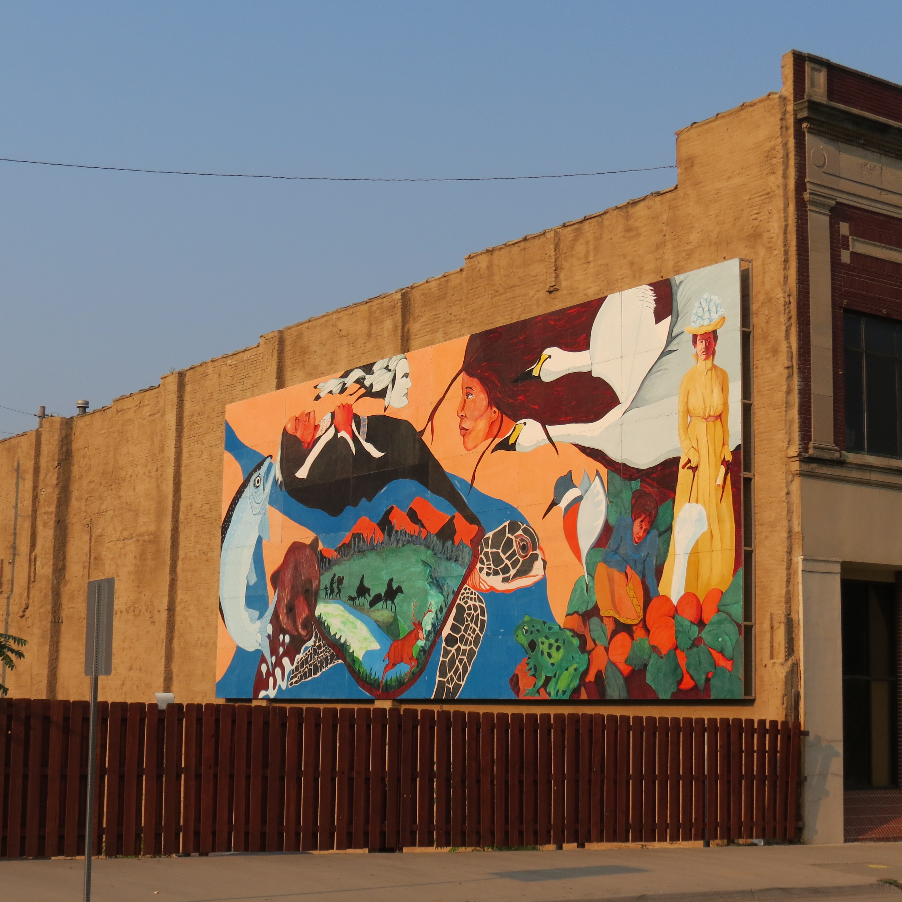
Over time, Wyandotte County, Kansas became home to three different Nations: the Shawnee, the Delaware (or Lenape), and the Wyandot (or Wendat). Each struggled and each thrived in the region.
Kaw Point, which sits at the mouth of the Kansas River, was established as a trading center in the early 18th century as French surveyors arrived in the area. It derived its name from the Kanza (or Kaw), who came to the region in pursuit of game and furs to trade. In 1804, Lewis and Clark fortified a position there and camped for three days.
Kaw Point, which sits at the mouth of the Kansas River, was established as a trading center in the early 18th century as French surveyors arrived in the area. It derived its name from the Kanza (or Kaw), who came to the region in pursuit of game and furs to trade. In 1804, Lewis and Clark fortified a position there and camped for three days.
In the 1820s, the United States government impelled tribes east of the Mississippi River even further west and away from white settlement — a process accelerated by the passage of the Indian Removal Act in 1830. "Liberty" became a relative term for the tribes as they were assigned new homelands.
The Shawnee were pushed south of the Kansas River, while the Delaware retained Wyandotte County between the Kansas and Missouri Rivers. The Wyandot, the last Nation to leave Ohio, ultimately purchased land from the Delaware after an earlier attempt to buy land from the Shawnee was blocked.
The Shawnee were pushed south of the Kansas River, while the Delaware retained Wyandotte County between the Kansas and Missouri Rivers. The Wyandot, the last Nation to leave Ohio, ultimately purchased land from the Delaware after an earlier attempt to buy land from the Shawnee was blocked.
This tour guides users to 10 locations across Kansas City, Kansas.
Scroll down to begin the tour.
Scroll down to begin the tour.
Previous slide
Next slide
Stop 1
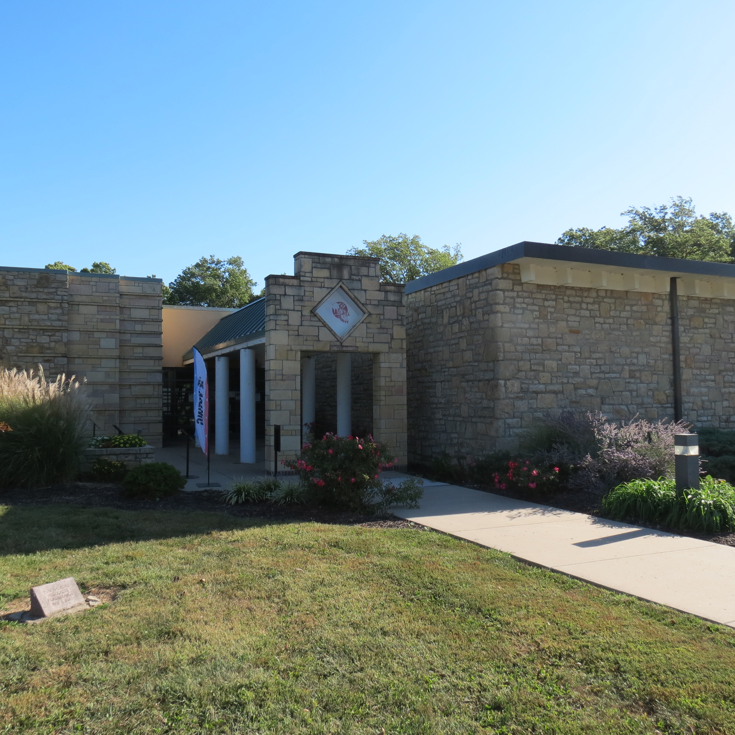
Wyandotte County Historical Museum
631 N 126th St. Bonner Springs, KS
DIRECTIONSWyandotte County Historical Museum
631 N 126th St. Bonner Springs, KS
The Wyandotte County Museum is the best place to begin our tour as it offers a good overview of the entire region. The first gallery deals with the prehistoric peoples in Wyandotte County. The second gallery concentrates on the history up through 1859 when Wyandotte County was created.

Previous slide
Next slide
Stop 2
Grinter Place
1420 S 78 St. Kansas City, KS
DIRECTIONSGrinter Place
1420 S 78 St. Kansas City, KS
Our next stop is in Lenape Country at Grinter Place State Historic Site. This site is named for Moses Grinter and his wife Annie. Moses came west to Fort Leavenworth shortly after its construction. He then was authorized to operate a ferry across the Kansas River near an earlier trading post. Moses married Annie Marshall, a Delaware, and they began a family. Eventually they would raise fruit, vegetables, and livestock while operating a trading post and continuing to operate the ferry, as it connected the Permanent Indian Frontier. This line ran from Fort Snelling, Minnesota to Fort Jesup, Louisiana. Its purpose was to keep the western tribes from attempting to push the new immigrants back to their old homelands.
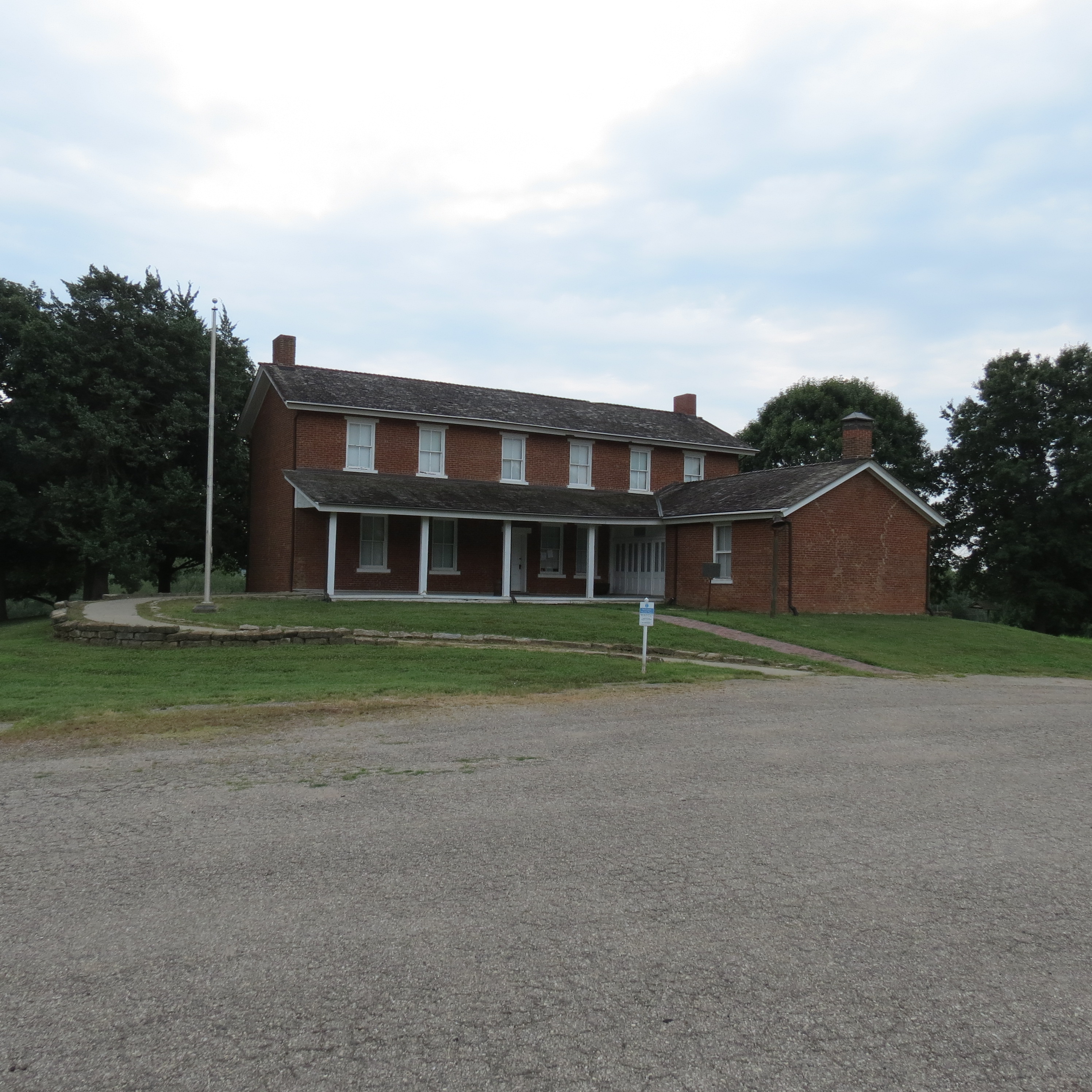
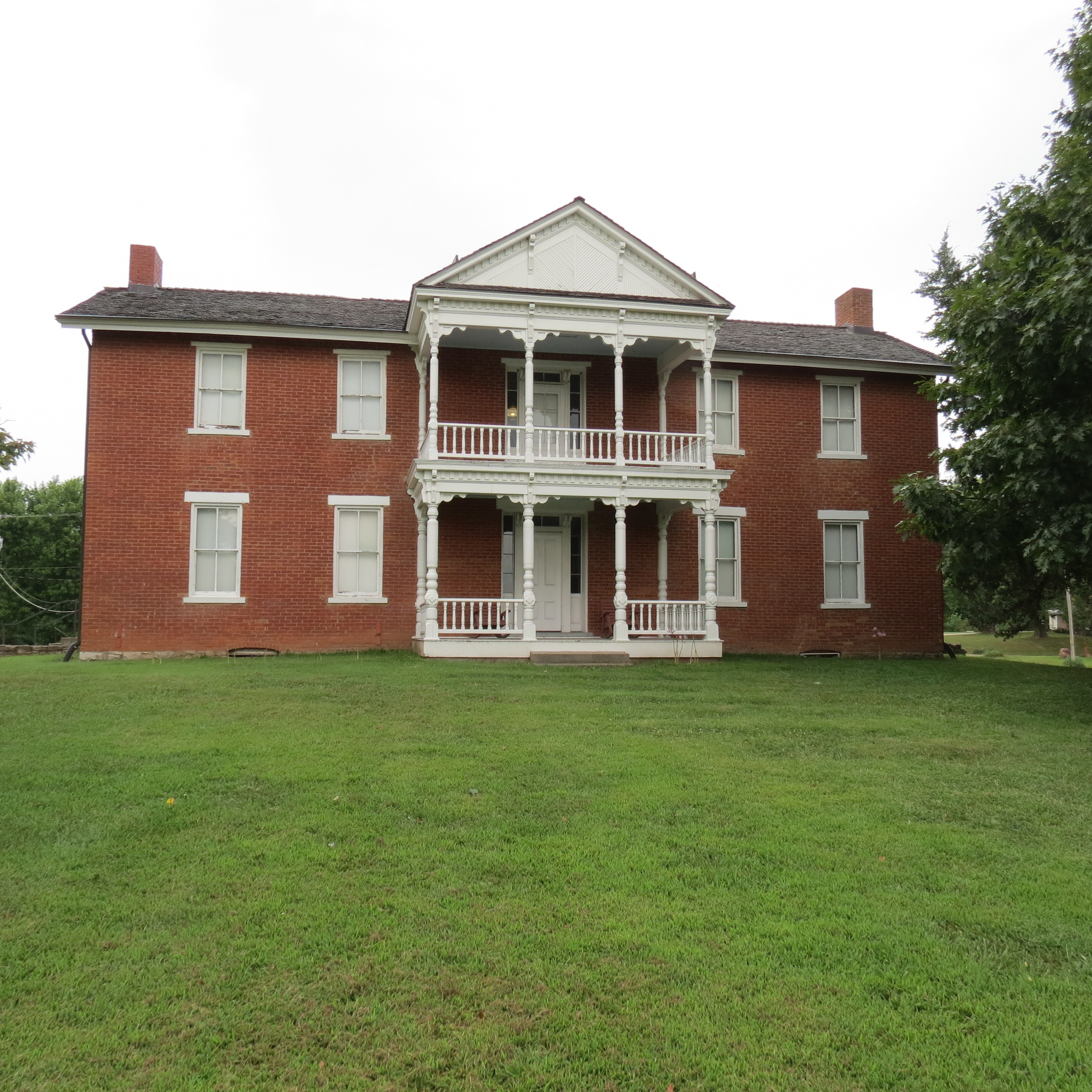
Annie is an example of an individual and family member who chose to intermarry and join American society. Other families and bands did not. To preserve the old ways, customs, and religion, some chose to move further away. Others chose a different route.
Previous slide
Next slide
Stop 3
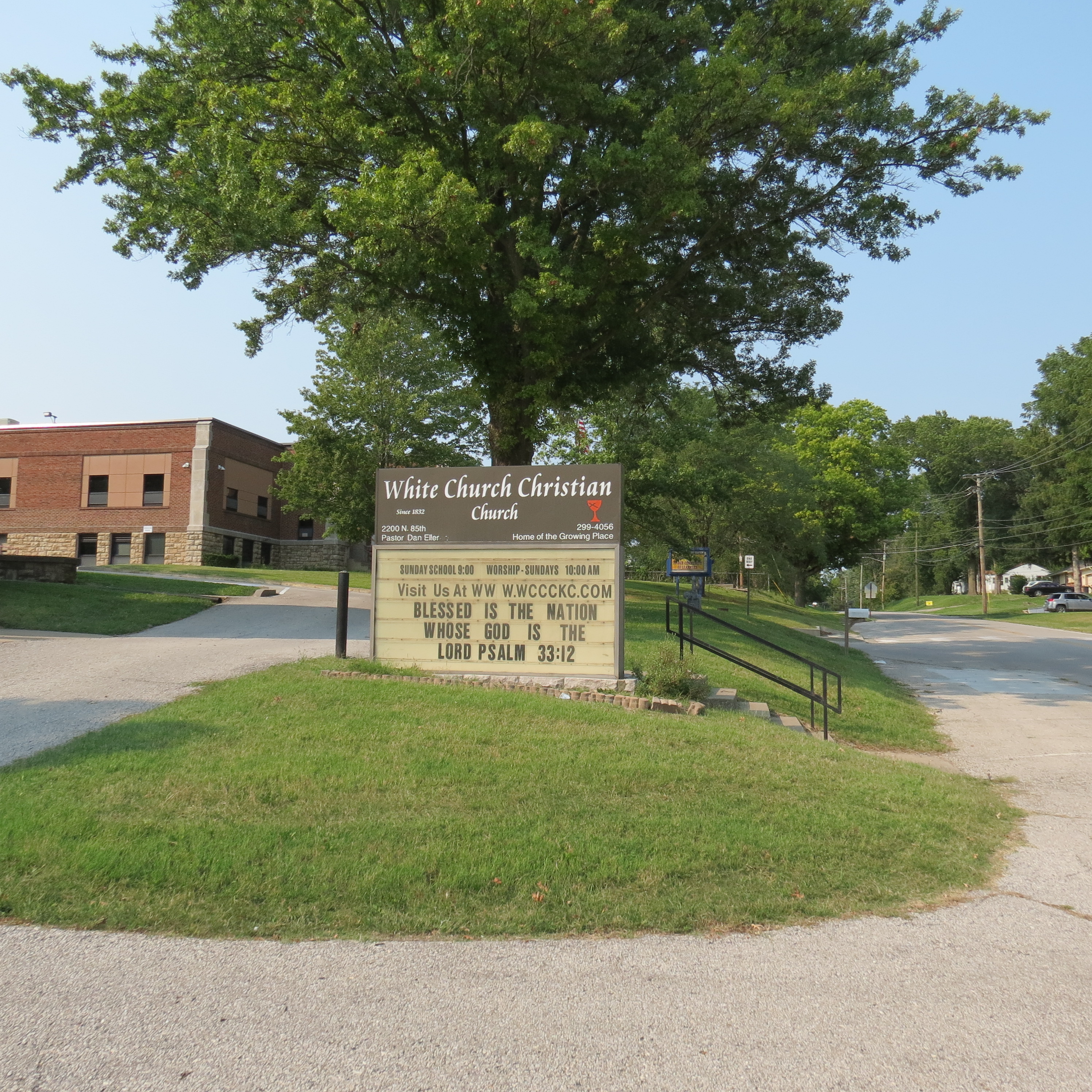
White Church
2200 N 85th St. Kansas City, KS
DIRECTIONSWhite Church
2200 N 85th St. Kansas City, KS
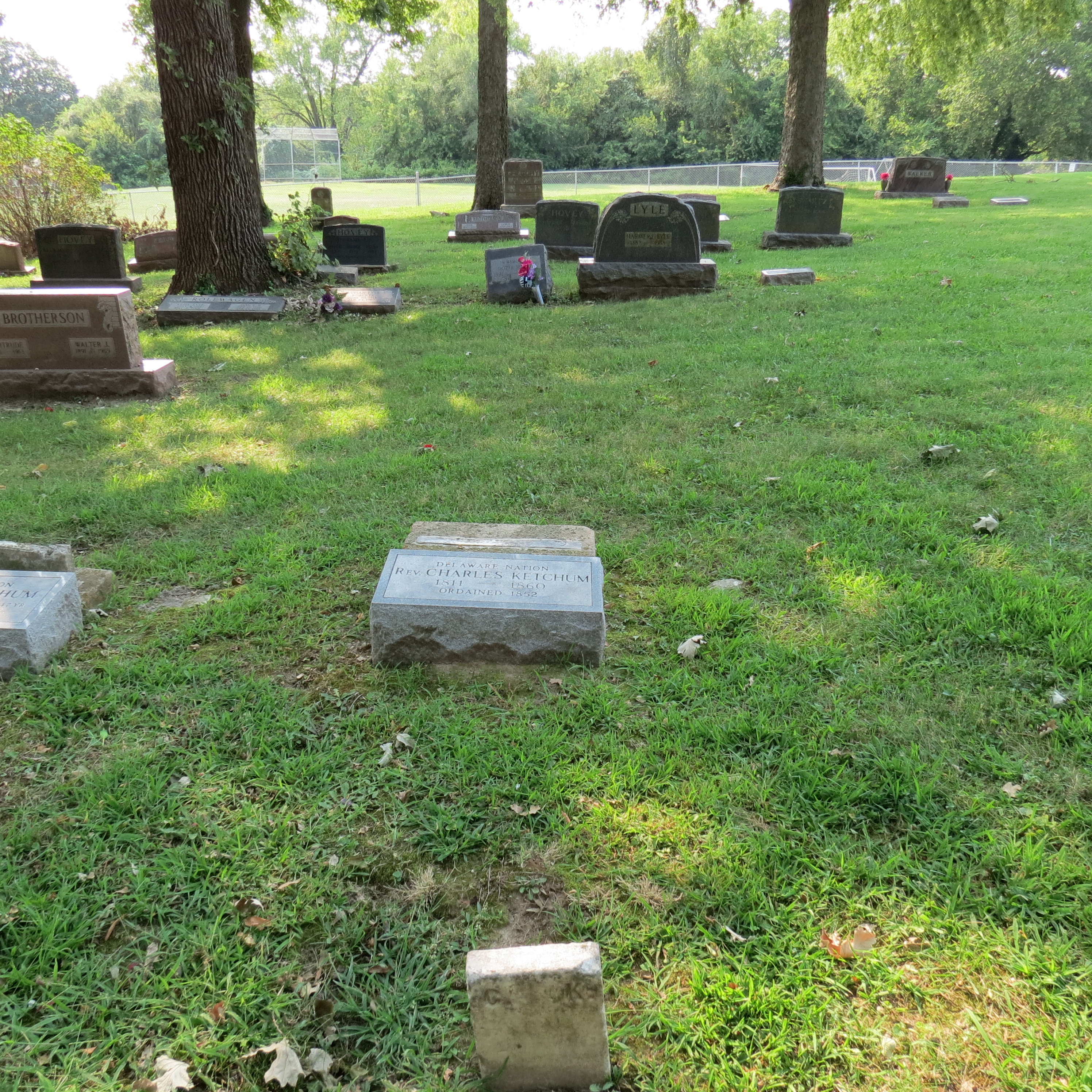
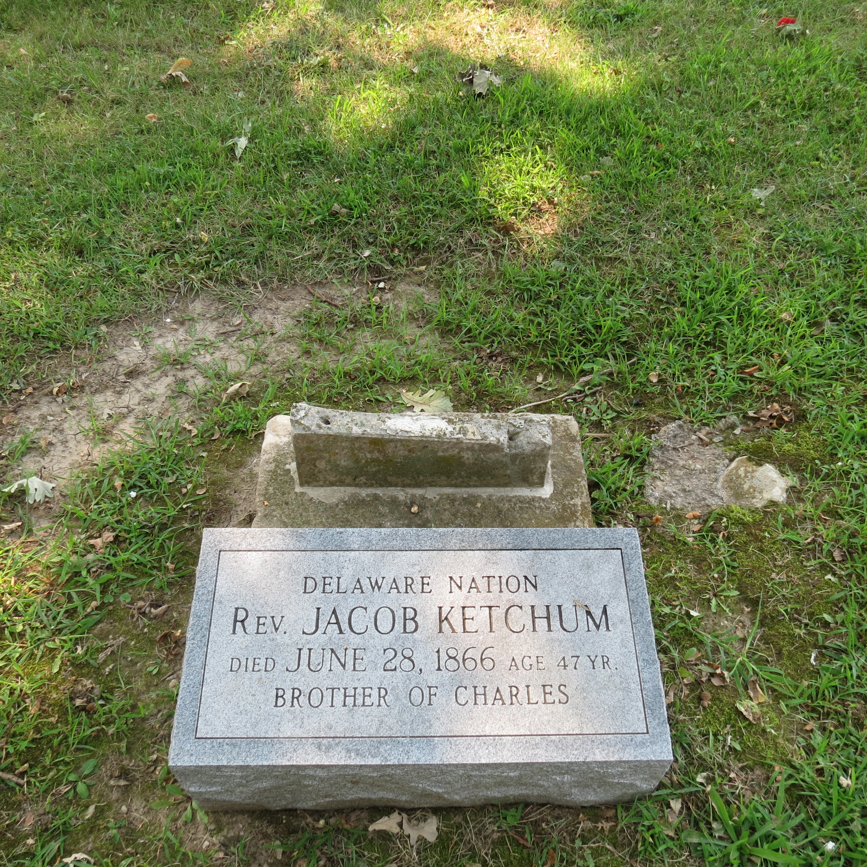
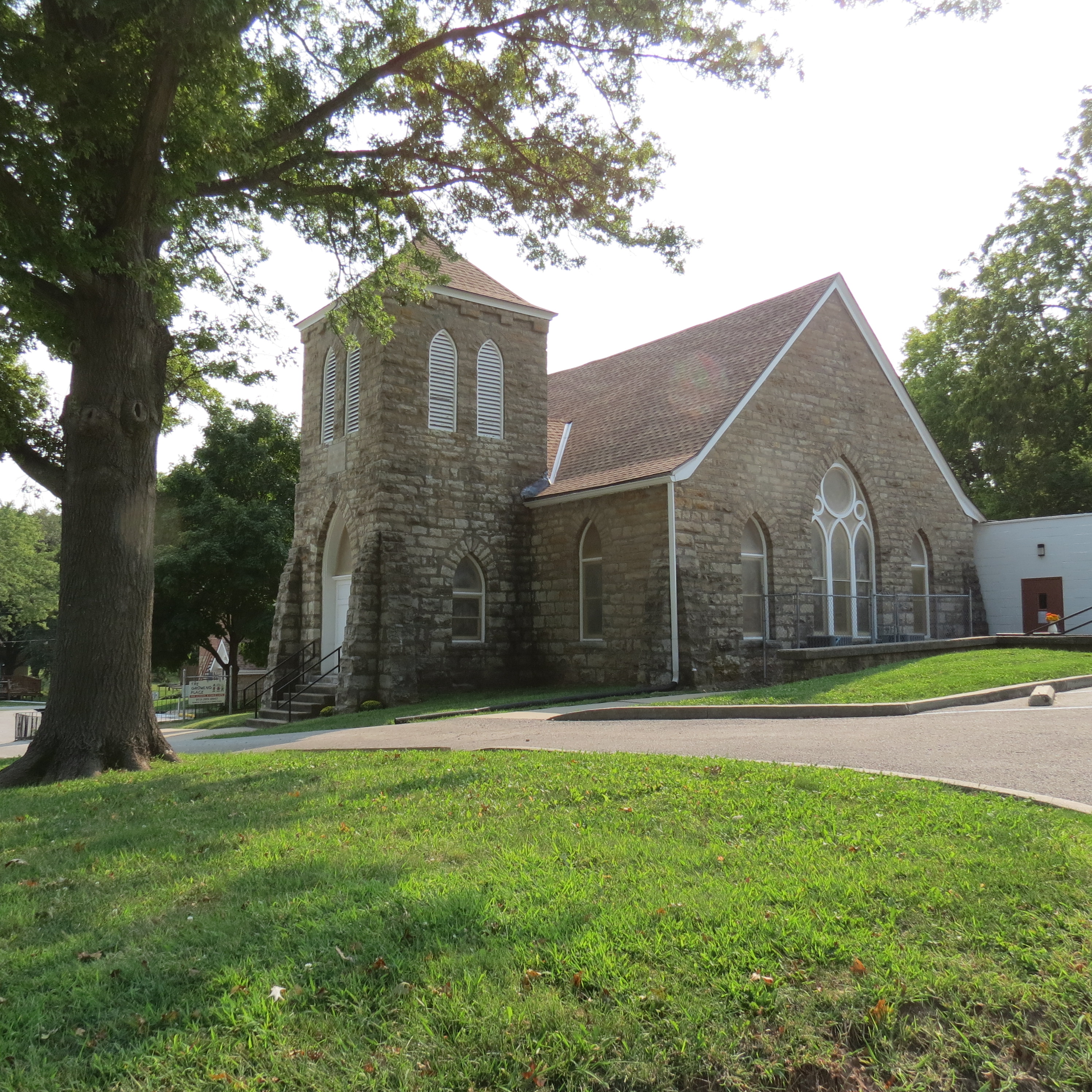
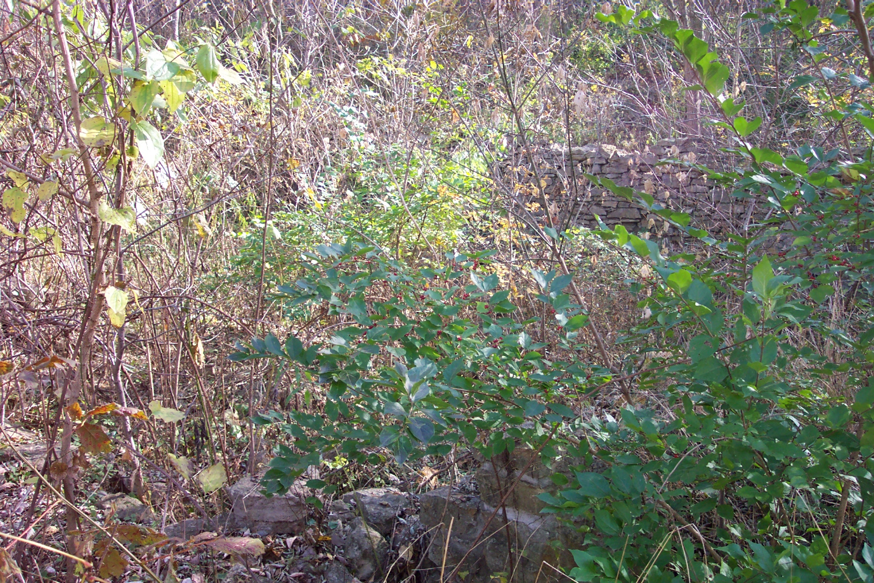
Our next stop is White Church Christian Church, which started as a mission church in 1831. The original church was log. When it was destroyed, it was replaced by a white frame church that gives its name to the current structure that replaced the two previous ones. In the rear of the church is a cemetery which contains several Delaware graves. The Ketchum family was prominent, and one grave is of the Chief while two others belong to brothers who were ordained in the 1850’s.

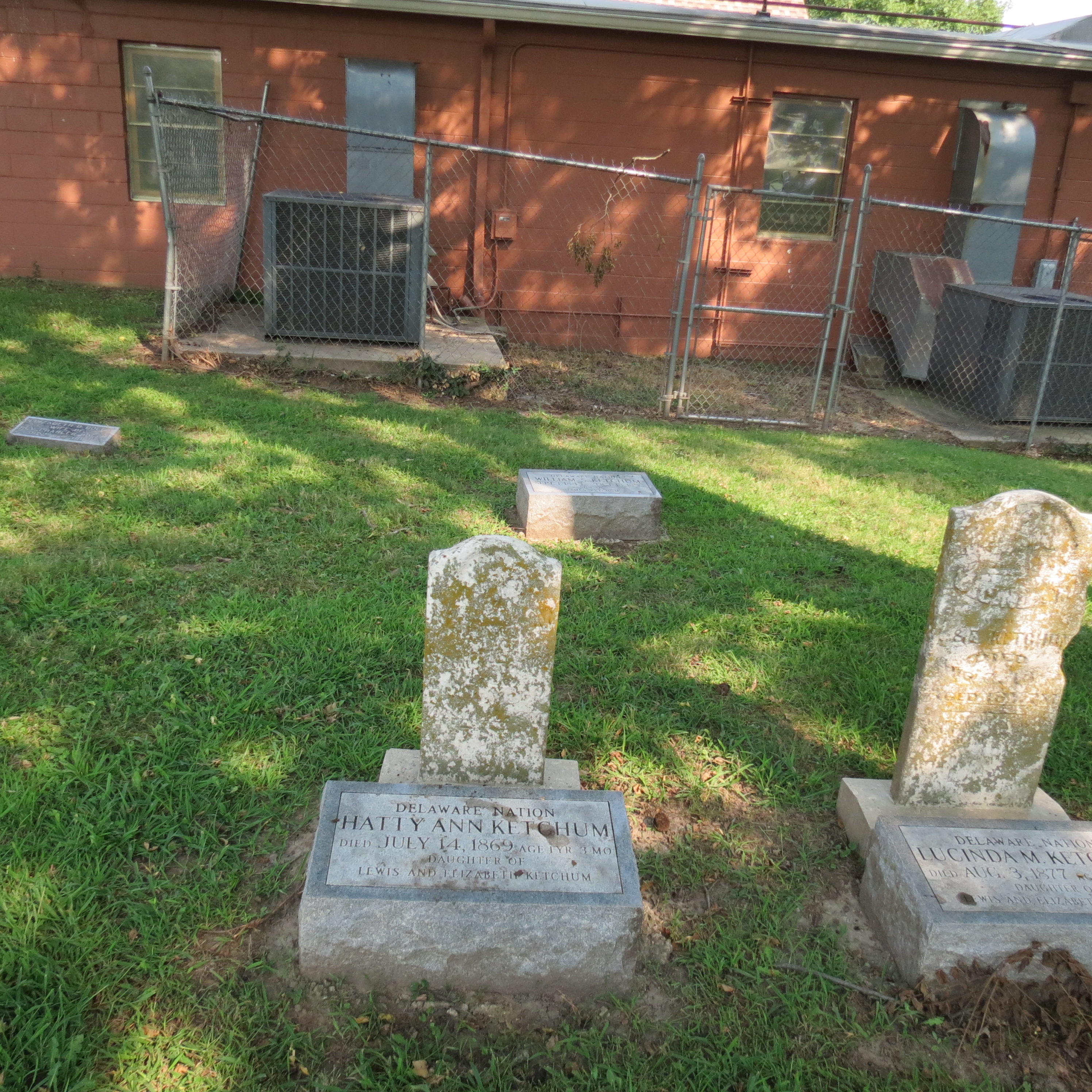


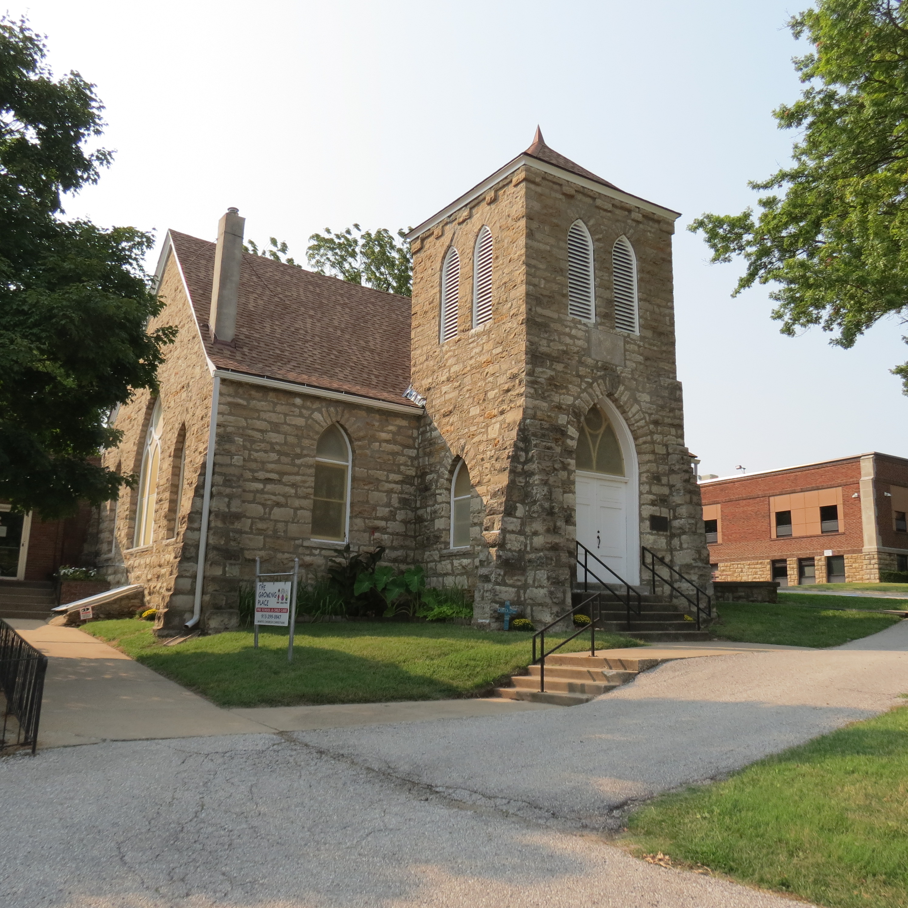
The family members here chose a similar path to Annie’s as they adopted the new religion and culture of the Americans. Other groups chose to trap, trade, and occasionally scout for the United States Army. These individuals followed a mix of traditional means of self-sufficiency with getting something more than the promised allocations from the US.
Previous slide
Next slide
Stop 4
Old Quindaro Cemetery
3638-3602 N 31st Ter. Kansas City, KS
DIRECTIONSOld Quindaro Cemetery
3638-3602 N 31st Ter. Kansas City, KS
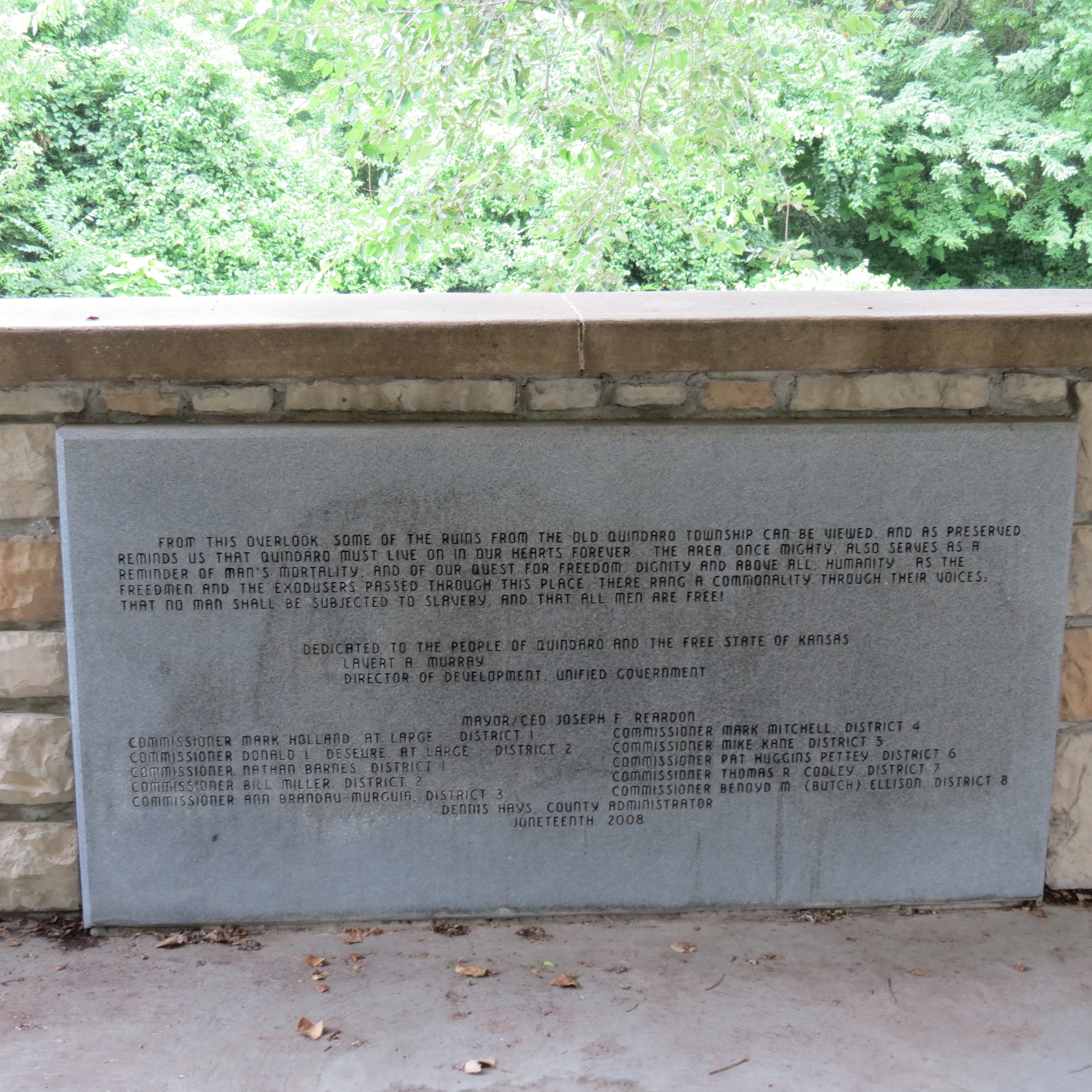
In 1843 the Wyandot began moving west. The “Great Awakening” was occurring and churches were splitting over the morality of slavery. The Wyandot, who had purchased land from the Delaware, were no exception. Traditionally the Wyandot did not support slavery and in fact assisted with the Underground Railroad and intermarried with Freedom Seekers. However, other members of the Nation followed the parent church when it decided all Mission Churches would be assigned to the Southern branch, and several even purchased slaves.


This cemetery marks the location of the Northern church after the Wyandot split over slavery. The cemetery gets its name from the abolitionist town of Quindaro. This town was founded as a Free State port on the Missouri River after the area was opened to white settlement in 1854.
Previous slide
Next slide
Stop 5
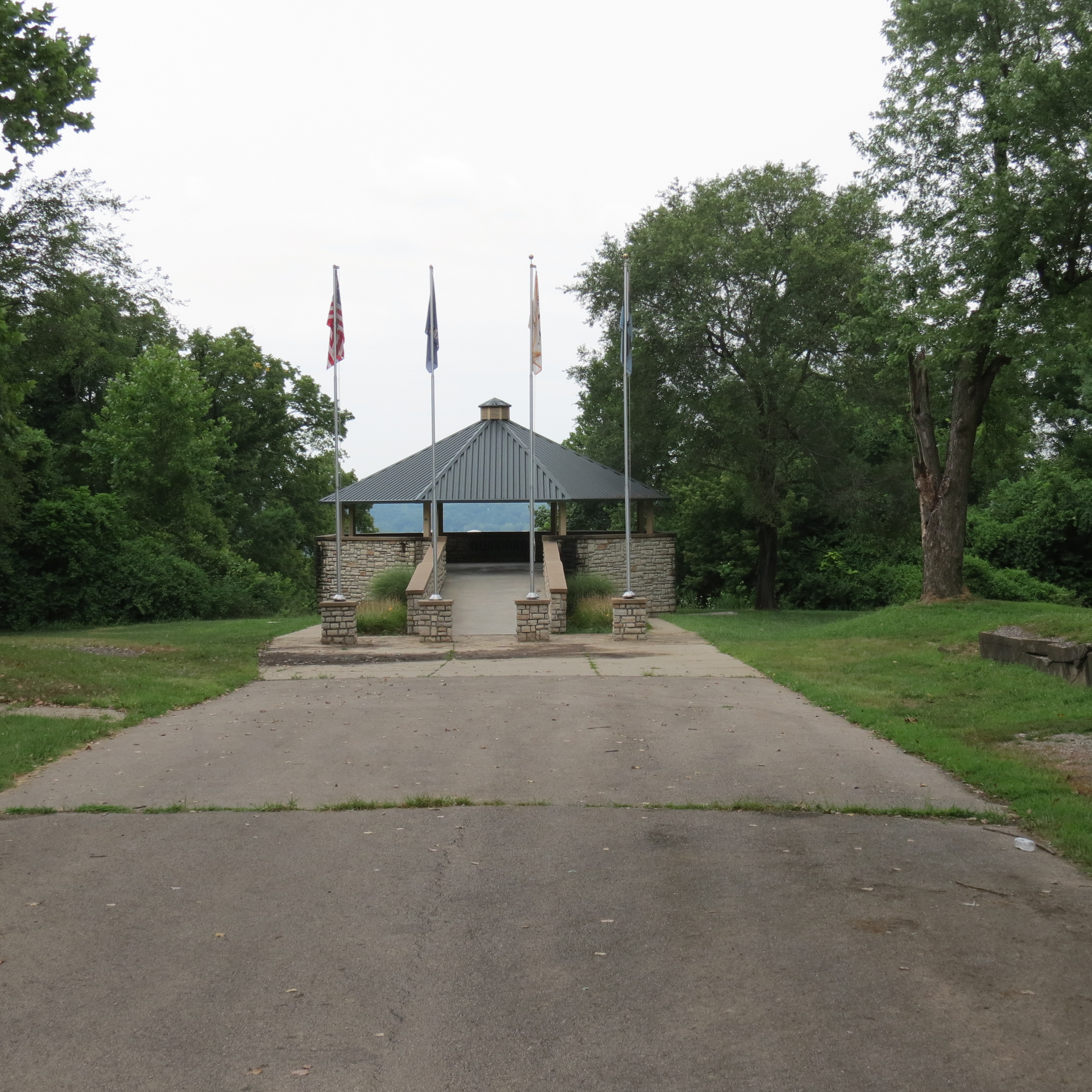
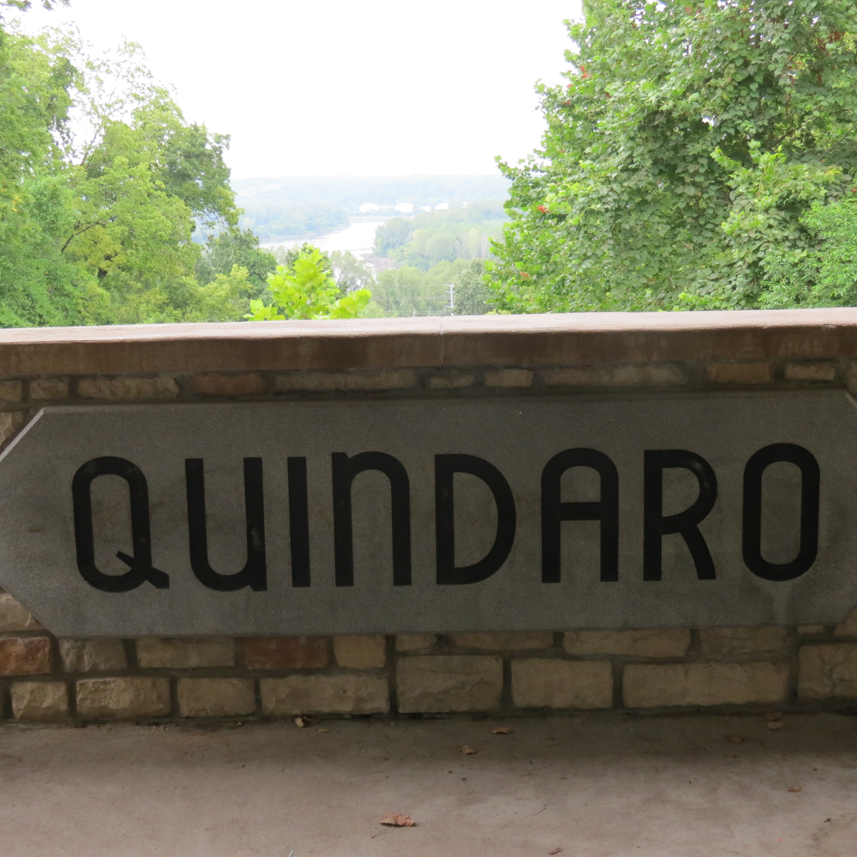
Quindaro Overlook
3507 N 27th St. Kansas City, KS
DIRECTIONSQuindaro Overlook
3507 N 27th St. Kansas City, KS
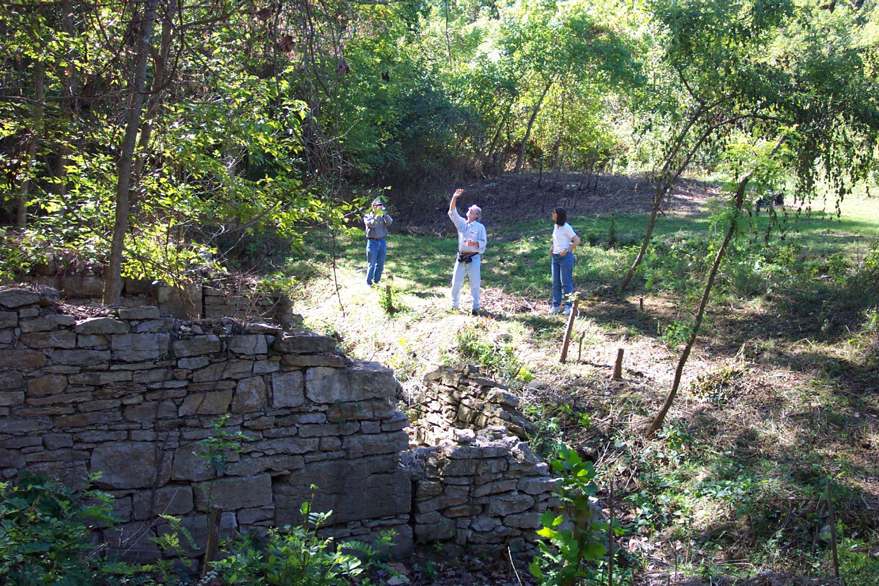
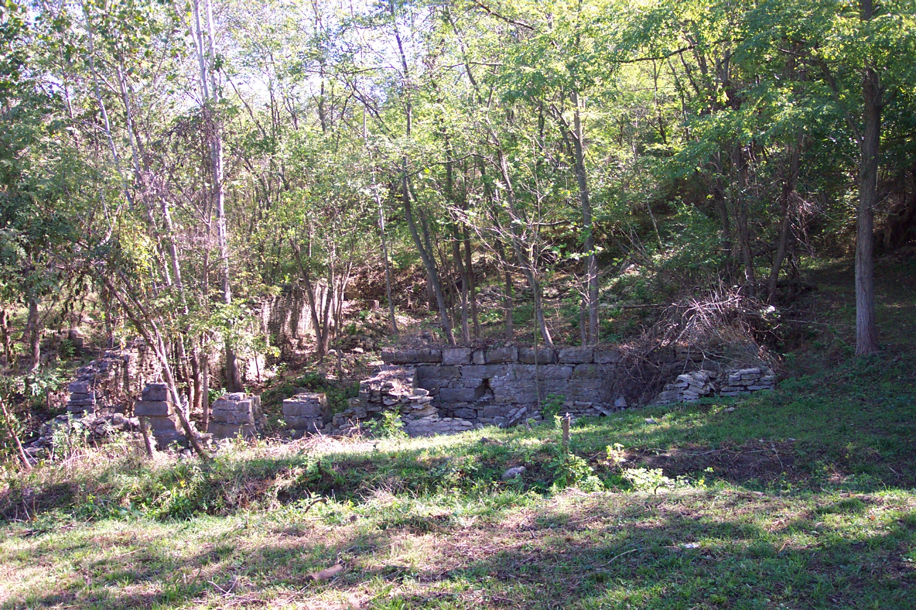
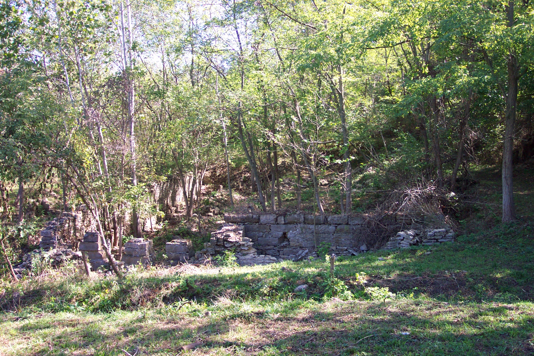
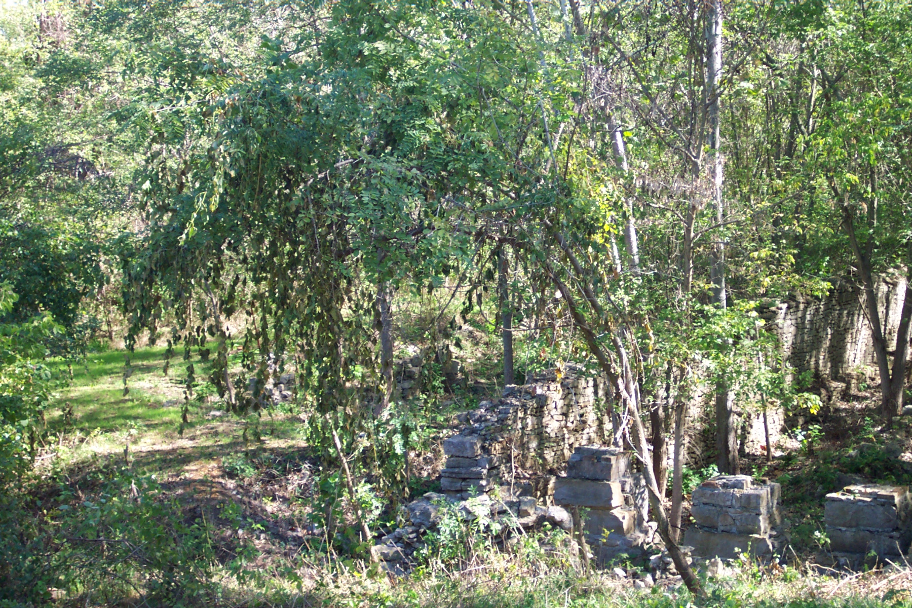
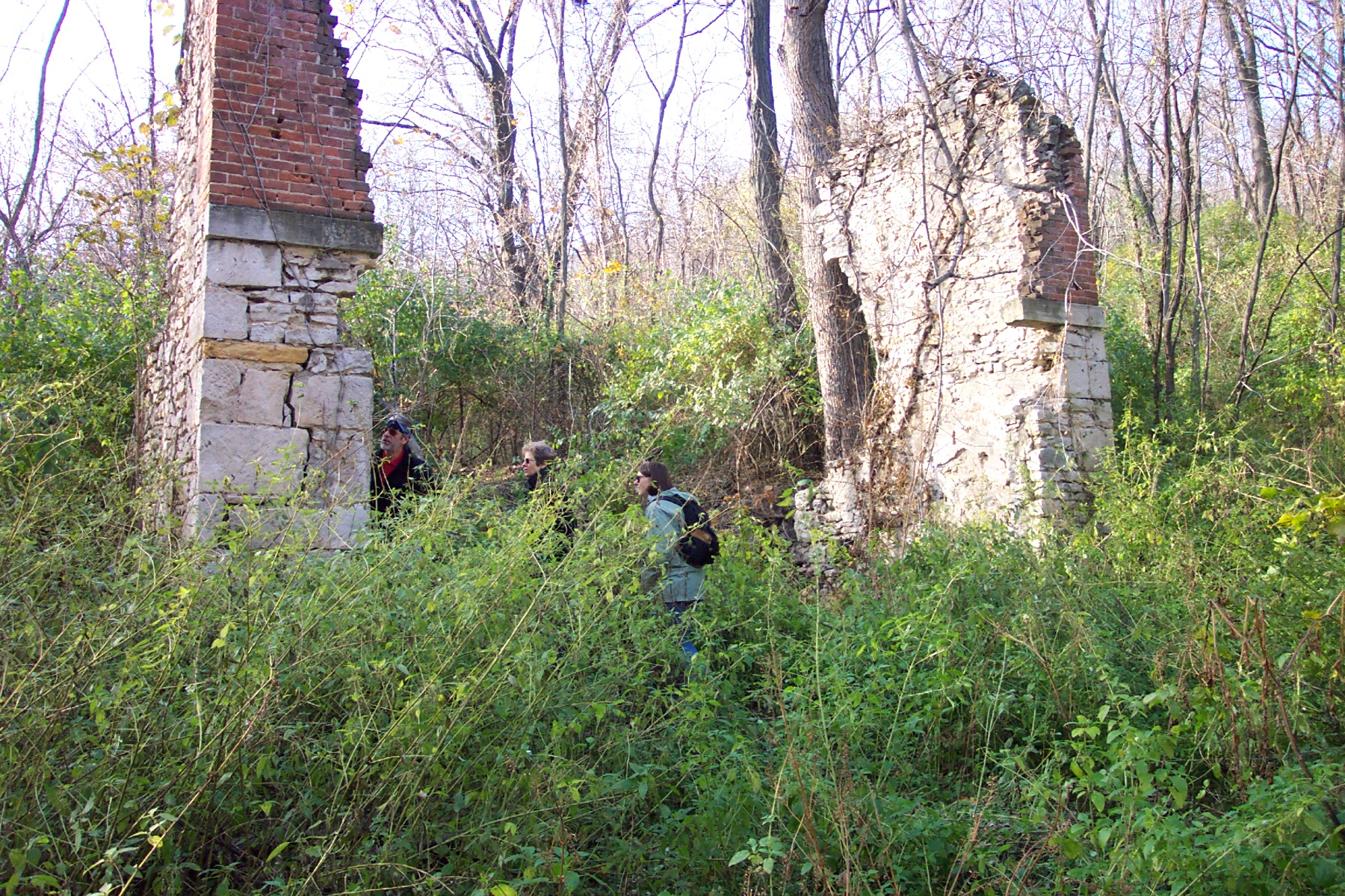
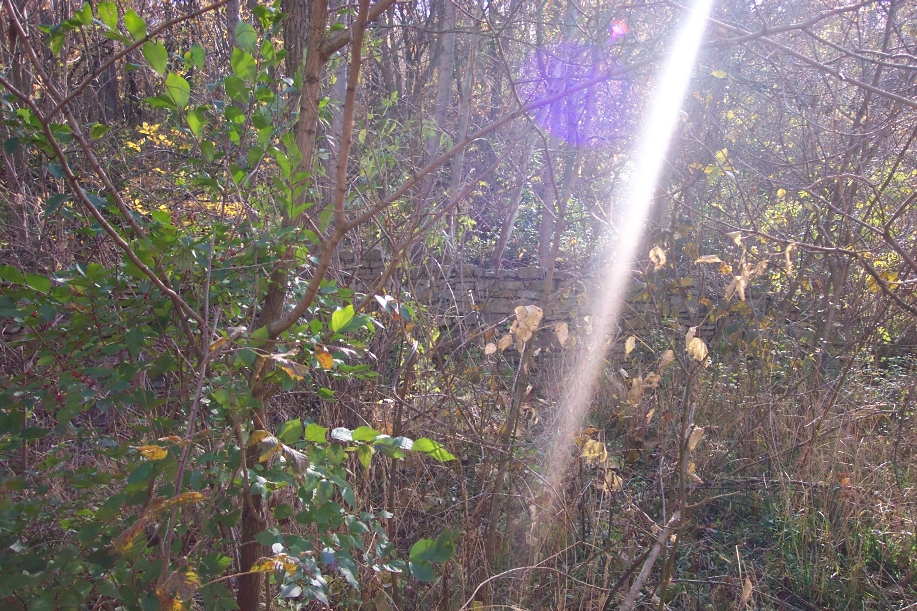
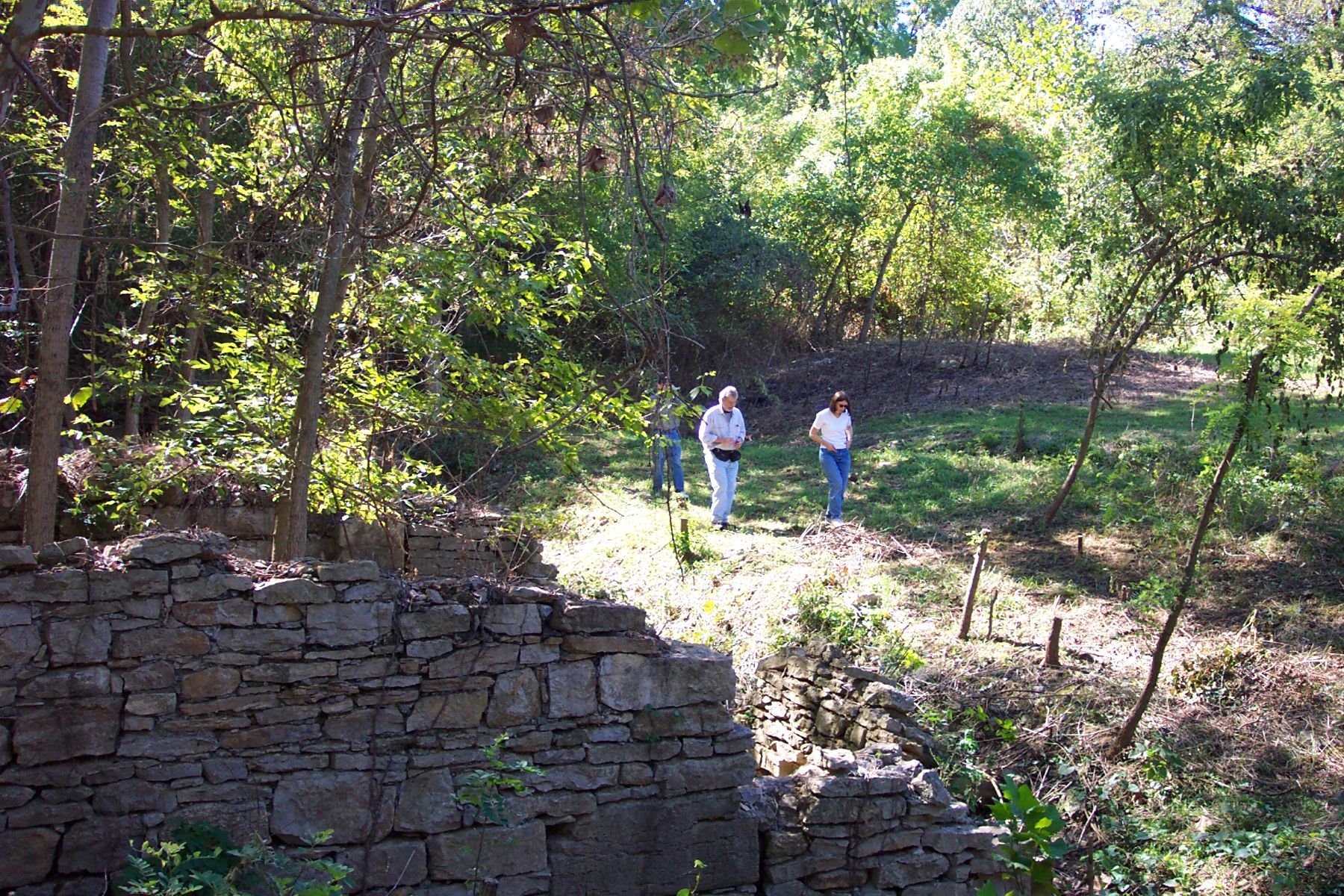
Quindaro Overlook looks down upon the original townsite of Quindaro, although the area is not readily accessible at present. Photos here show what part of the site looked like after archaeological excavations.
Quindaro was a Free State port founded by sympathetic Wyandots and former members of the New England Emigrant Aid Company and had a reputation for welcoming escaping enslaved persons. All three groups worked together to help build the town before a number of events destroyed its significance.


Previous slide
Next slide
Stop 6
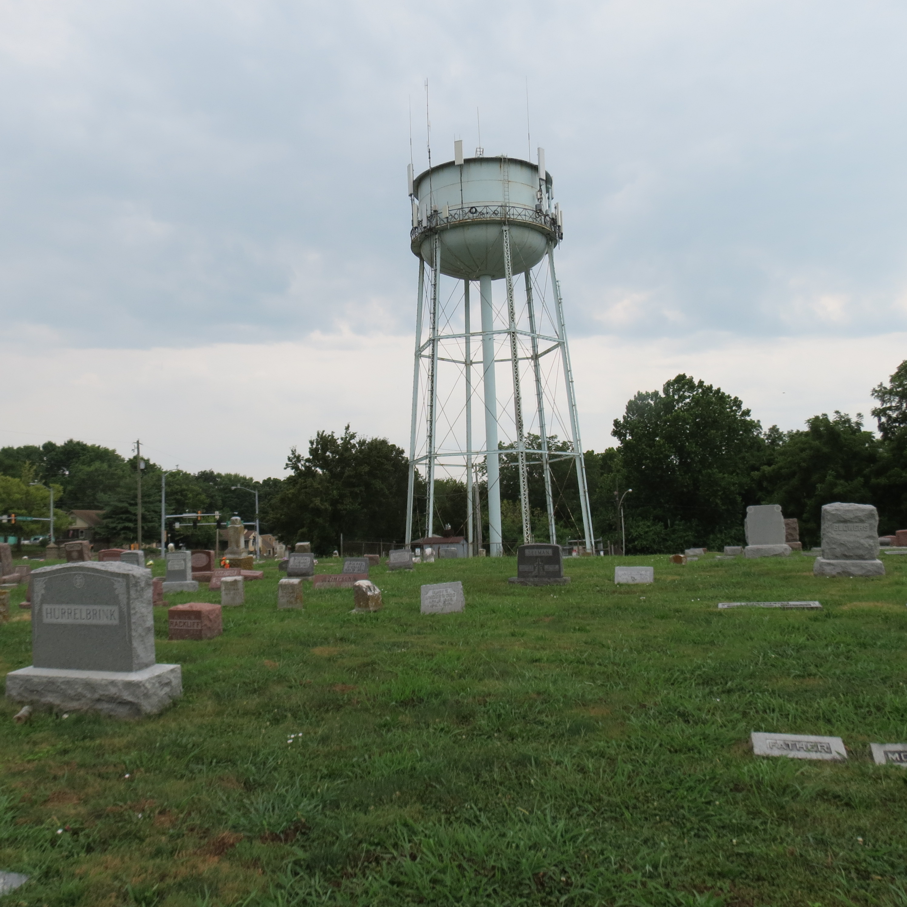
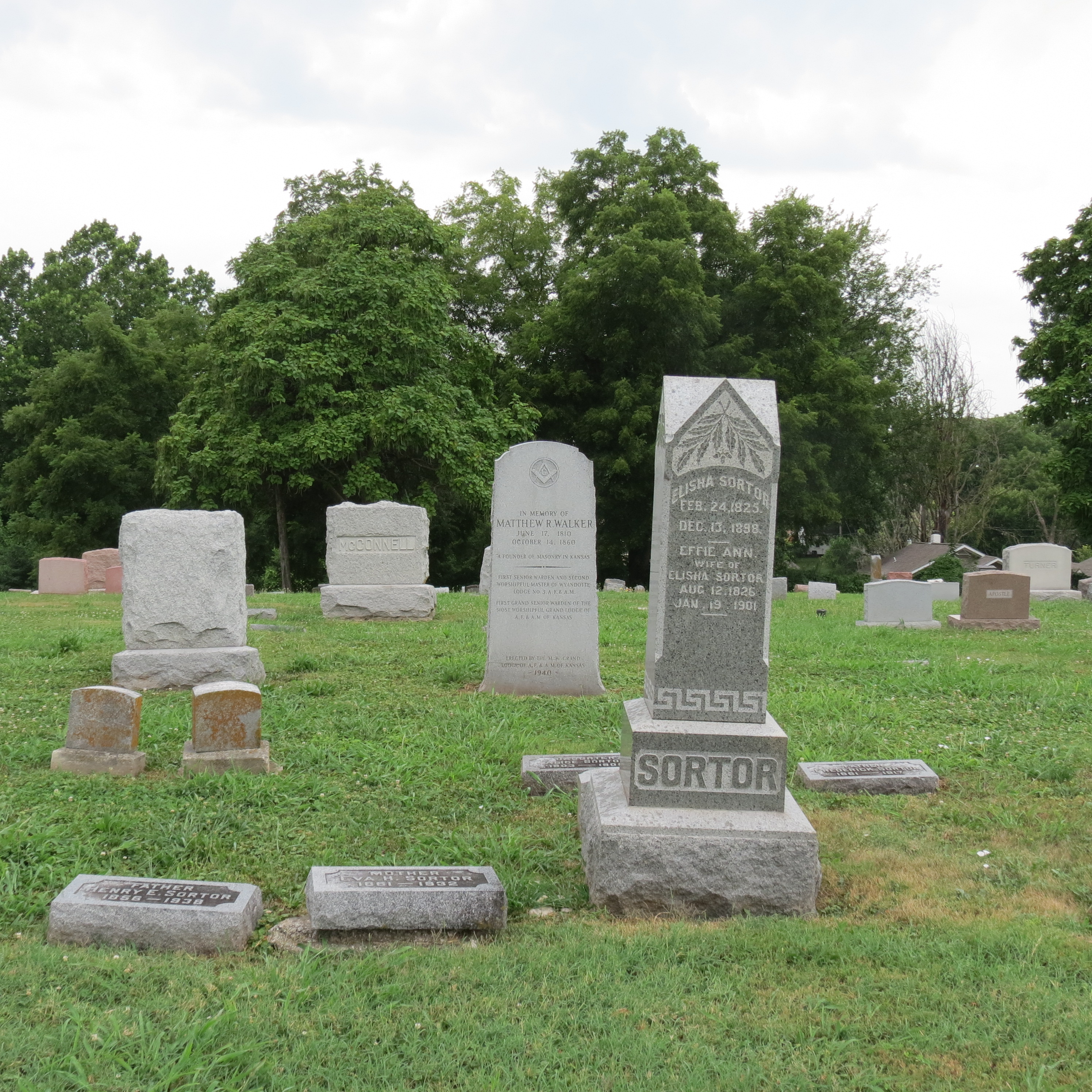
Oak Grove Cemetery
2025 Springfield Blvd. Kansas City, KS
DIRECTIONSOak Grove Cemetery
2025 Springfield Blvd. Kansas City, KS
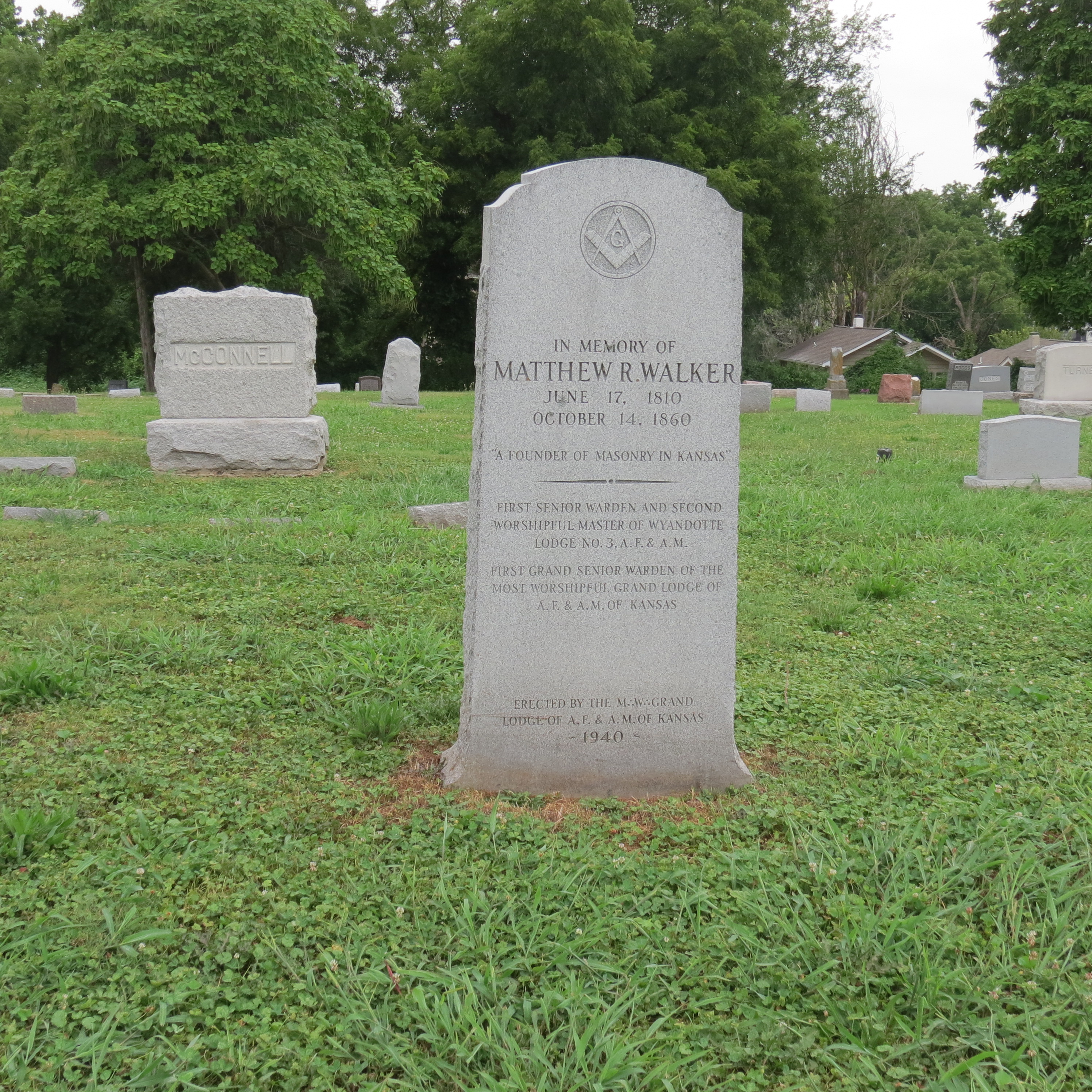
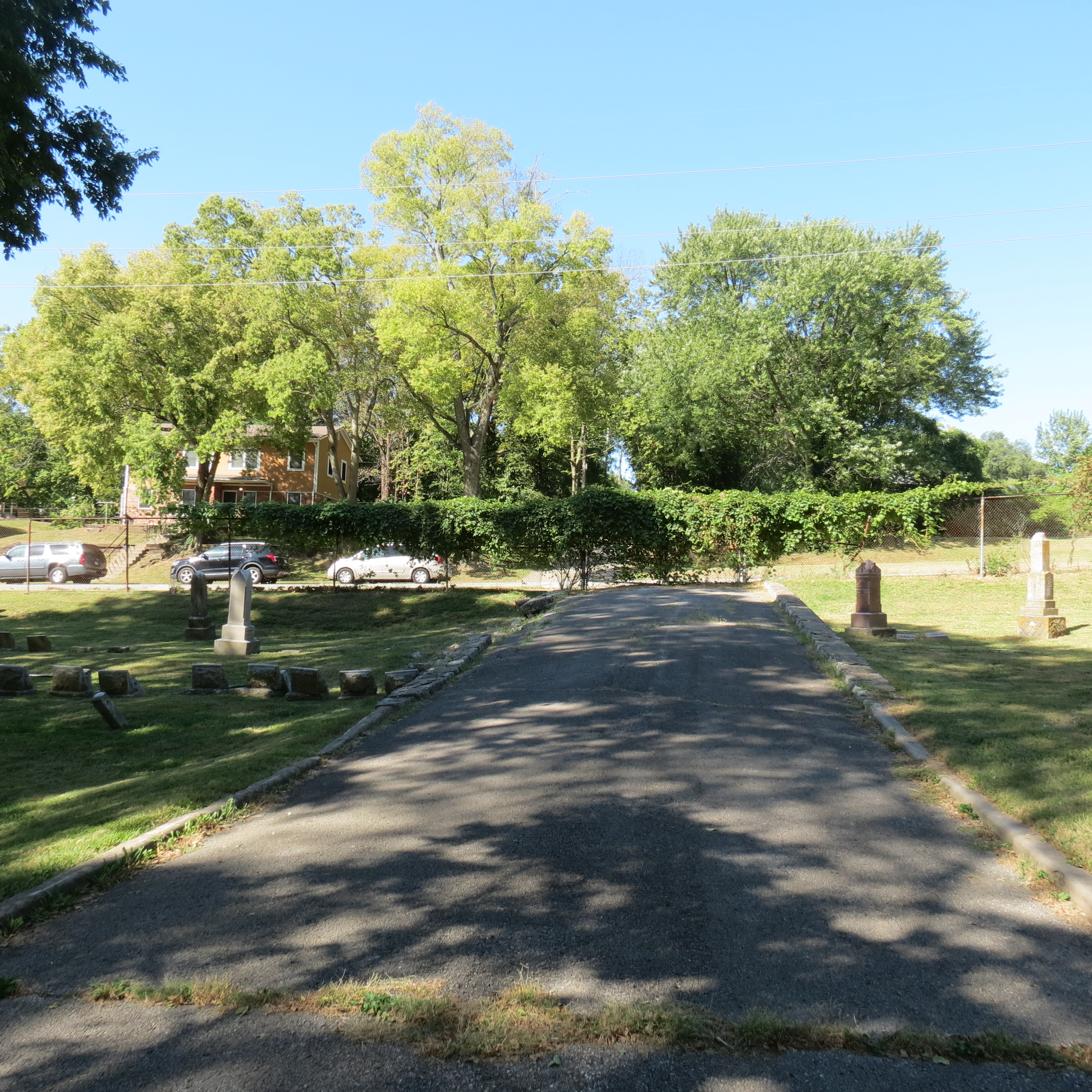
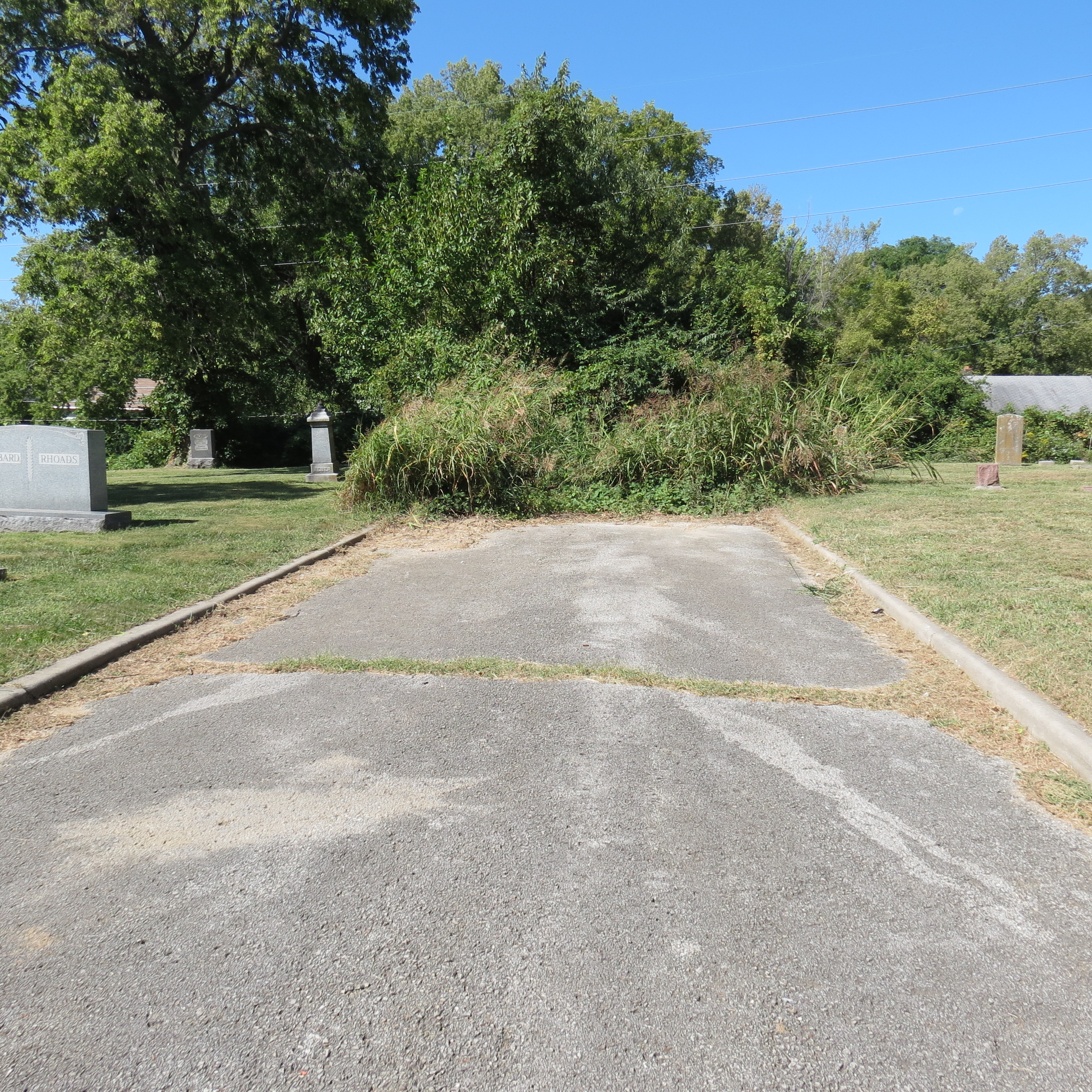
At Oak Grove Cemetery, take the second road to the left nearly to the end and count 8 rows back and 3 rows to find a grave marked Governor William Walker 1800-1874. Walker, who was a Wyandot, and others concerned about how long it was taking the US to pay for their lands and improvements in Ohio looked into obtaining land in fee simple title. In other words, owning land and doing what they chose with it. Native Americans could not buy, own, or sell land as individuals without Congressional approval. Since nine years had passed without full payment people were getting concerned. Walker and others looked into forming a Territory to improve their chances. In 1852 they engineered an election for the Provisional Territory of Nebraska.
The results of this election, which included votes by Native Americans, missionaries, soldiers, and government employees, indicated that the Southern part would probably come in as a slave territory while the Northern part (Nebraska) would come in as a free territory. It is believed that this helped inspire the Kansas-Nebraska Act which opened up the Territory to “Popular Sovereignty” allowing those in the territory to choose. One point—Native Americans were not citizens and therefore could not vote except in tribal elections!


Previous slide
Next slide
Stop 7
Huron Cemetery
641 Minnesota Ave. Kansas City, KS
DIRECTIONSHuron Cemetery
641 Minnesota Ave. Kansas City, KS
This block was platted as Huron Place in the 1850s. The original plan was for churches at each of the corners with a school building adjoining the Wyandotte National Burying Ground, also known as Huron Cemetery. This cemetery was also the scene of a continuing struggle to either preserve its sanctity as sacred ground or to sell the ground and attempt to remove the remains.
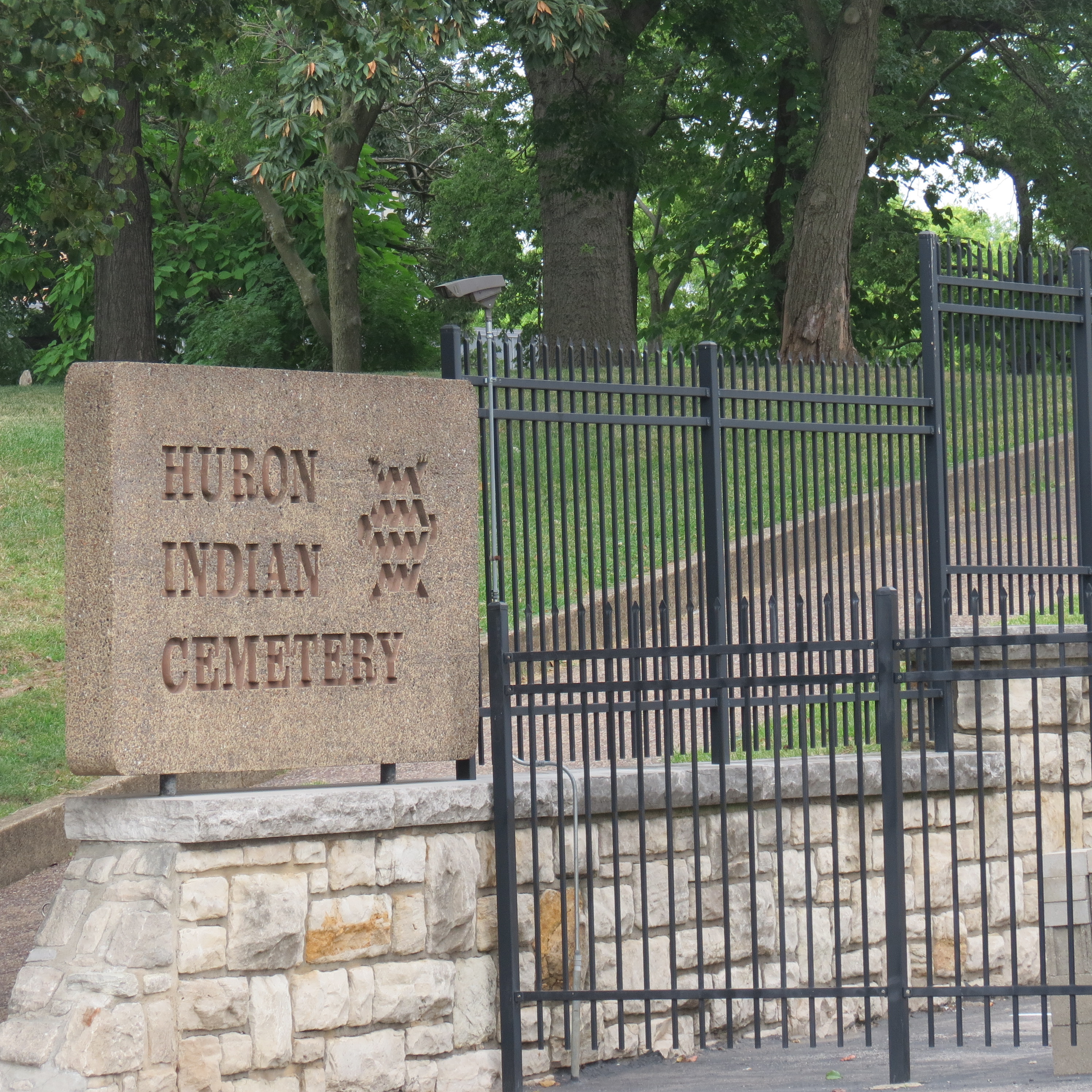

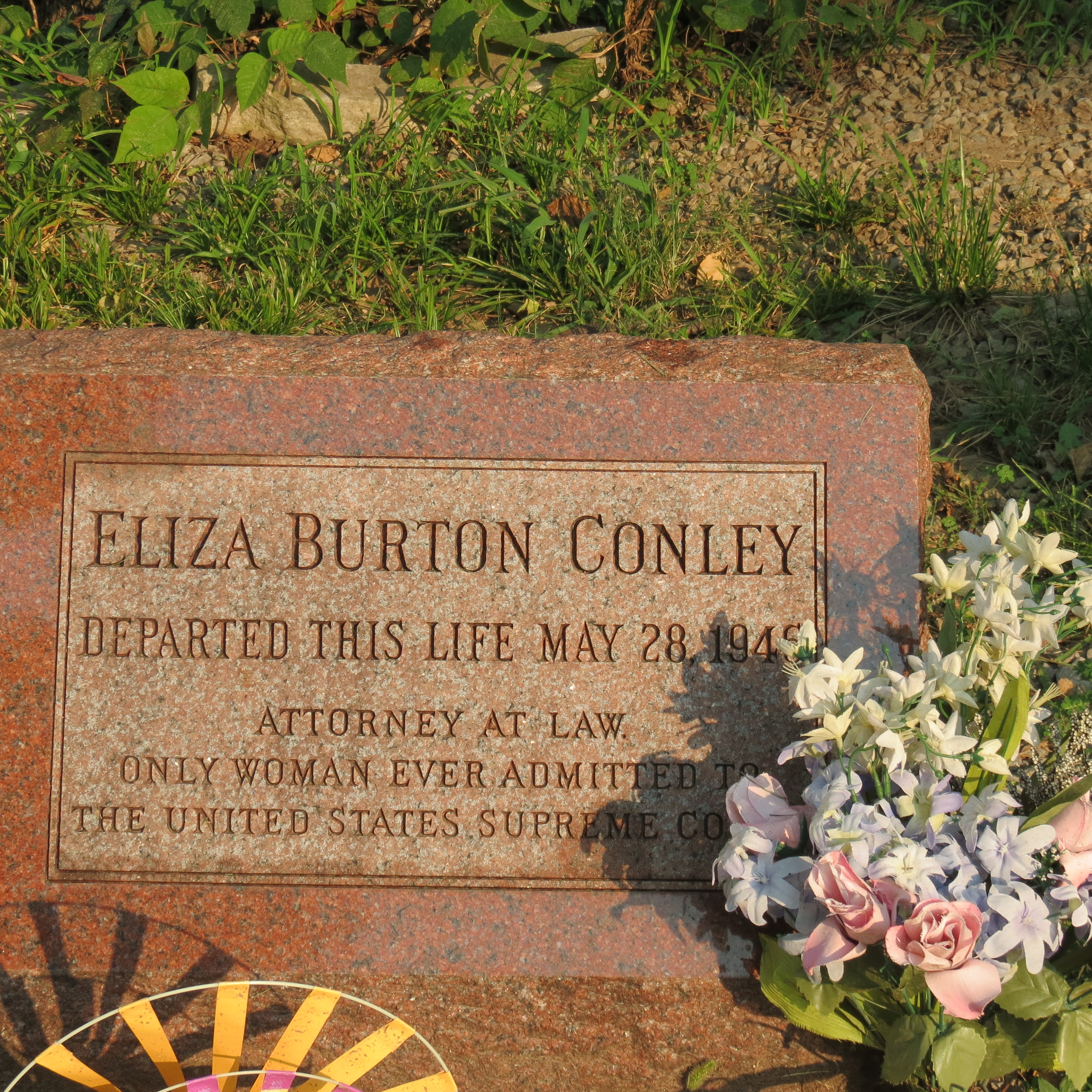

This battle would result in the Conley sisters, specifically Lyda and Lena, building a small house over their relatives’ graves while more commercially minded people felt it was valuable real estate. Lena eventually would use the shotgun owned by their father on a policeman who attempted to forcibly remove them. Her tombstone bears the inscription “Cursed be the villain that molests these graves.” Lyda took a different approach, becoming a practicing attorney and reportedly the first Native American woman to plead a case before the United States Supreme Court. These two are examples of the traditional Wyandot leadership provided by women. The Wyandot were a matrilineal and matriarchal society, with the women’s council even having the right to tell the men when to go to war.

The Old Scottish Rite Temple nearby (777 N 7th St Trfy) was repurposed as the 7th Street Casino by the Wyandotte Nation of Oklahoma when they purchased the structure and had it declared as Indian Trust Land. The Oklahoma branch of the Wyandotte is federally recognized while the Wyandot Nation of Kansas is not. Differences caused by an 1855 treaty providing for citizenship and proposing the elimination of the Wyandot as a sovereign nation have softened today but the pain caused by the treaty and its resulting split still linger. The old adage “divide and conquer” was certainly followed when the Indian agent got the treaty signed and ratified even though a number of tribal members found their signatures had been placed on the document without their agreement and sometimes without their knowledge. When the state of Kansas allowed taxation on Wyandot land in direct violation of one of the terms of the treaty, many of the Kansas group lost their lands due to tax sales to pay back taxes. The presence of the Casino marks a return to the area by a group which had been forced to leave.
Previous slide
Next slide
Stop 8
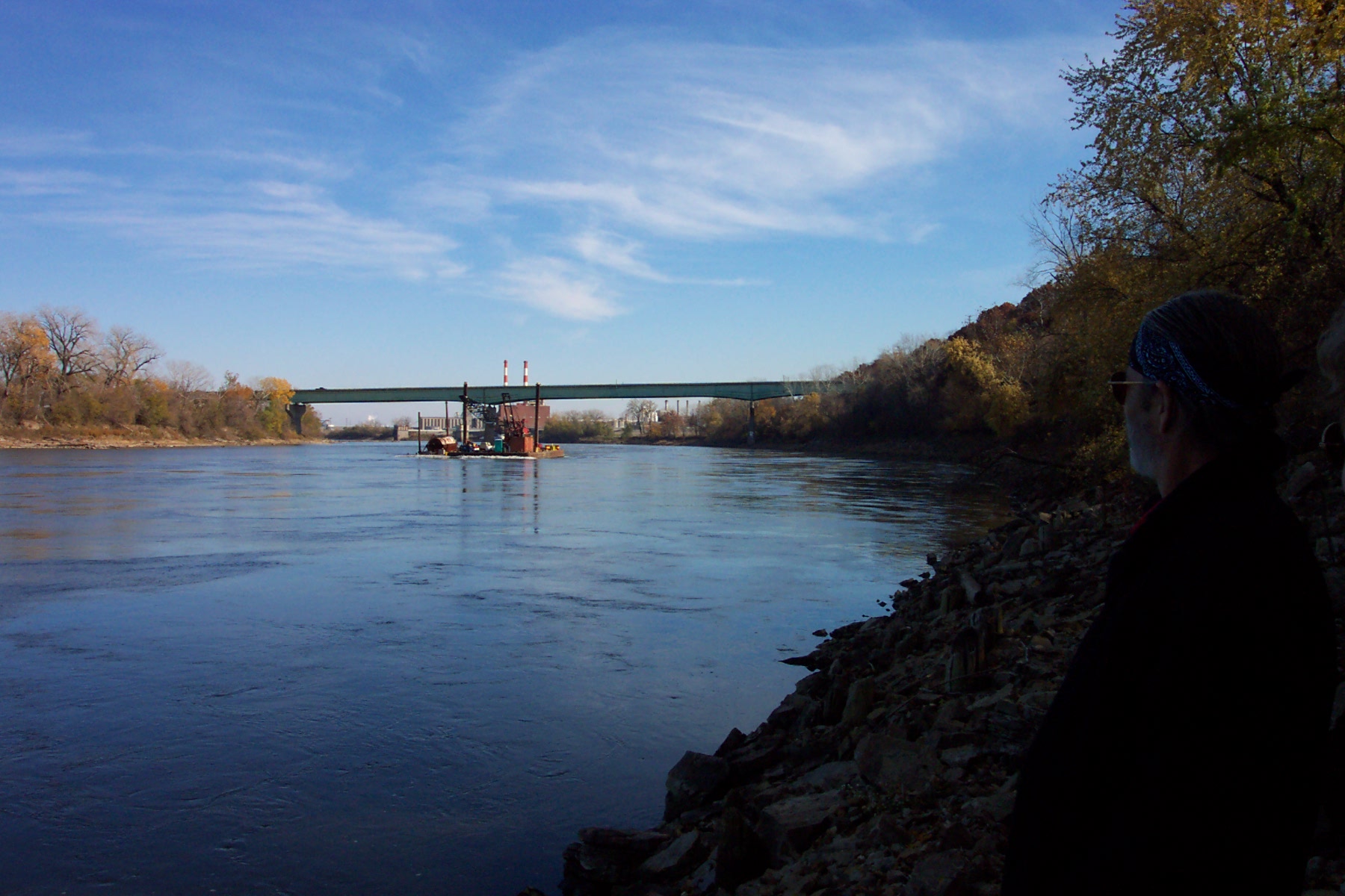
Kaw Point
1403 Fairfax Trafficway, Kansas City, KS
DIRECTIONSKaw Point
1403 Fairfax Trafficway, Kansas City, KS
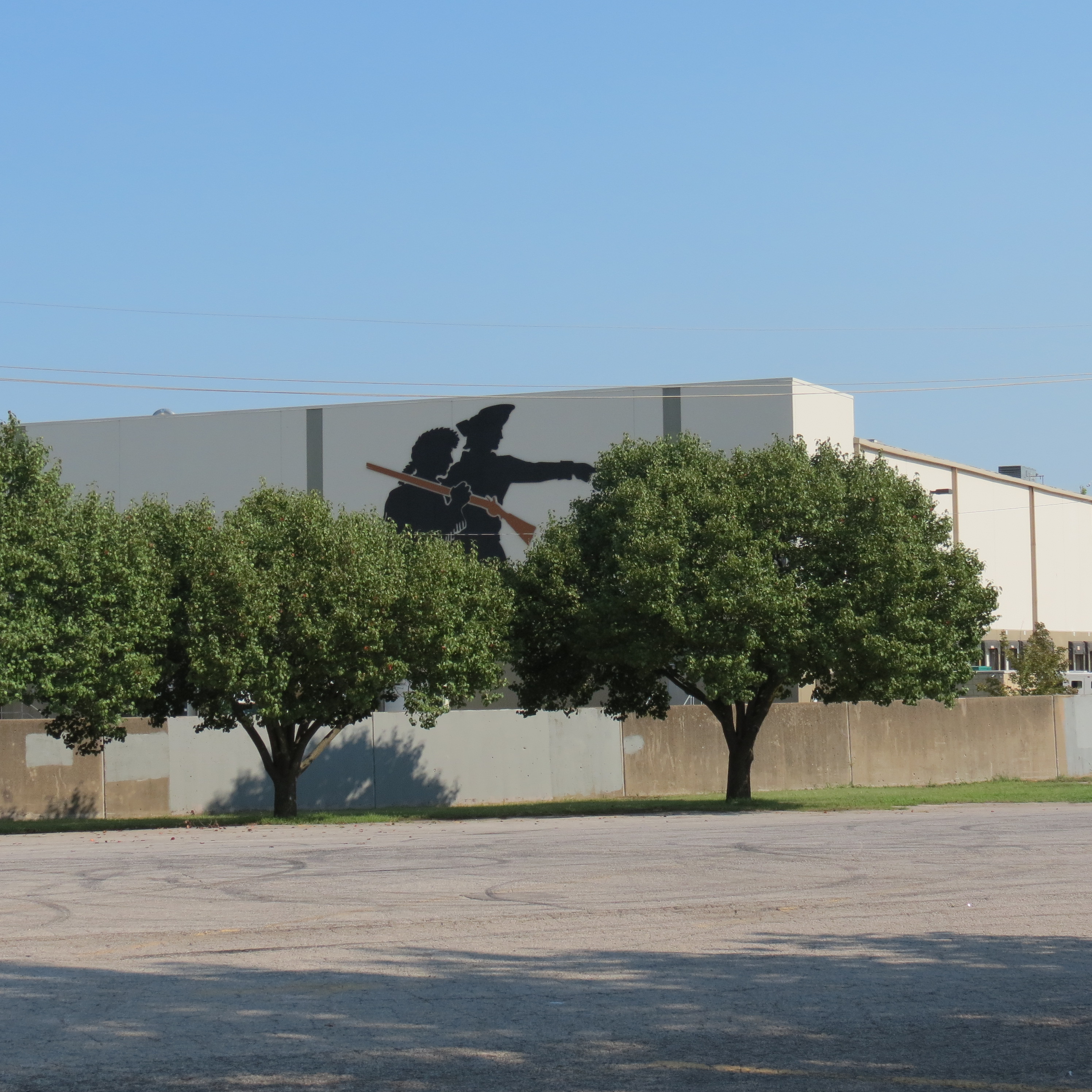
Kaw Point marks the junction between the Kansas and Missouri Rivers where Lewis and Clark camped in June 1804. The side of a building beside the park has a large silhouette of the two explorers.
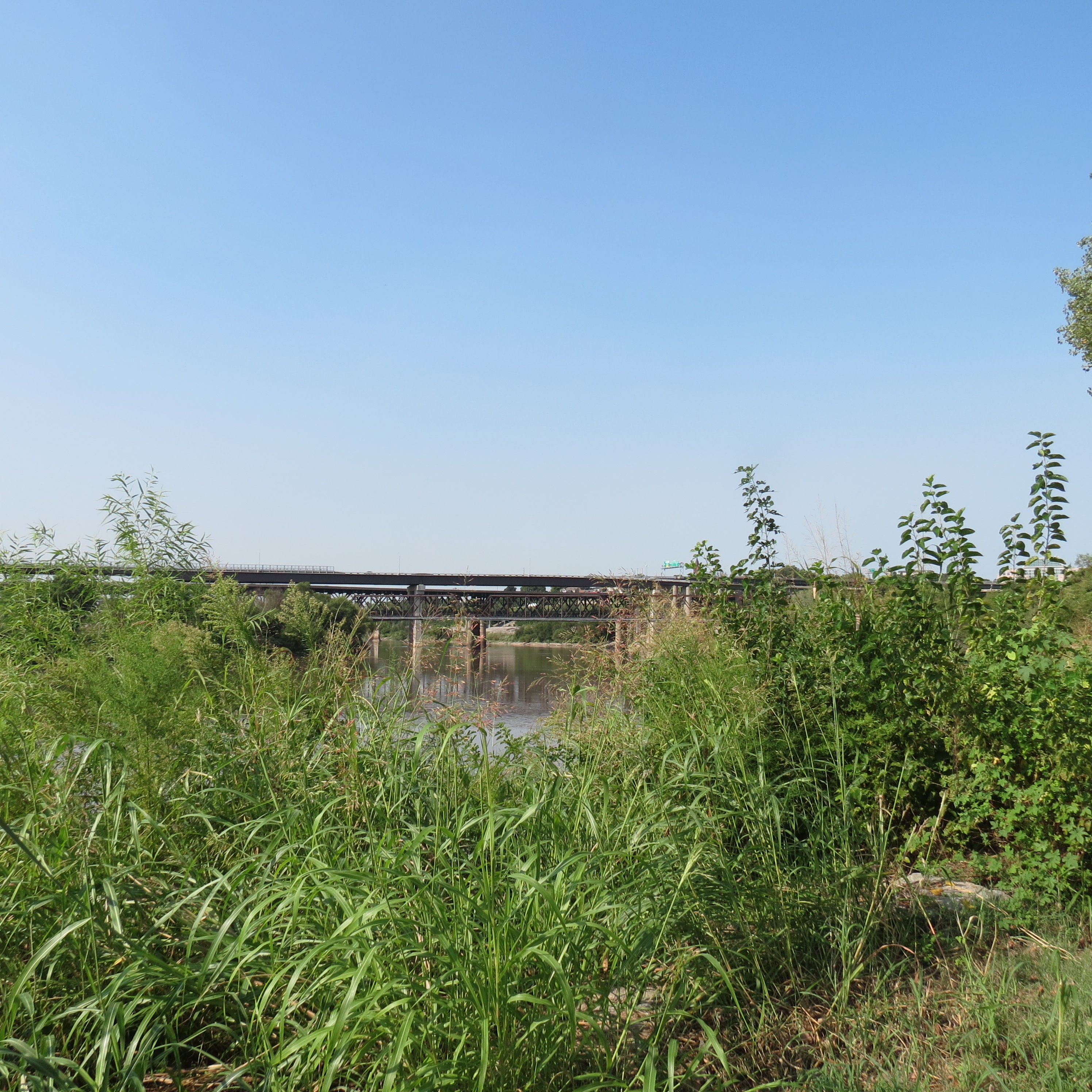
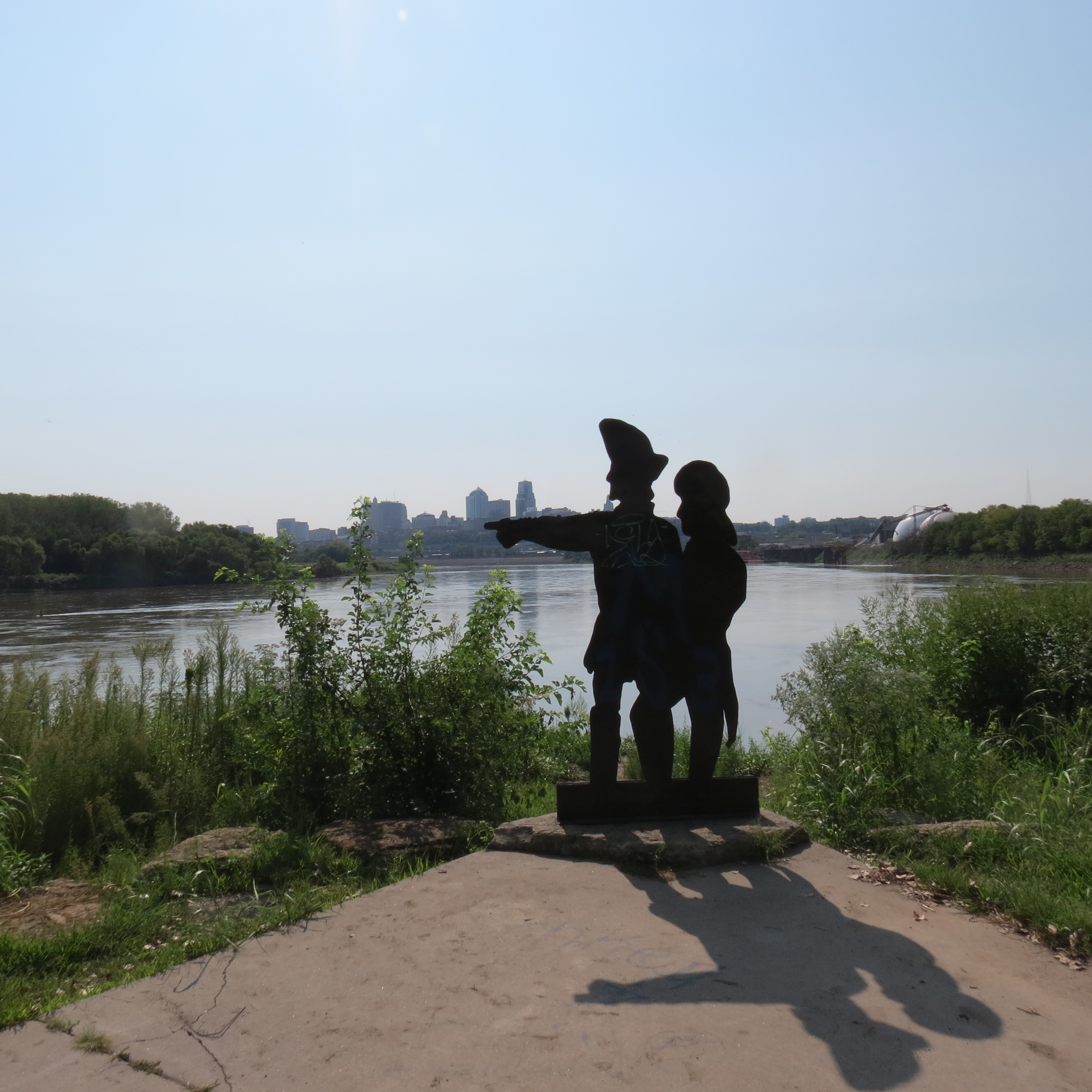
Reports from the explorers would talk about fertile soil and a good supply of game. They would also describe the water from the Missouri River in a way that would cement its nickname as “the Big Muddy.”
Previous slide
Next slide
Stop 9
White Feather Spring
3814 Ruby Ave. Kansas City, KS
DIRECTIONSWhite Feather Spring
3814 Ruby Ave. Kansas City, KS
The small monument here marks the location of White Feather Spring. Near this site, now owned by the Shawnee Tribe, was located Prophets Town (sometimes spelled "Prophetstown") named for Tecumseh’s brother Tenskwatawa or, known as “the Prophet.”. When Tecumseh left on another of his recruiting missions, he gave his brother strict instructions not to fight. Instead Tenskwatawa attacked the American troops, leading to a disastrous defeat.

Previous slide
Next slide
Stop 10
Shawnee Mission Manual Labor School
3403 W 53rd St. Fairway, KS
DIRECTIONSShawnee Mission Manual Labor School
3403 W 53rd St. Fairway, KS
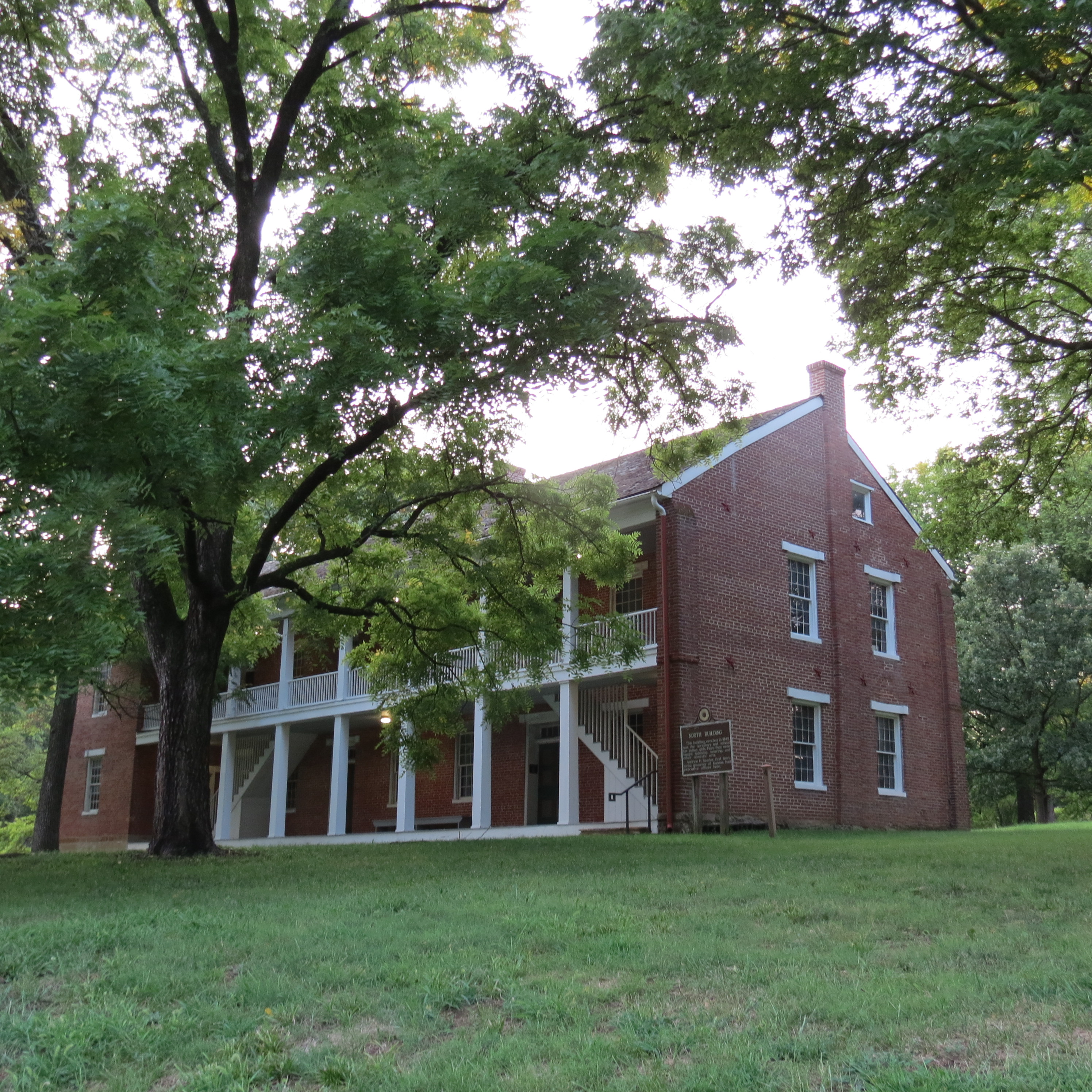
Tecumseh continued trying to form a strong alliance of tribes to push back the Americans but the damage was done. Eventually the Prophet would go into exile in Canada and later return and move to be with the remainder of the Shawnee. By the time of his death many of the Shawnee were disillusioned with him and his teachings of abandoning all things American and European. Some, like Black Bob in eastern Johnson County, would hold on to traditional beliefs and ways of life. Others would decide to try adapting and would send their children to the Shawnee Methodist Manual Labor School and Mission.


Previous slide
Next slide