Edit Content

SANTA FE TRAIL LANDMARK TOUR


Use this arrow to learn more at each stop.
The Santa Fe Trail Landmark Tour puts the trailhands’ experience into the palm of your hand. Using your device, you'll make 13 stops along the trail in Douglas County, Kansas, each with audio descriptions and images that bring the location's history to life.
Note: Addresses are approximate. Please use the "Directions" button for each stop's exact location.
A print-friendly map is available here. For a mobile-friendly map, click here.
Previous slide
Next slide
Stop 1
The Narrows
Near N 200 Rd. and E 2200 Rd. Lawrence, KS
DIRECTIONS
The Narrows is a term used for the ridge that serves as the watershed divide between the Wakarusa and Kansas Rivers to the north and the Marais des Cygnes river to the south.

The wagon trains followed this ridge knowing that it would greatly minimize the creeks and streams they would need to cross, thus greatly reducing the chances of getting stuck or damaging their wheels and axles.
There is no specific beginning or end but it probably started at roughly the Douglas County line on the east and ended close to Overbrook on the west.

The Narrows followed a thin narrow ridge between the tributaries of these two rivers. The need for the wagons to follow this ridge is the reason the trail bent to the north and then back south as it moved across Douglas County.

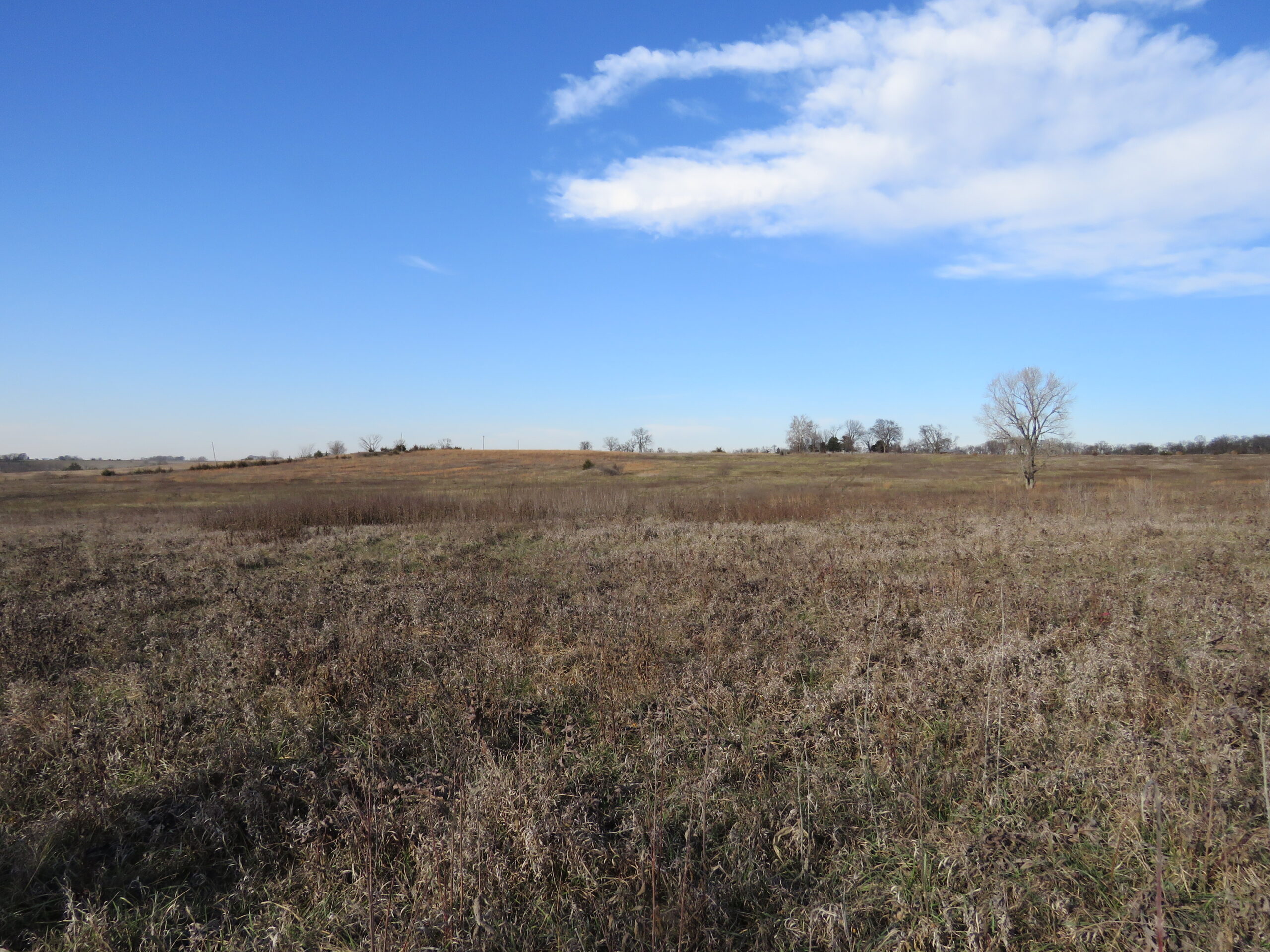
View from Black Jack Ruts looking northwesterly to the distant ridge was referred to as part of the narrows.
Grindstone Creek at the bottom of the hill was one of the last creeks they would have to cross for some distance to the west.

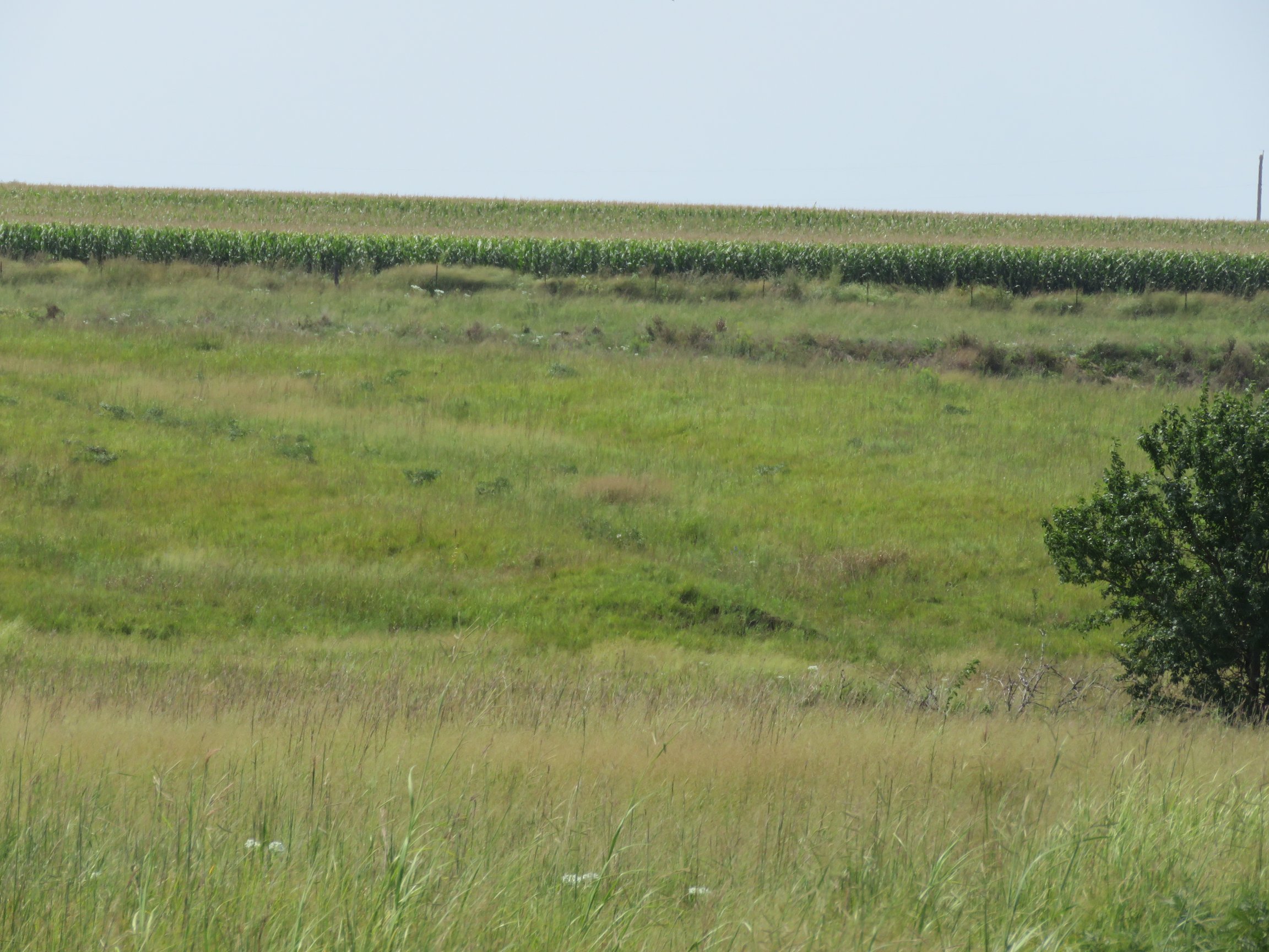
A view of the narrows from the west end of the diagonal road to the west of Trail Park.

Another view of the narrows from the west end of the diagonal road to the west of Trail Park.
Previous slide
Next slide
Stop 2
Black Jack Town Site
195 E 2075 Rd. Wellsville, KS
DIRECTIONS
The town of Black Jack was located 4 miles east of Baldwin and ½ mile south of current US 56. Black Jack was settled by immigrants as early as 1852 even though the territory was not officially open to settlement until 1854.
In 1857 about ten local men formed a company and petitioned the government to survey a town site. The site comprised of 40 acres divided into 20 blocks and located on the divide between the Kansas and Marais des Cygnes Rivers. The town took its name from Black Jack Crossing, located ½ mile to the west. The crossing was named by the Mexican wagon train drivers, probably because of the Black Jack oaks that grew along the creek.
By 1858 there was a hotel, two black smith shops, a wagon shop, stage barn, two churches, a post office, and a doctor’s office. The main road was the Santa Fe Trail. Some years 60,000 teams travelled through town on this route.
The cemetery was platted in 1874 for 90 graves. It is the only thing remaining of the town today. Many of the stones are still visible.

The Kansas Pacific Railroad was completed through Wellsville in 1870, and after that most commercial interests abandoned Black Jack and moved to Wellsville.

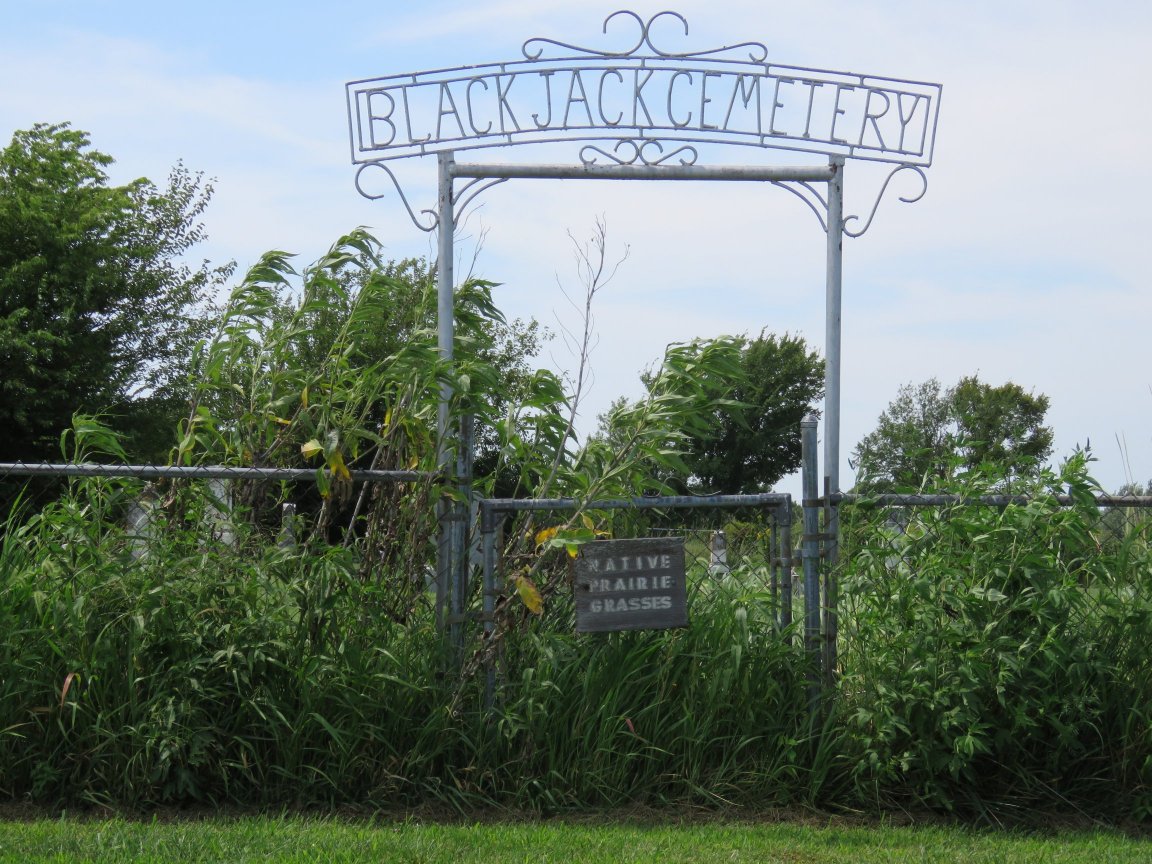
Gateway into Black Jack Cemetery.

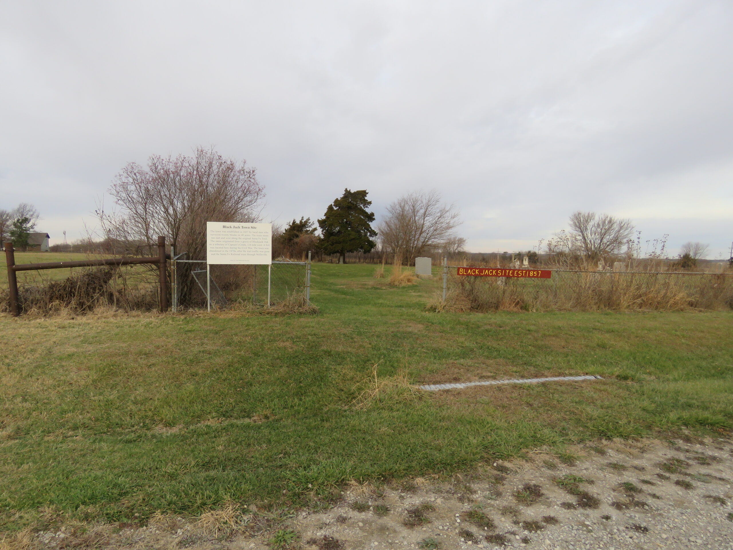
Black Jack cemetery information panel and location sign.

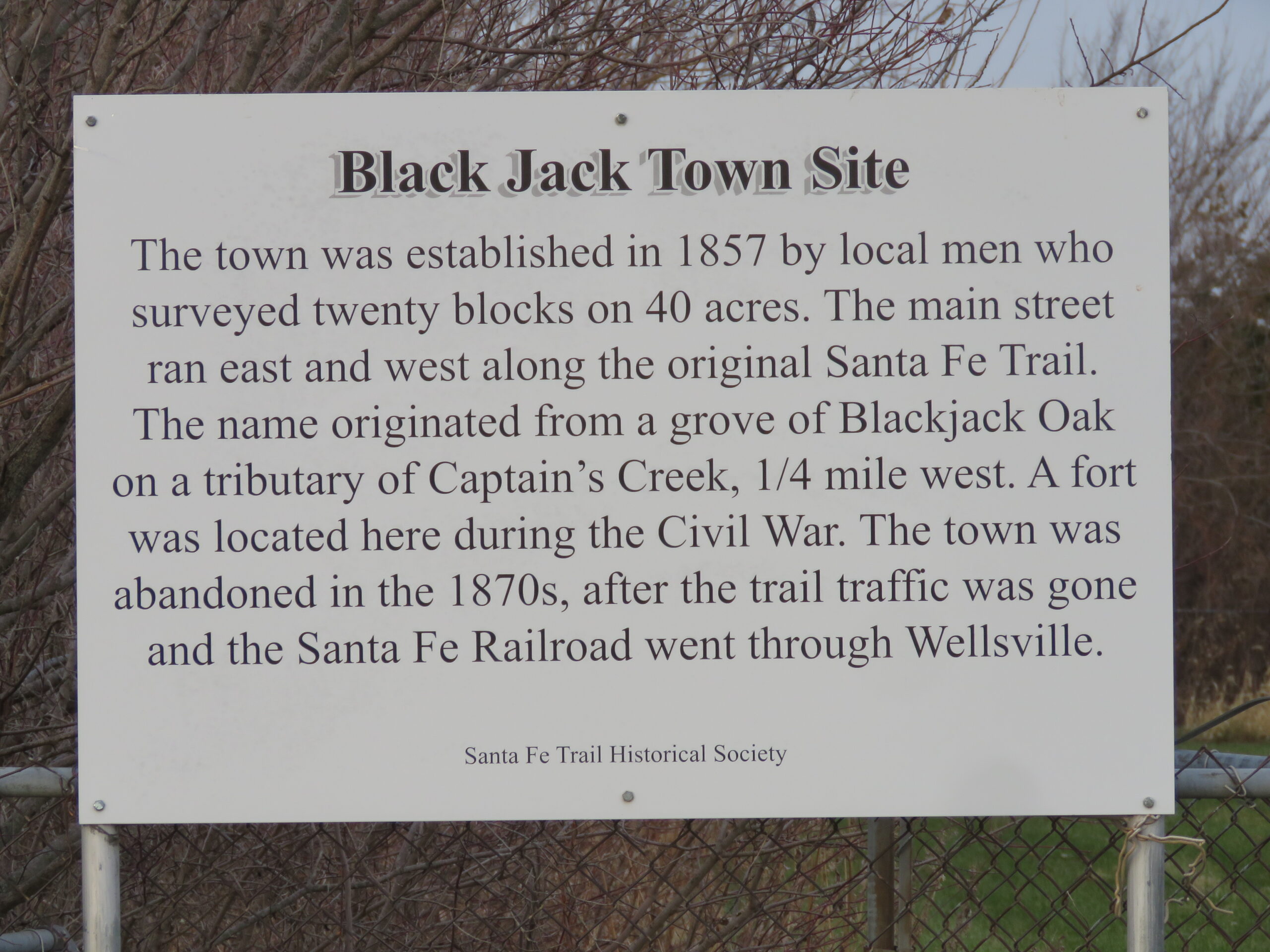
Up close view of information panel.

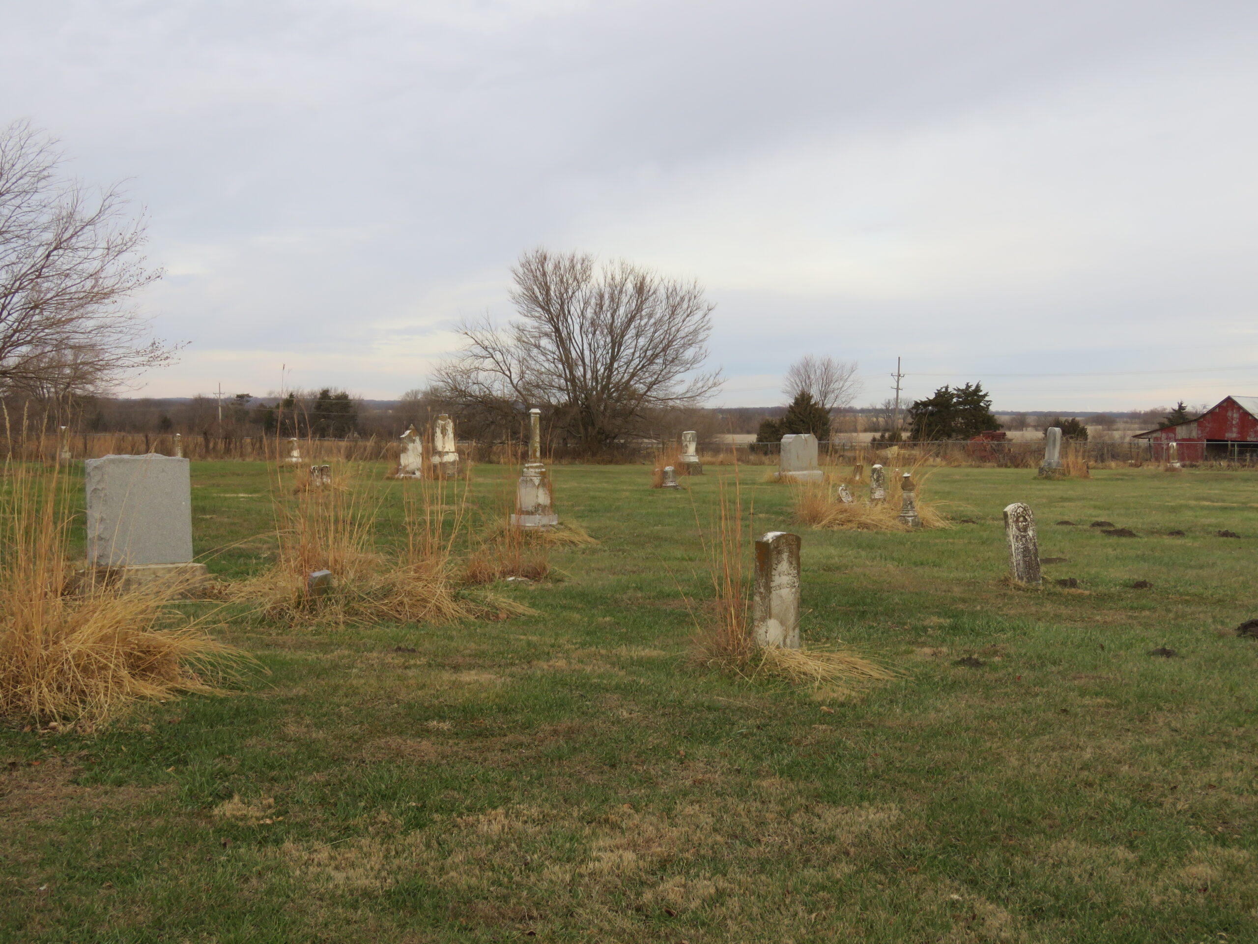
View of the cemetery with grave stones.
Previous slide
Next slide
Stop 3
Black Jack Ruts and Ivan L. Boyd Memorial Prairie Preserve
2043 E 2000 Rd. Wellsville, KS
DIRECTIONS
This roadside park has two large historical markers, one describing the Battle of Black Jack, which occurred ½ mile to the south, and the other relating the history of Baldwin, which is 3 miles west on US 56.
The stone marker was originally placed by the Daughters of the American Revolution at the Black Jack Town Site, ½ mile to the east. The green metal sign describes the 18 acres of native prairie to the south which still contains five very impressive tracks, as well as five more obscure tracks, all left by wagons using the Santa Fe Trail between 1821 and the 1870’s.
A new gravel foot trail to the south goes out to these ruts.

The Black Jack Ruts and Ivan L. Boyd Memorial Prairie Preserve are owned and managed by Douglas County and listed as a National Historic Landmark.

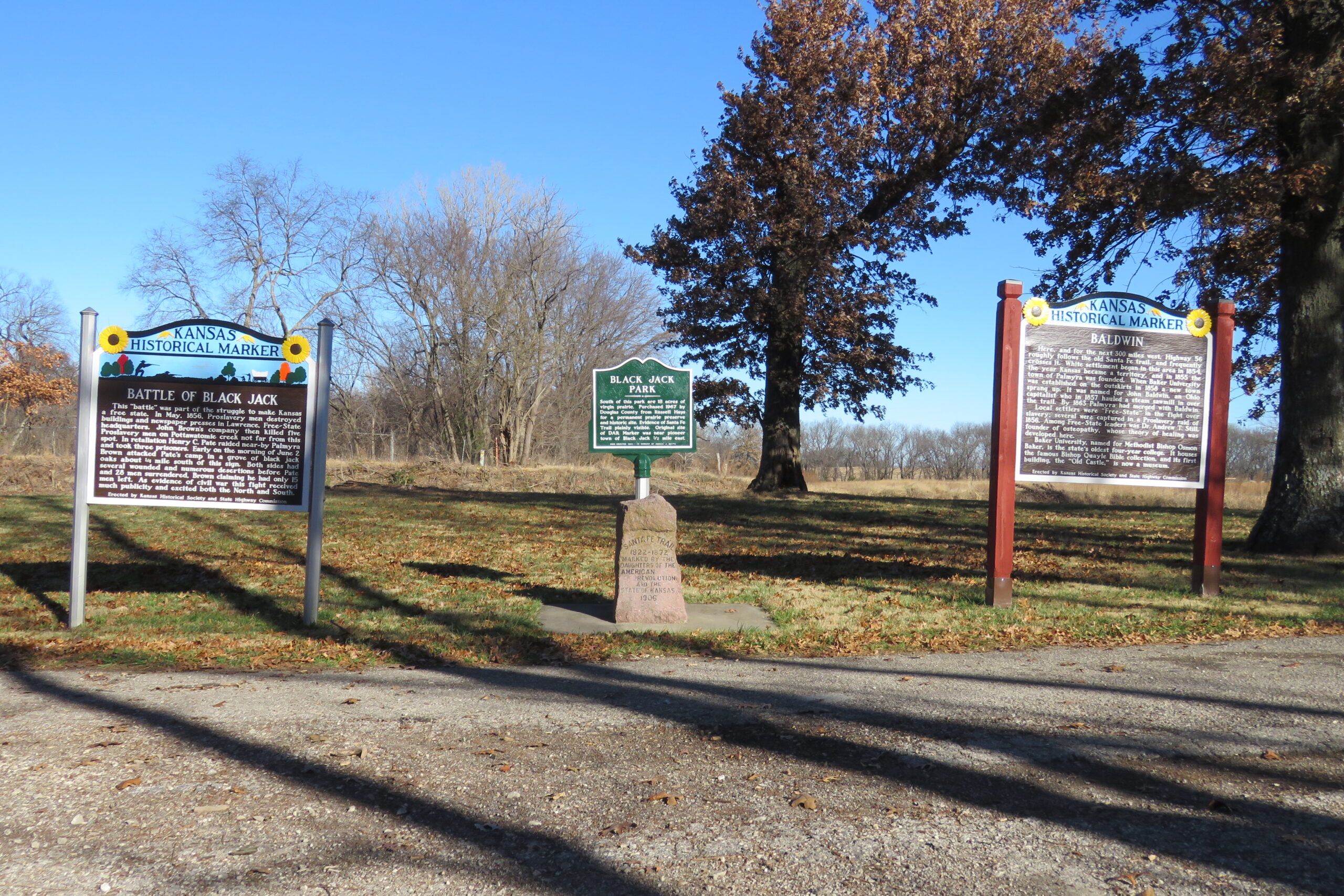
Large Kansas Highway Historical marker, DAR granite marker, and green metal Black Jack Park Marker.

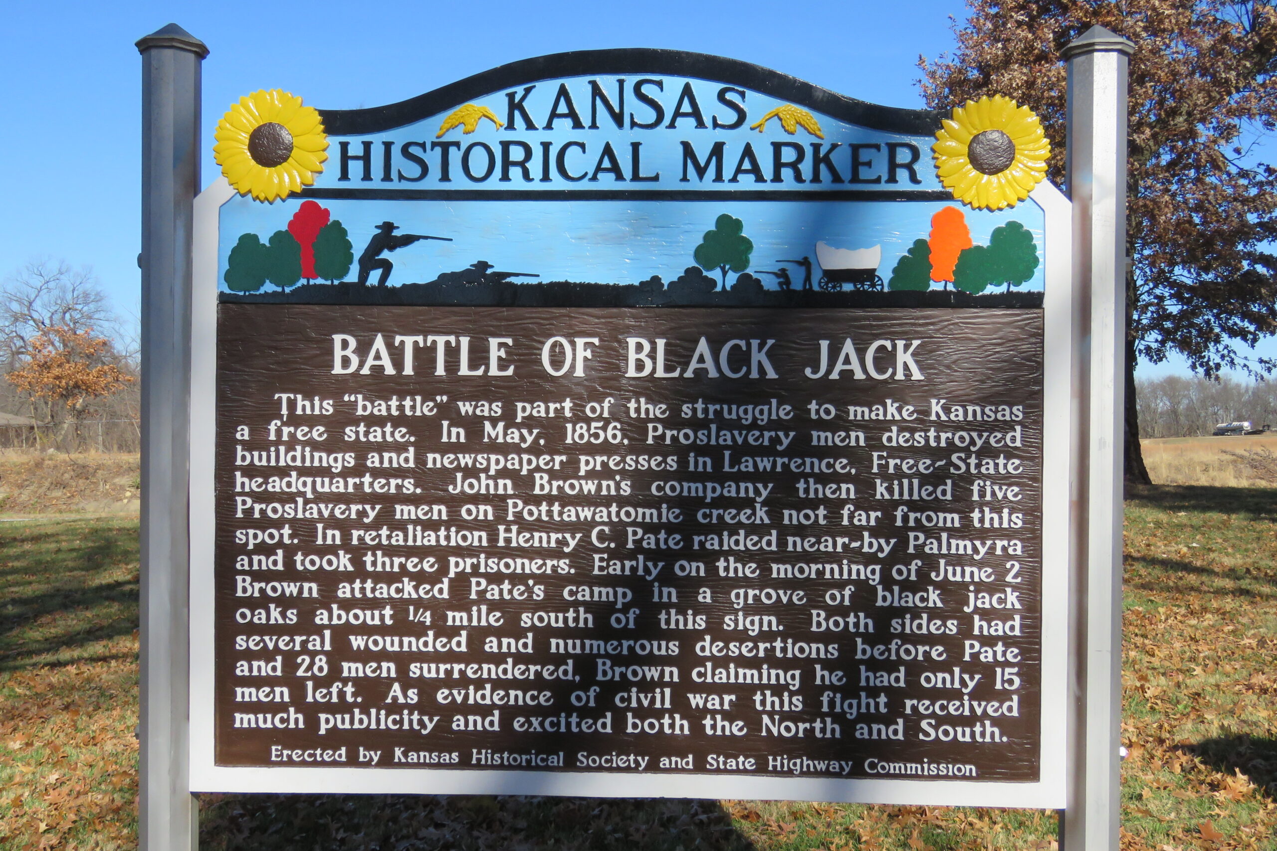
Close up of Battle of Black Jack Historical Marker.

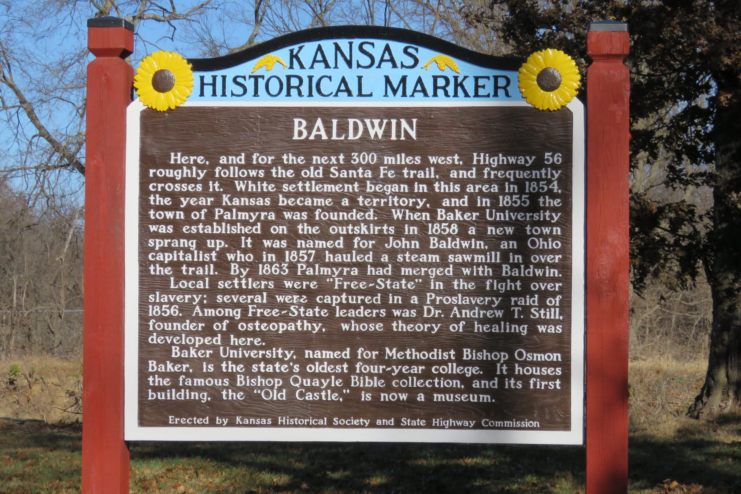
Close up of Baldwin Historical Marker. Relocated from US 56 and High St. in 2020.

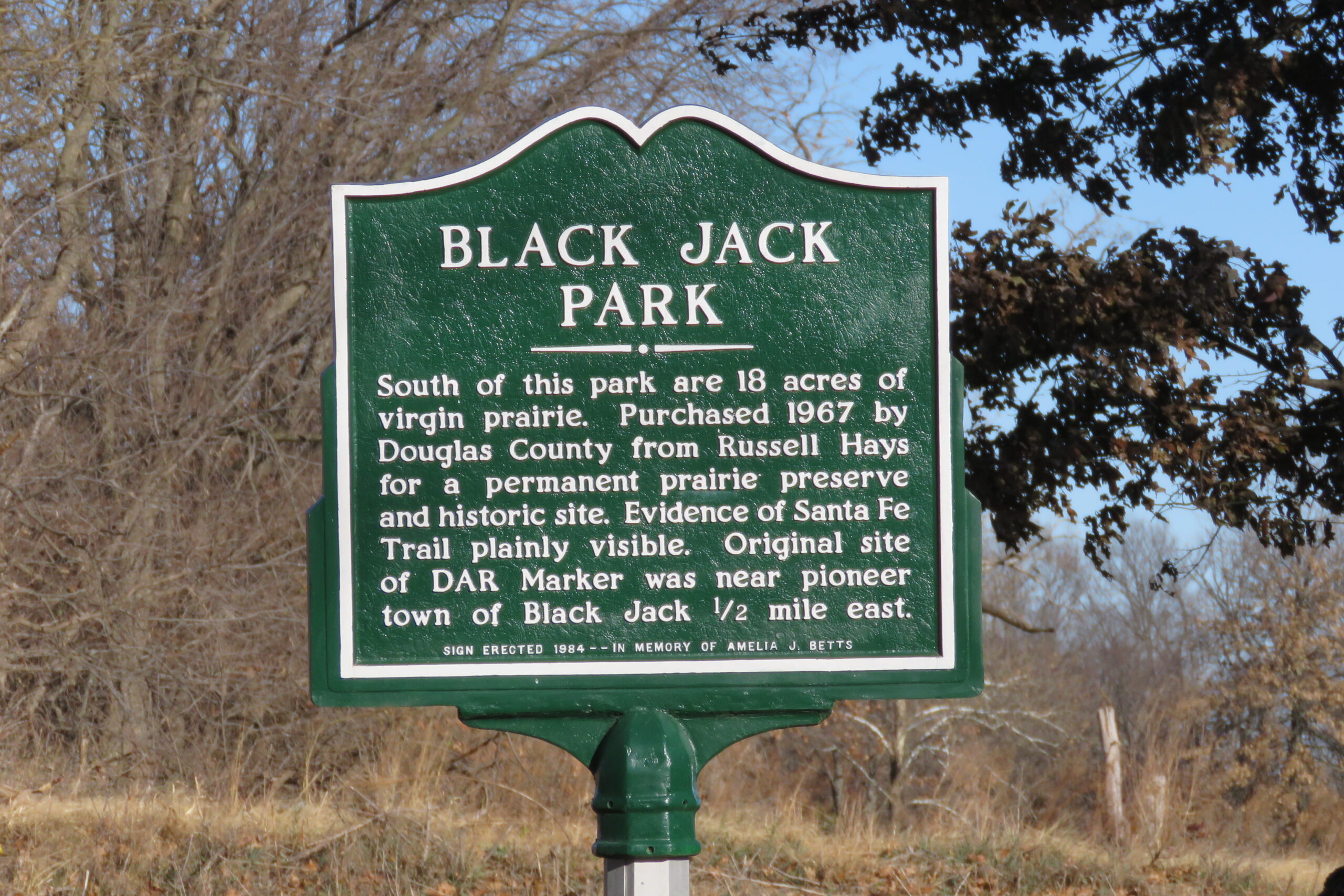
Close up of green metal marker for Black Jack Park.

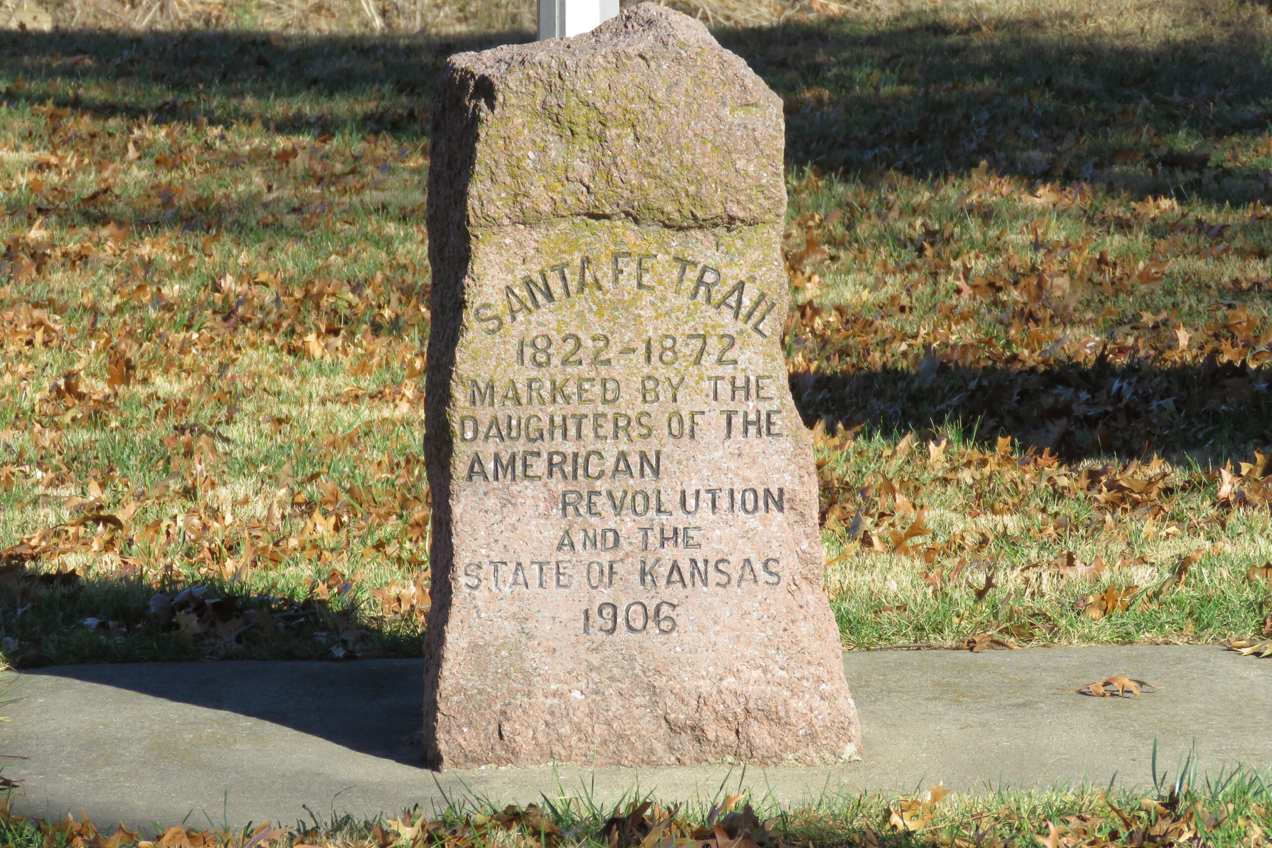
Close up of DAR Marker.

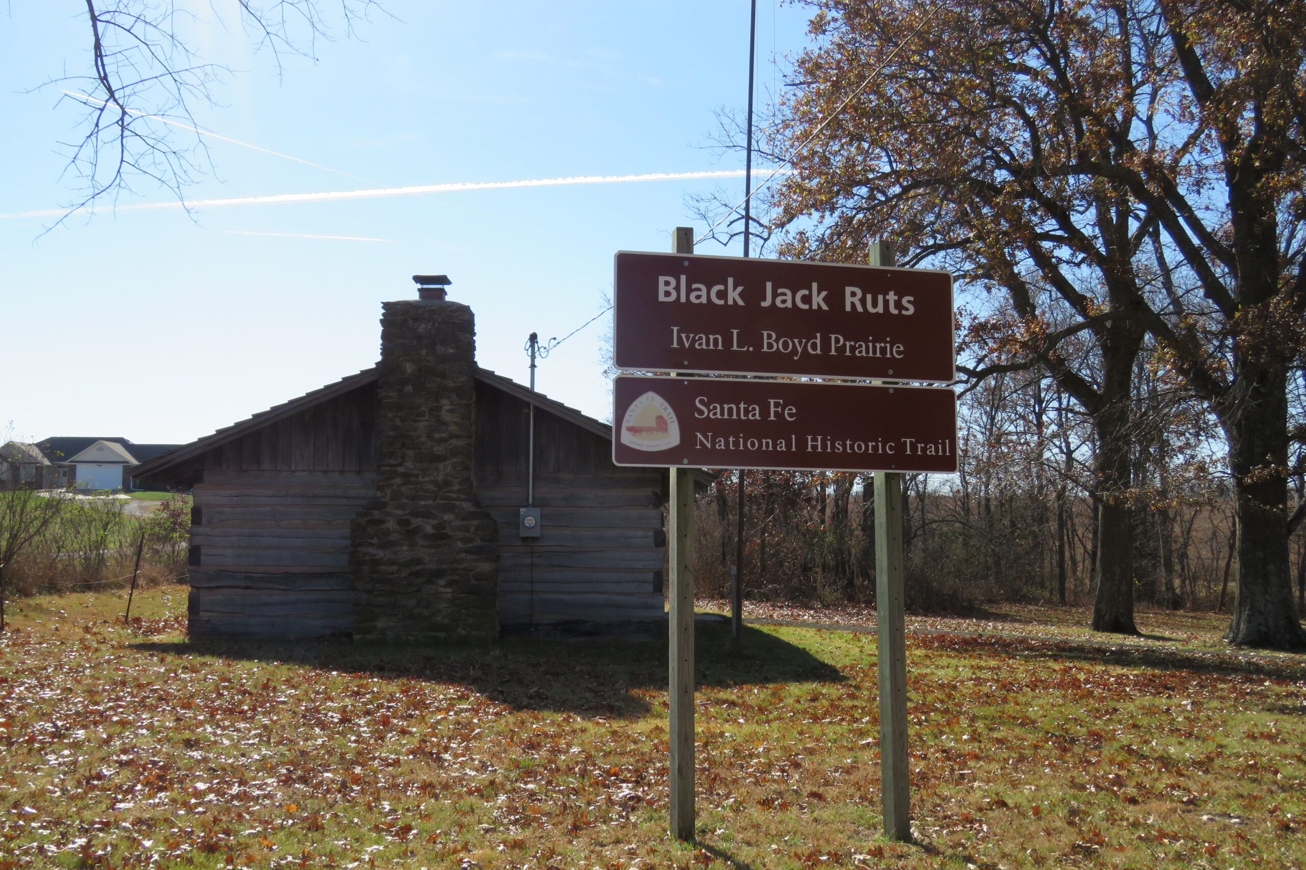
Entrance sign indicating site name of Black Jack Ruts and Ivan Boyd Prairie with the log cabin in the background.

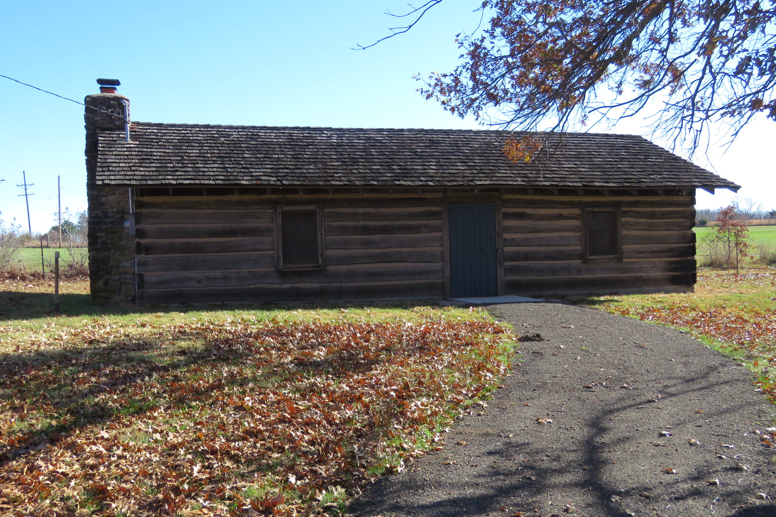
Replica log cabin built from locally milled logs in 1969 by Santa Fe Trail Historical Society. Used as a meeting place and a place to display many historical artifacts from the area.

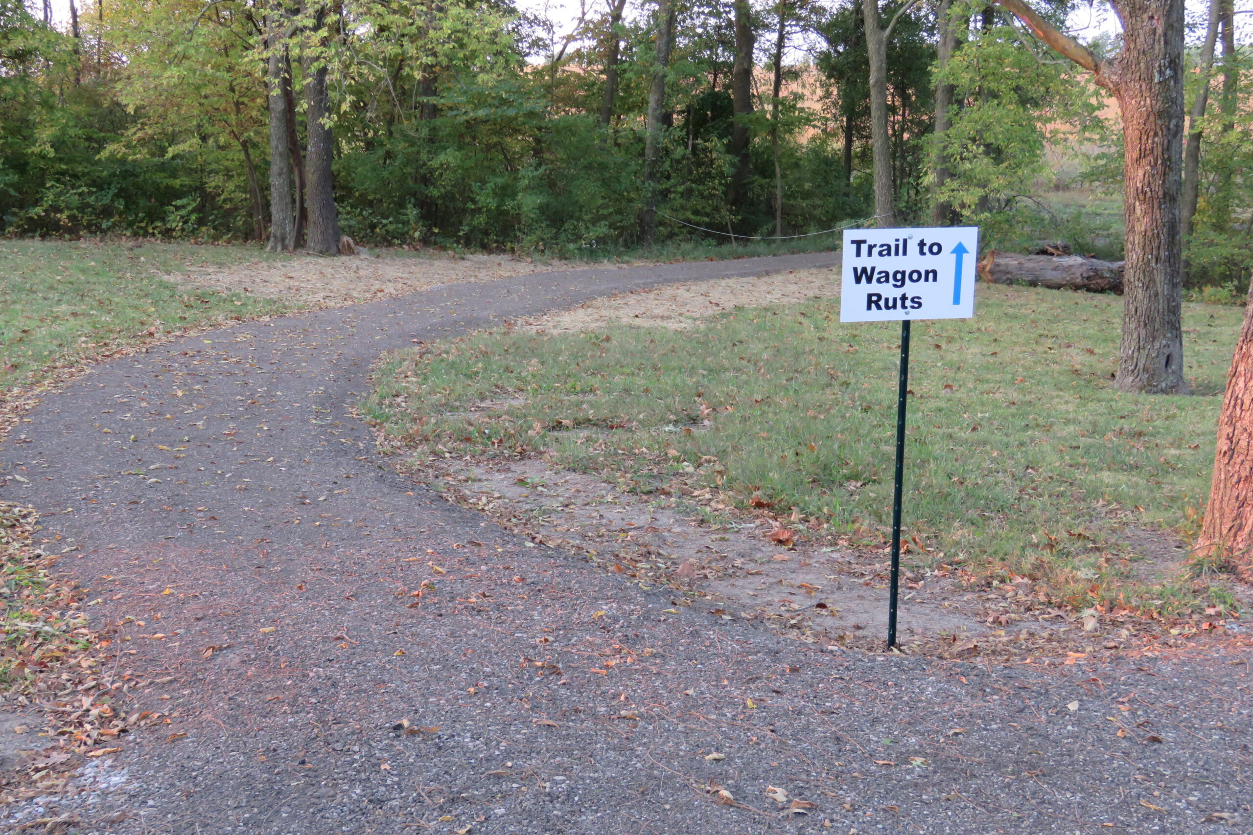
A view of the entrance to the new walking trail from cabin to wagon ruts. Interpretive panels installed 2021.

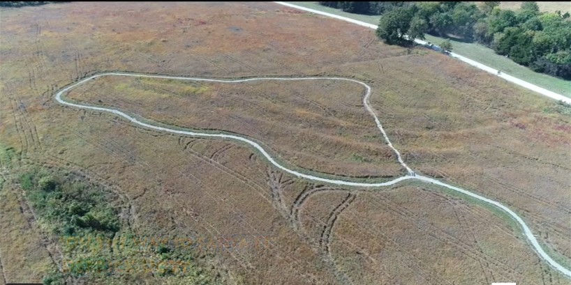
Drone view of new walking trail which is a quarter mile long and loops around and through the five main ruts.

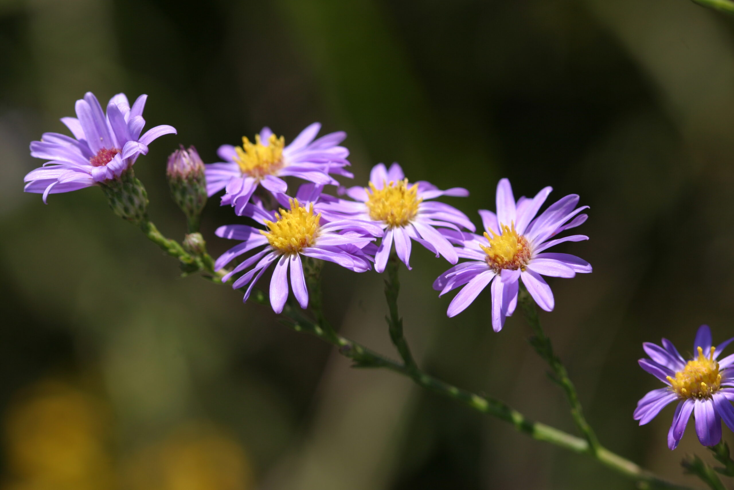
Photo of Azure Aster (Symphyotrichum oolentangiense) one of 230 species of plants that have been identified at the site by local botanist, Dr. Roger Boyd.

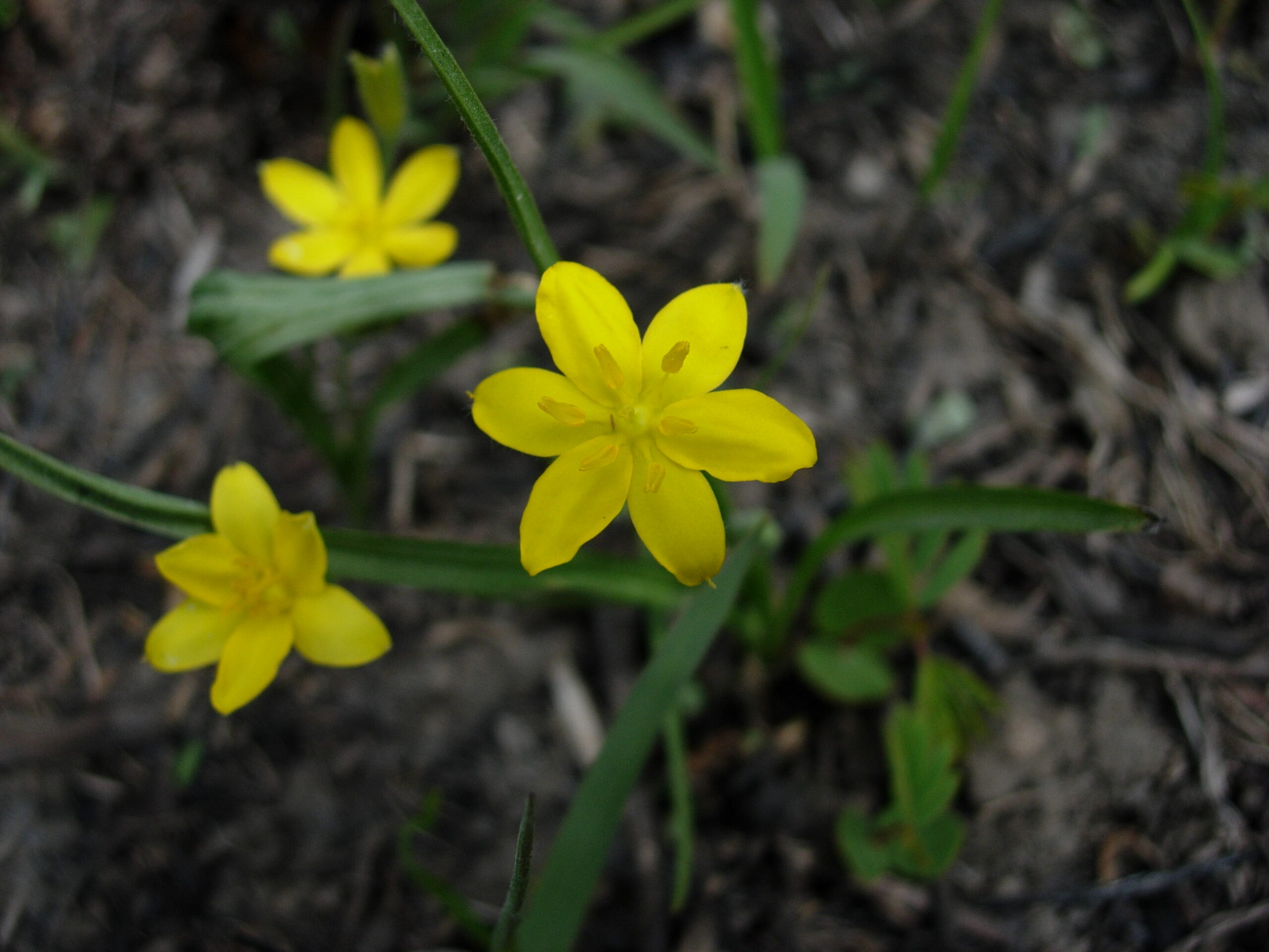
Photo of Yellow Stargrass (Hypoxis hirsute) one of 230 species of plants that have been identified at the site by local botanist, Dr. Roger Boyd.
Previous slide
Next slide
Stop 4
Black Jack Battlefield
163 E 2000 Rd. Wellsville, KS
DIRECTIONS
This location as well as the Santa Fe Trail ruts to the northeast were the site of what many consider to be the first battle of the Civil War.
In the early morning hours of June 2, 1856, Free Stater John Brown and 29 men advanced upon Captain Henry C. Pate and company who were camped on this site. The five-hour battle concluded in tricking Capt. Pate into believing Brown’s forces were much larger than they were, and Pate surrendered.
Three days later, Pate and his men were turned over to Colonel E.V. Sumner, from Fort Leavenworth, at Trail Park, just west of Palmyra. They were then released to other leaders of the Missouri border ruffians and sent back to Missouri.

Robert Hall Pearson fought in the battle alongside Brown, and after the war bought 200 acres where the battle was fought. In the 1880’s he built a farmhouse on the site. This house has recently been restored and is open to visitors on occasion.
Several miles of nature trails can be explored on the property. The Black Jack Battlefield and Nature Park is owned and managed by Black Jack Battlefield Trust and is listed as a National Historic Landmark.

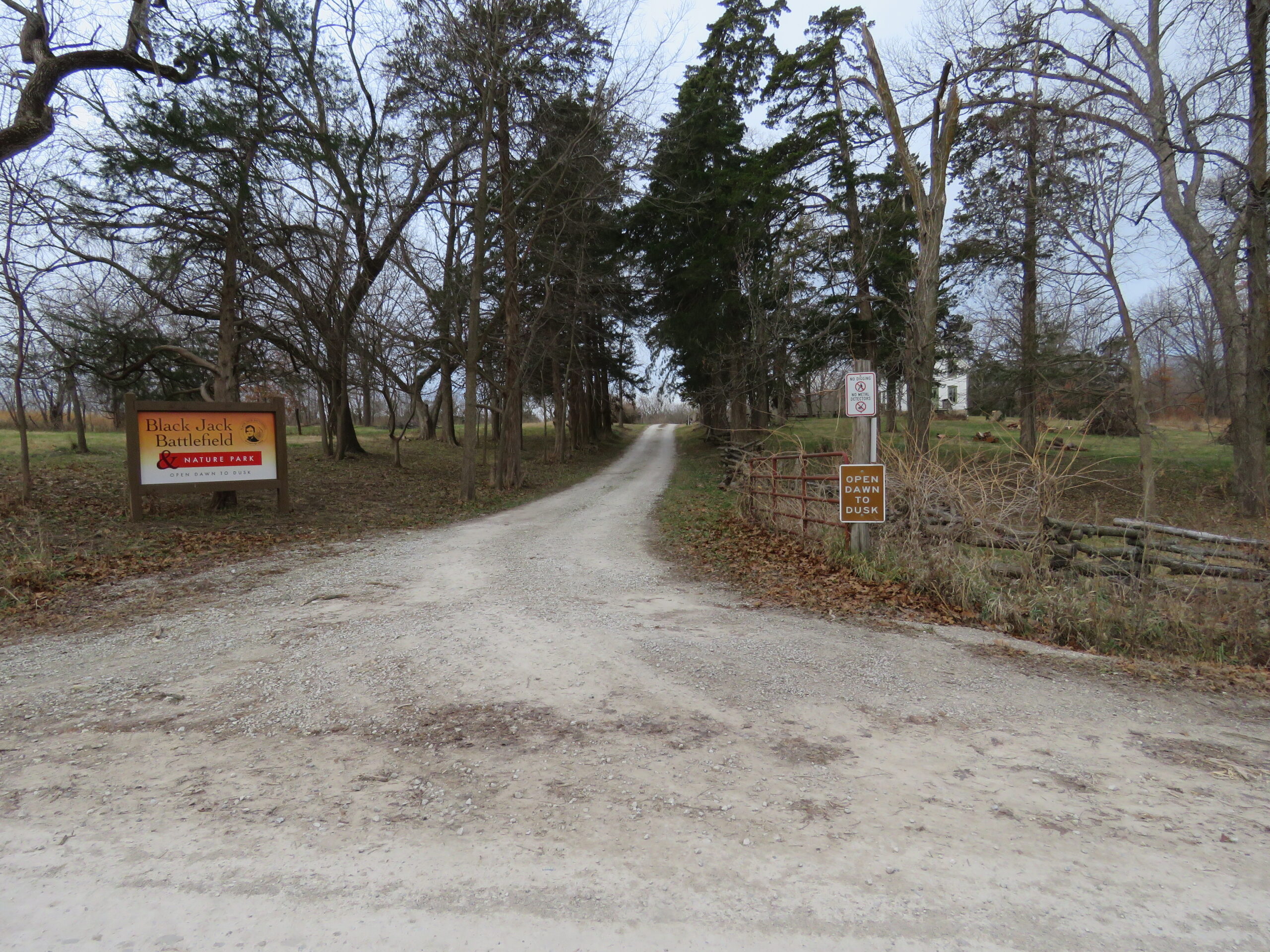
View of entrance to the Black Jack Battlefield and Nature Park. View looking west from East 2000 Rd.

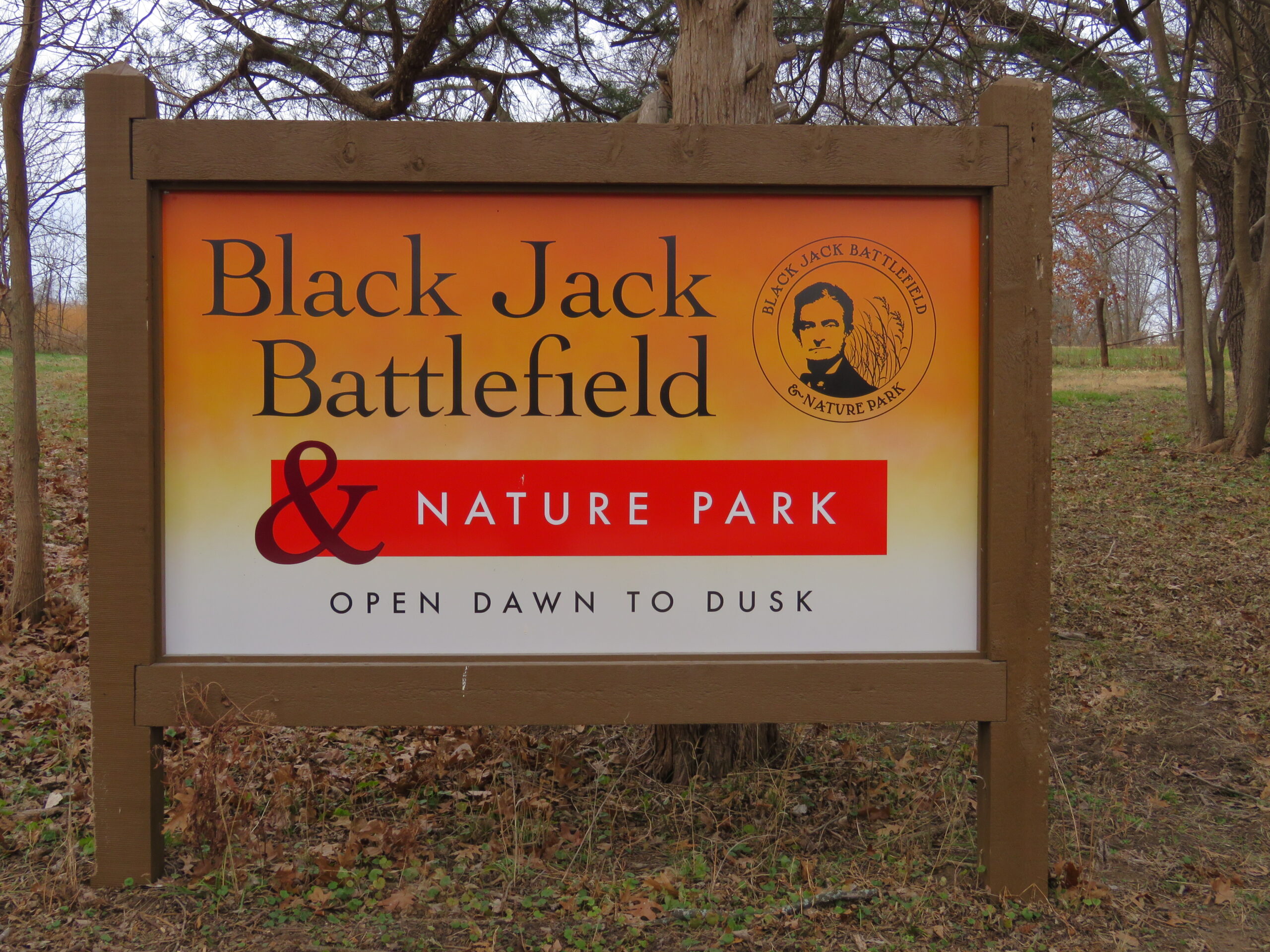
Closeup view of the entrance sign to the Black Jack Battlefield and Nature Park.

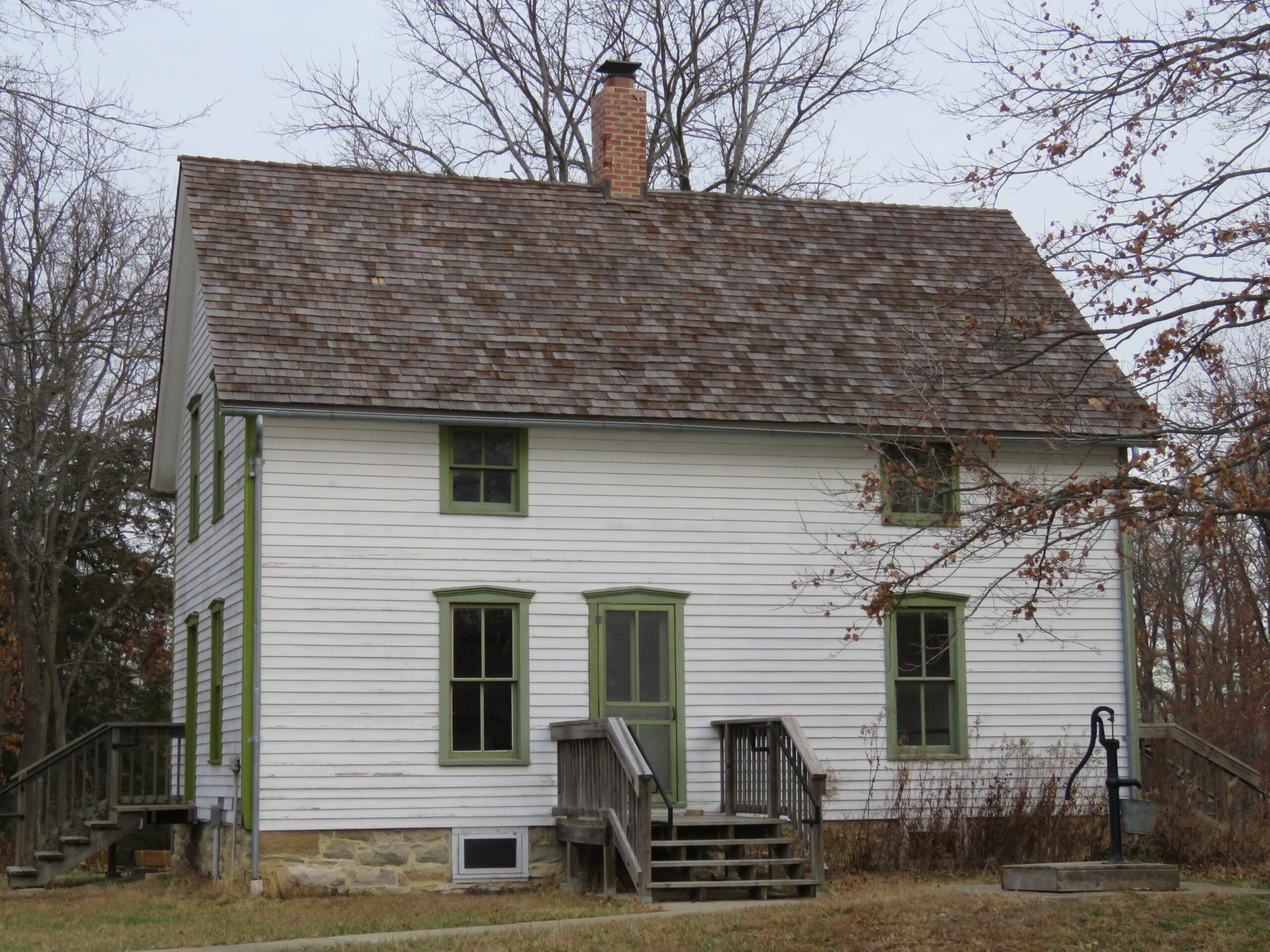
View of Robert Hall Pearson farmhouse built in 1880’s. View of house looking north.

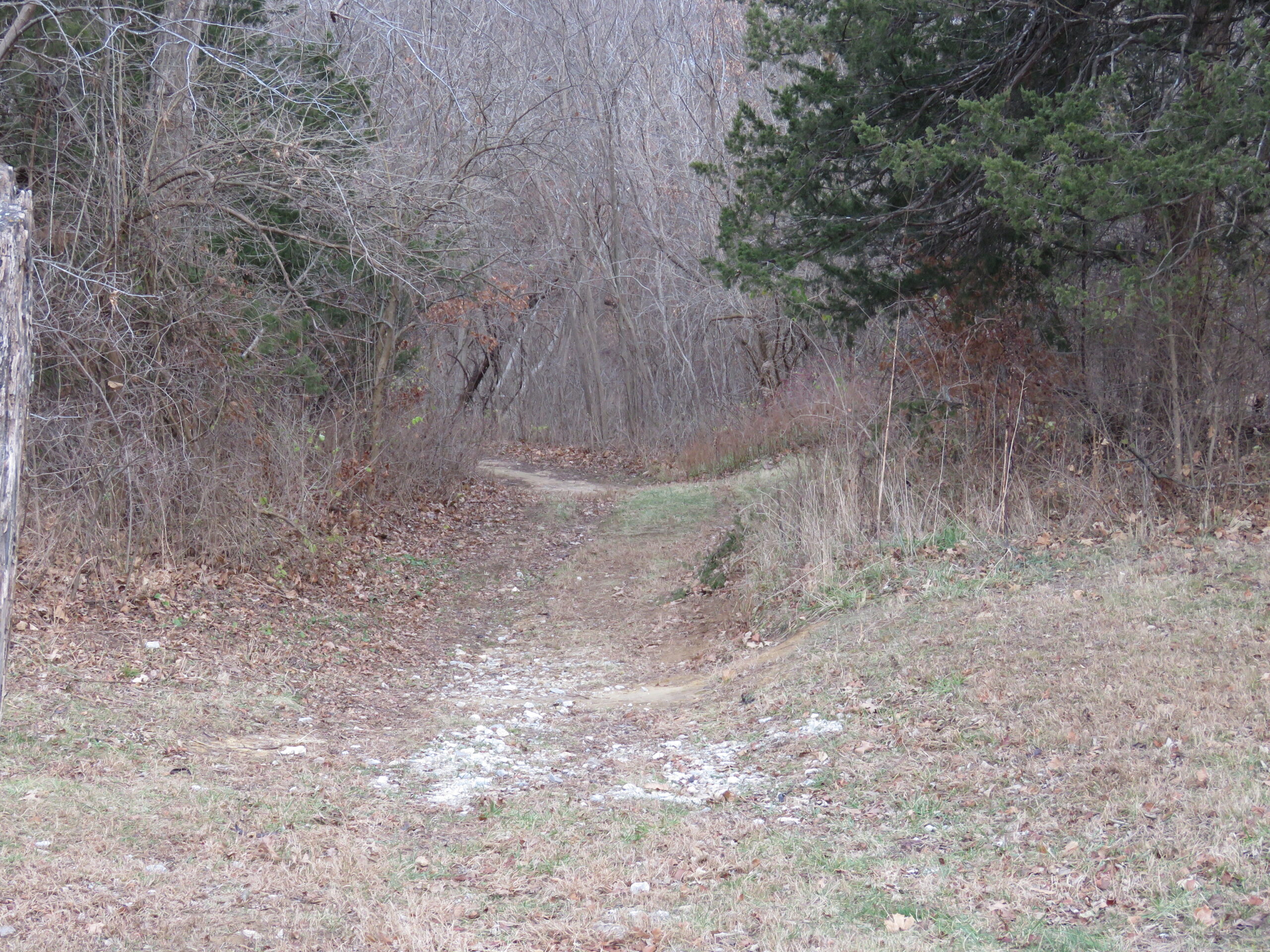
View of main nature trail, looking northwesterly from farmhouse.
Previous slide
Next slide
Stop 5
Palmyra Well
Washington St. & Palmyra Ln. Baldwin City, KS
DIRECTIONS
This well was dug prior to 1857 when the town of Palmyra was established. This and the Blood Grocery Store to the west were the main meeting places in town.
The well provided a reliable source of water to the many travelers along the trail as well as to the residents in the area. Earliest photos show an open wooden box around the well with a simple cross bar to pull up the buckets of water. No roof was present.
The current structure was built in 2010 to enclose the well for liability issues.

Distant view of site.

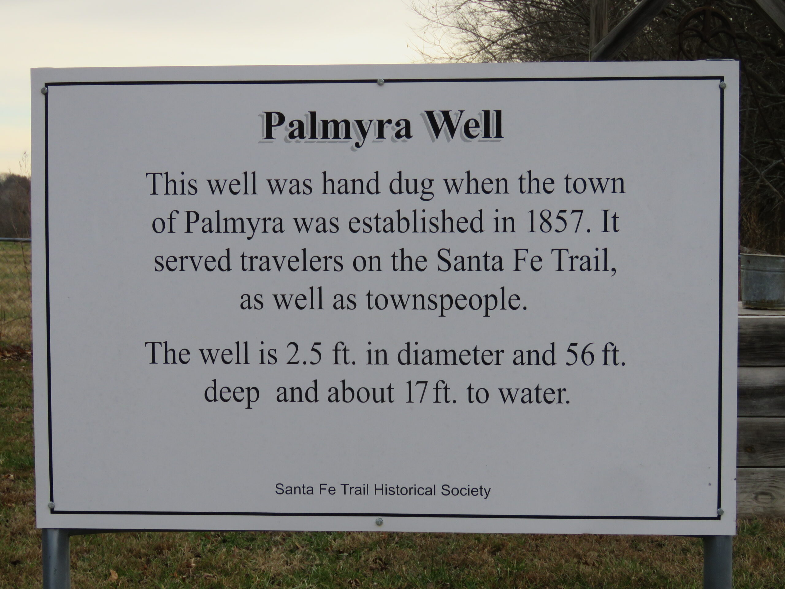
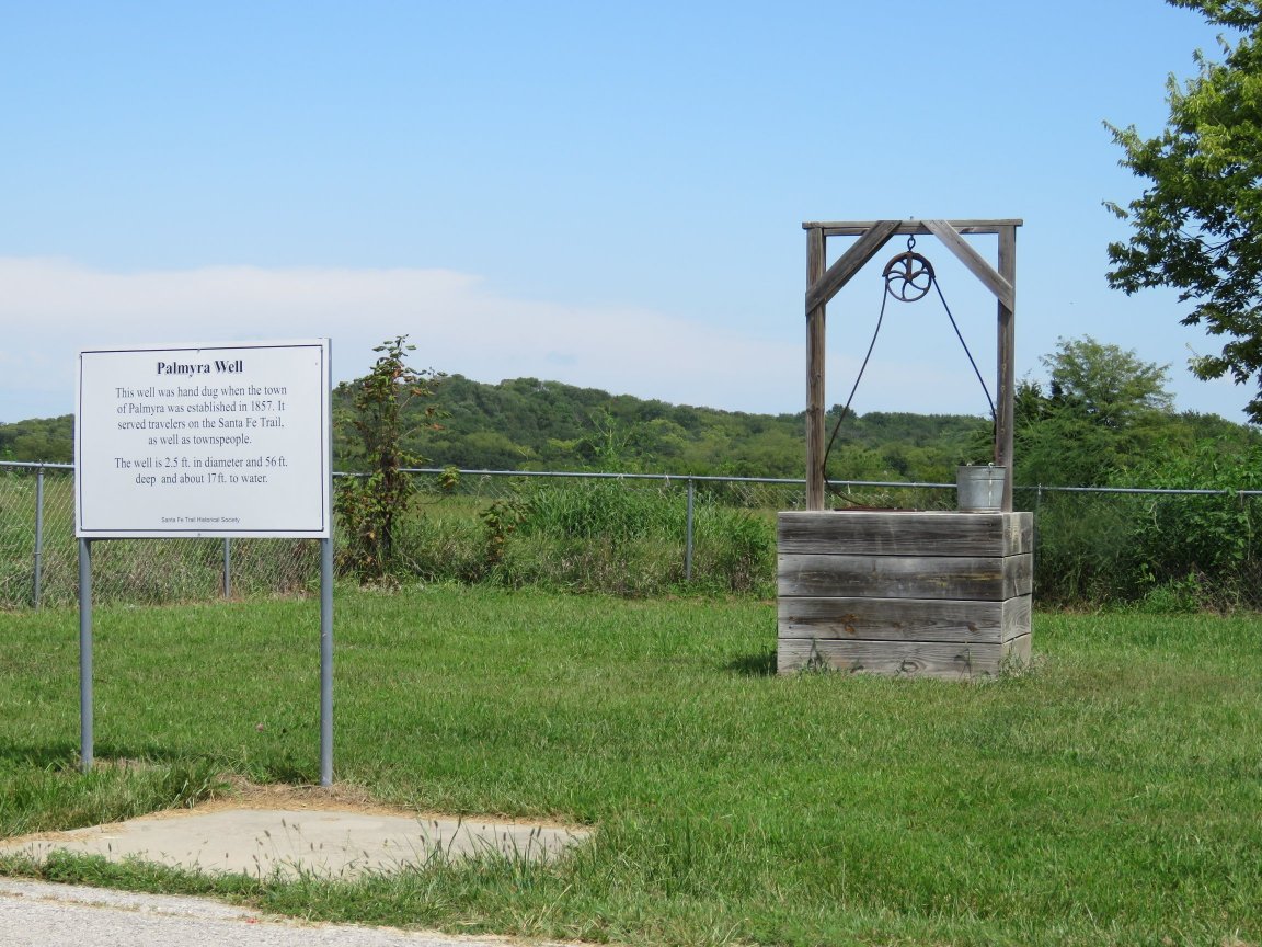
Photo of current information sign at the site.

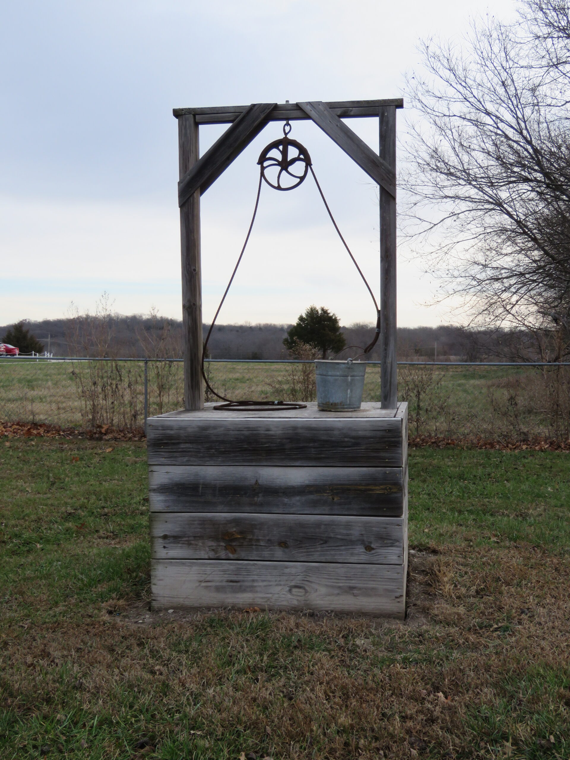
Photo of current well structure.
Previous slide
Next slide
Stop 6
Palmyra DAR Marker
Eisenhower St. & Palmyra Ln. Baldwin City, KS
DIRECTIONS
This typical granite DAR marker is located on the east side of the Baldwin Junior High School and within the former Palmyra Town site.
With it is a green metal sign with information about Palmyra. The metal sign was placed here in 1983 by local historians Katharine Kelley and Amelia Betts.
Both signs are located on the west side of the intersection of Eisenhower St. and Palmyra Lane, and one block west of the Palmyra Well. They are located close to where the Blood Grocery Store and Post Office was originally located in Palmyra.

This post office was relocated several times and now is located next to Old Castle at 511 5th St. in Baldwin. It has recently been restored.

Distant view of markers at intersection of Eisenhower St. and Palmyra Lane. View is looking west.

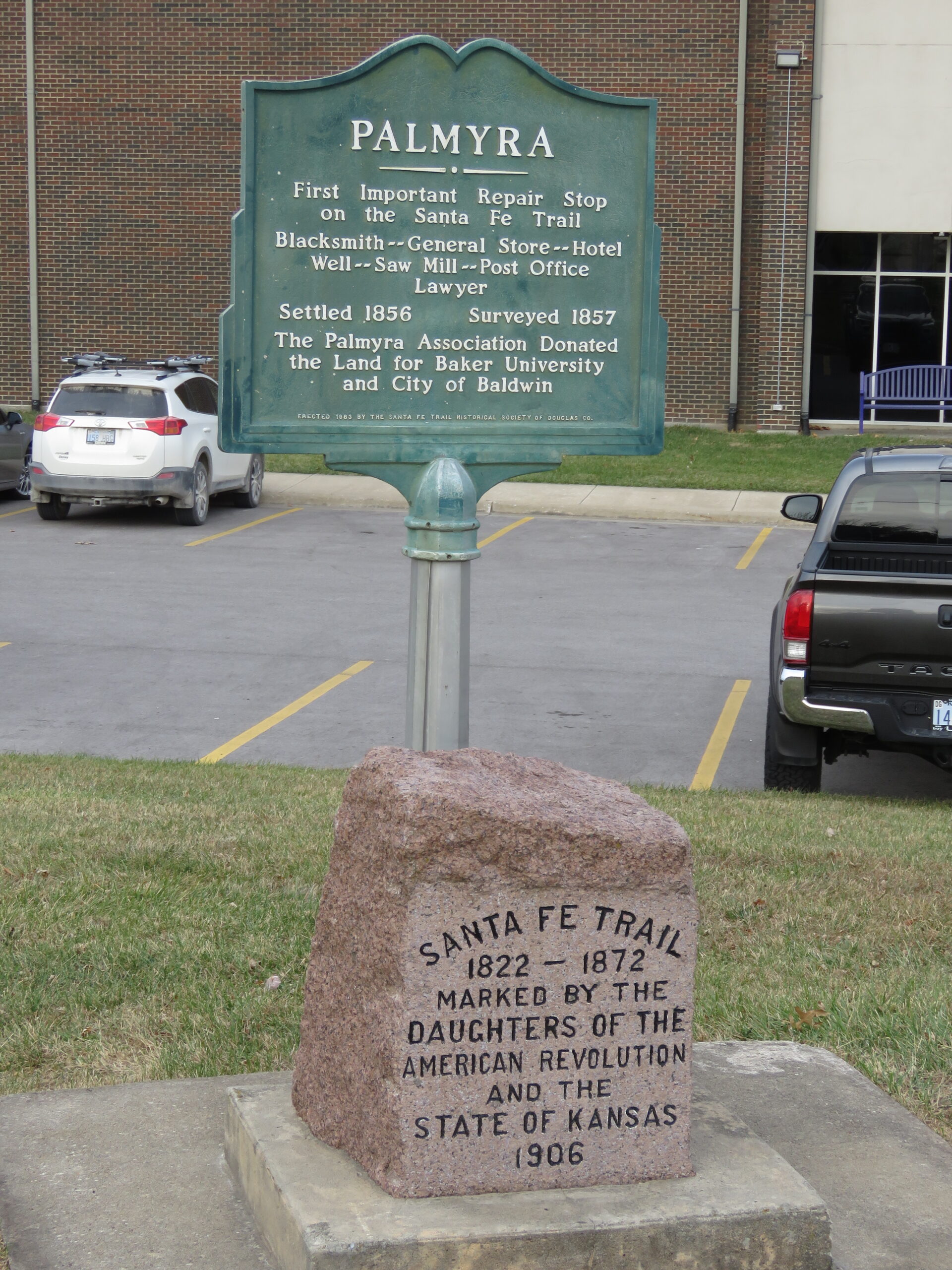
Closeup view of granite DAR marker and green metal marker providing information about Palmyra. Metal signed placed here in 1983 by local historians Katharine Kelley and Amelia Betts.
Previous slide
Next slide
Stop 7
Trail Park
N 400 Rd. Baldwin City, KS
DIRECTIONS
This park was located along the Santa Fe Trail and is adjacent to a small stream that was sometimes called Cut Off Crossing. The stream originated from of the upper reaches of Ottawa or Tauy Creek.
In the time of the trail, the creek would have been shallow with little noticeable banks and easily crossed. It would also have had timber along it for use as firewood for camping.

On this site, June 5, 1856, three days after the Battle of Black Jack, John Brown turned over his prisoners, Capt. Henry C. Pate and 22 of his men, to Colonel E.V. Sumner of Fort Leavenworth, who then turned them over to leaders of the Missouri border ruffians who, in turn, sent them home.
The site contains a large granite DAR maker, a wooden sign, and a green metal sign erected in 1983 by local historians Katharine Kelley and Amelia Betts. The DAR marker originally contained a large bronze plaque which was stolen in 1967 and replaced with a marble plaque in 1969.

The angling road on the left is part of the original route of the Santa Fe Trail. The Trail Park is owned and managed by Baker University and is listed as a National Historic Landmark.

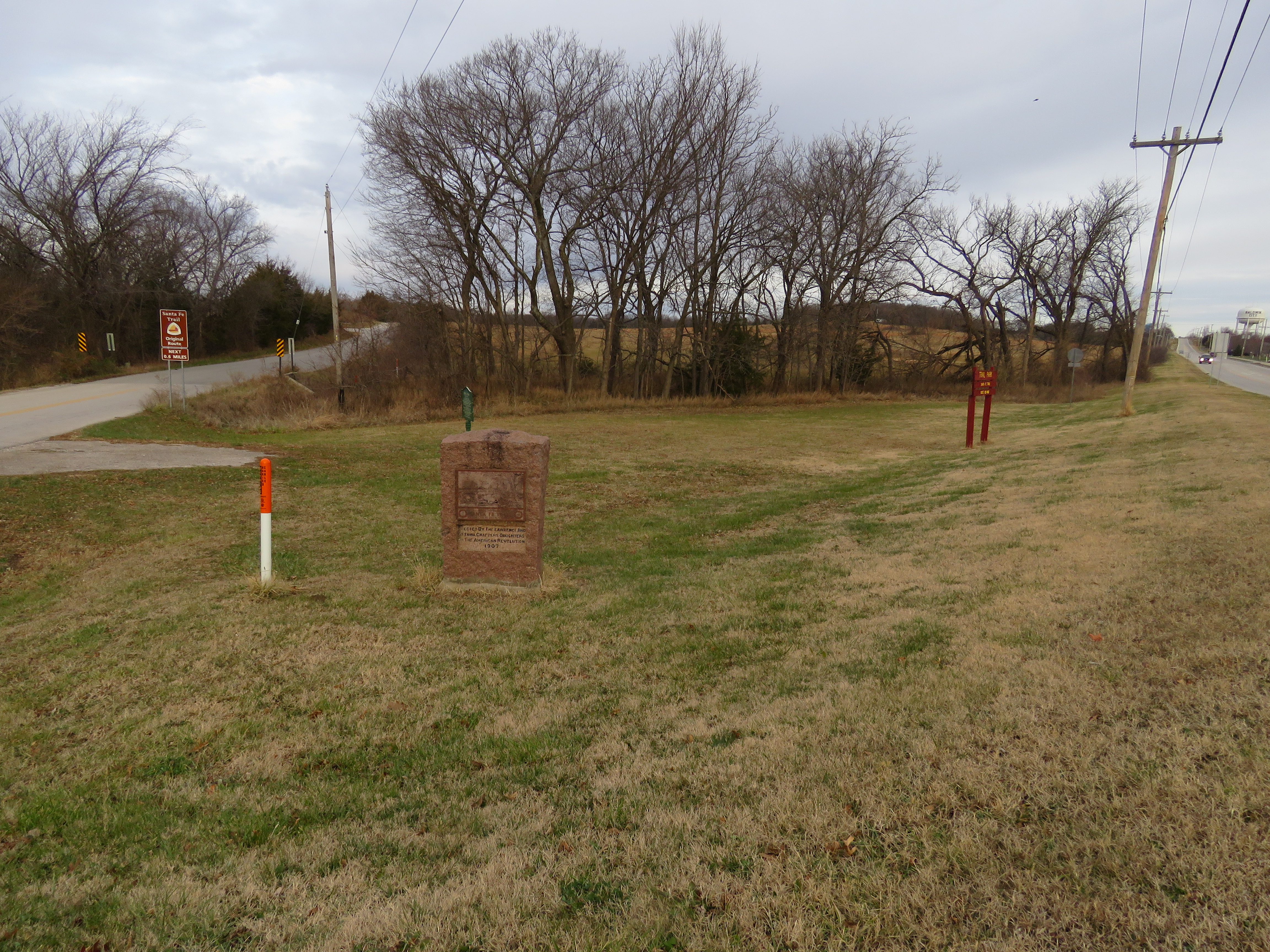
Distant view of Trail Park looking northwest. In the foreground is the large granite DAR marker. The green metal sign is directly behind the DAR marker. To the right is the red wooden sign. The trees in the background are on the banks of the small creek.

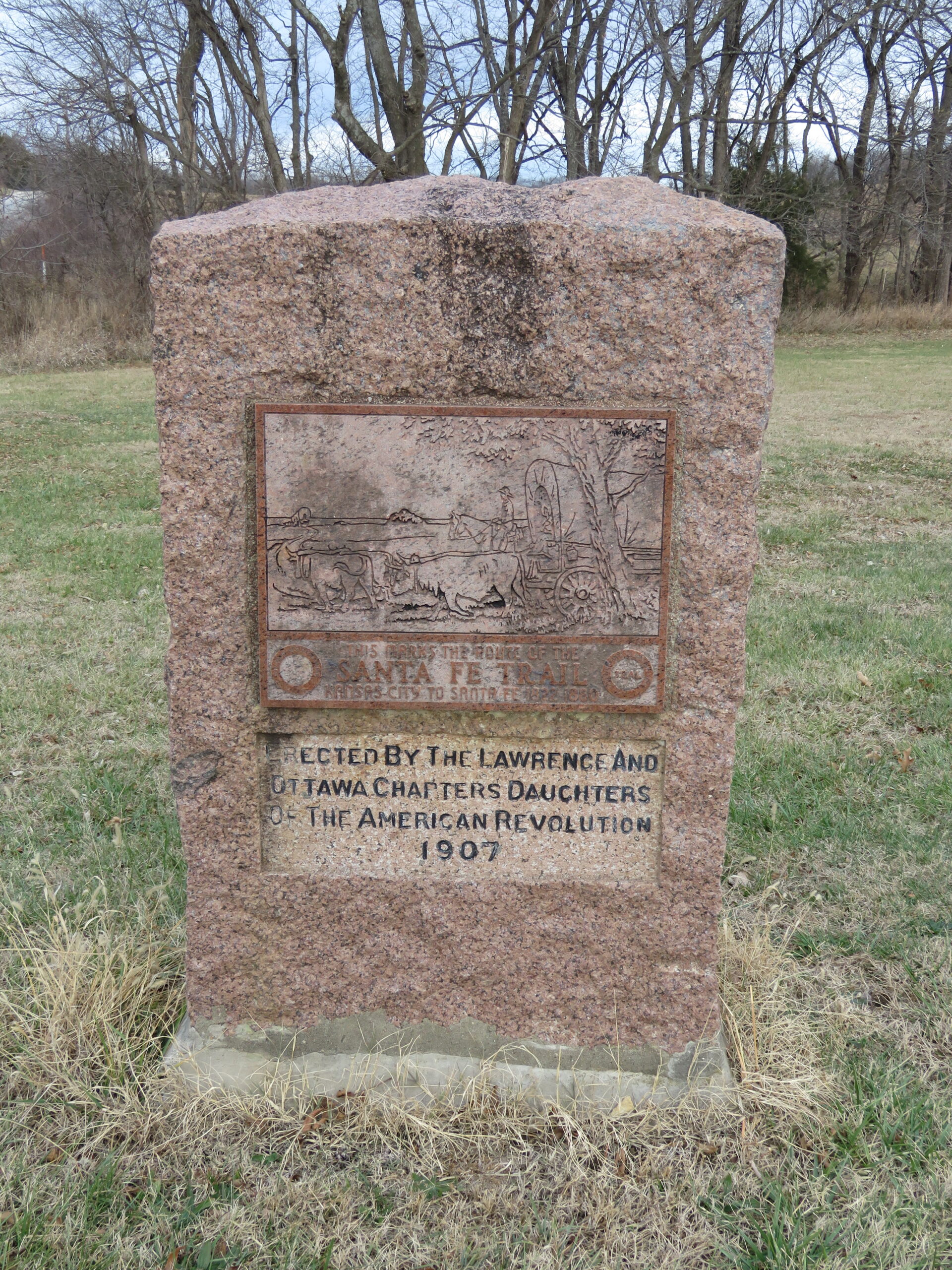
Closeup view of the large, oversized granite DAR marker.

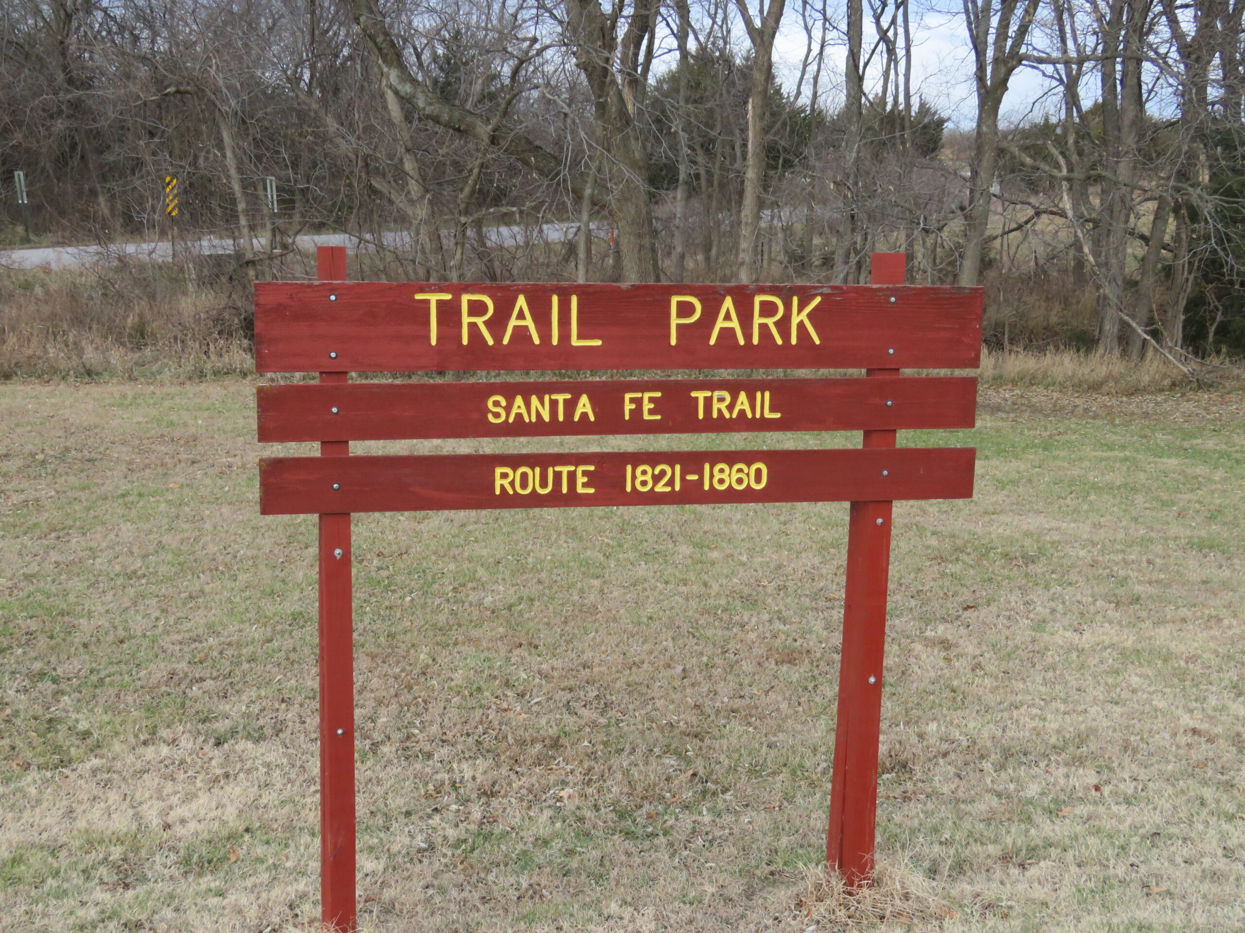
Closeup view of the wooden sign indicating the location of Trail Park.

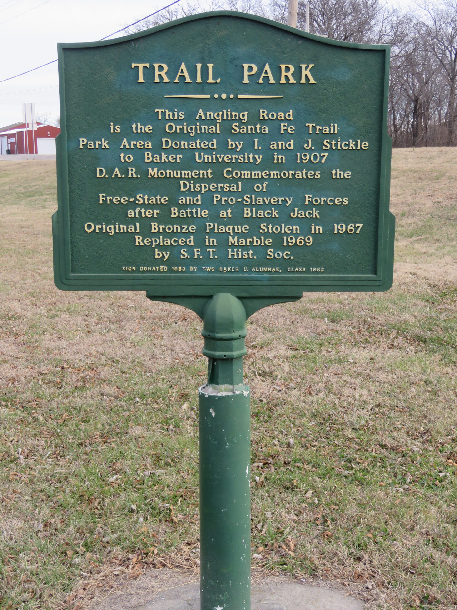
Closeup view of the green metal sign giving information about the site and placed here in 1983 by local historians Katharine Kelley and Amelia Betts.
Previous slide
Next slide
Stop 8
Brooklyn DAR
N 550 Rd & E 1400 Rd. Willow Springs, KS
DIRECTIONS
Brooklyn was established as early as 1855. It was halfway between the proposed “paper towns” of Louisiana and Pacific City. The town was incorporated in 1858.
There were from six to eight buildings on the site: a general store and saloon, a livery stable, John Moore’s home, and several other dwellings. The Santa Fe Trail came through the town. Everything except the saloon was burned to the ground by Quantrill’s raiders after exiting Lawrence on August 21, 1863.

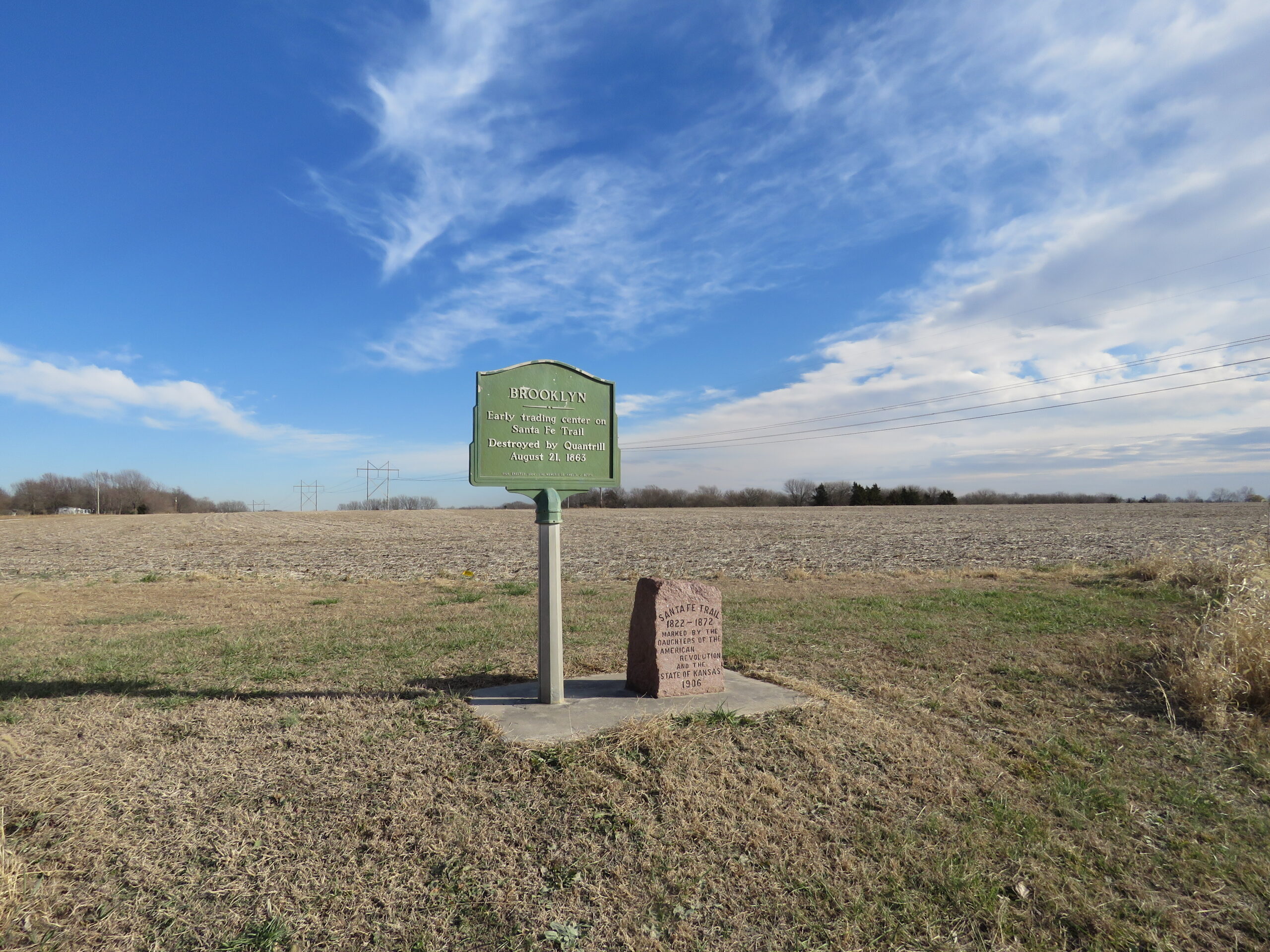
Distant view of granite DAR marker, and green metal Brooklyn Marker placed here in 1984 by historians Katharine Kelley and Amelia Betts. All surrounding fields have been extensively cultivated and no sign of the trail exist.

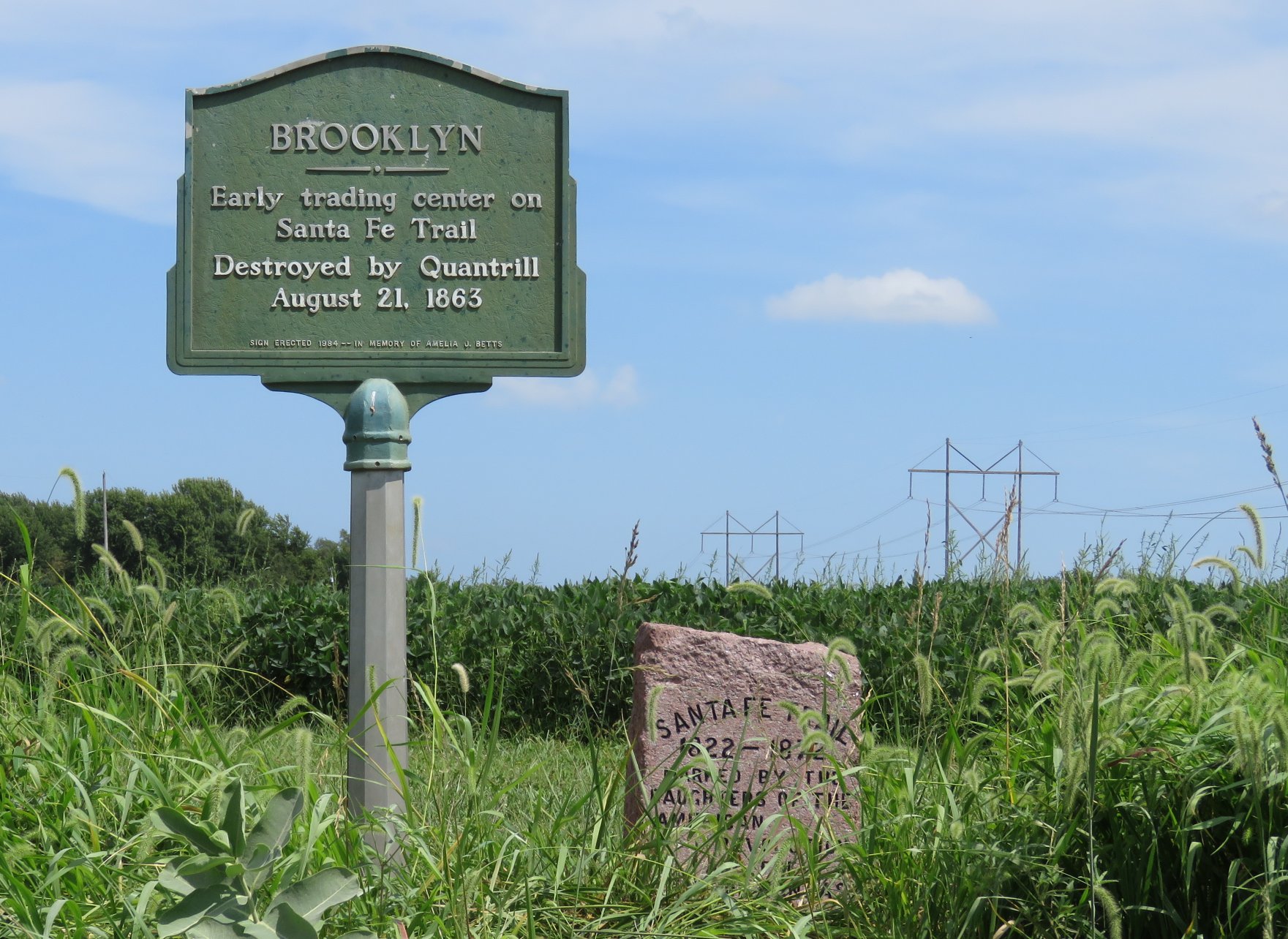
Closeup of DAR and green metal marker.
Previous slide
Next slide
Stop 9
Willow Springs
E 1100 Rd. & N 550 Rd. Baldwin City, KS
DIRECTIONS
This DAR marker is located just west of the intersection of East 1100 Rd. and North 550 Rd.
A reliable spring located about ¼ mile to the west was often used for watering horses, mules, and oxen. A combined general store, post office, and hotel were just behind and slightly south of the marker.
As business waned, the community center, as such, focused more on the large German Baptist Brethren Church, built in 1885, about 100 yards to the south. It is believed that the military trail from Leavenworth connected to the Santa Fe Trail about a mile or so east of this marker, but little evidence has been found to verify that.

The Willow Springs area is listed as a National Historic Landmark.

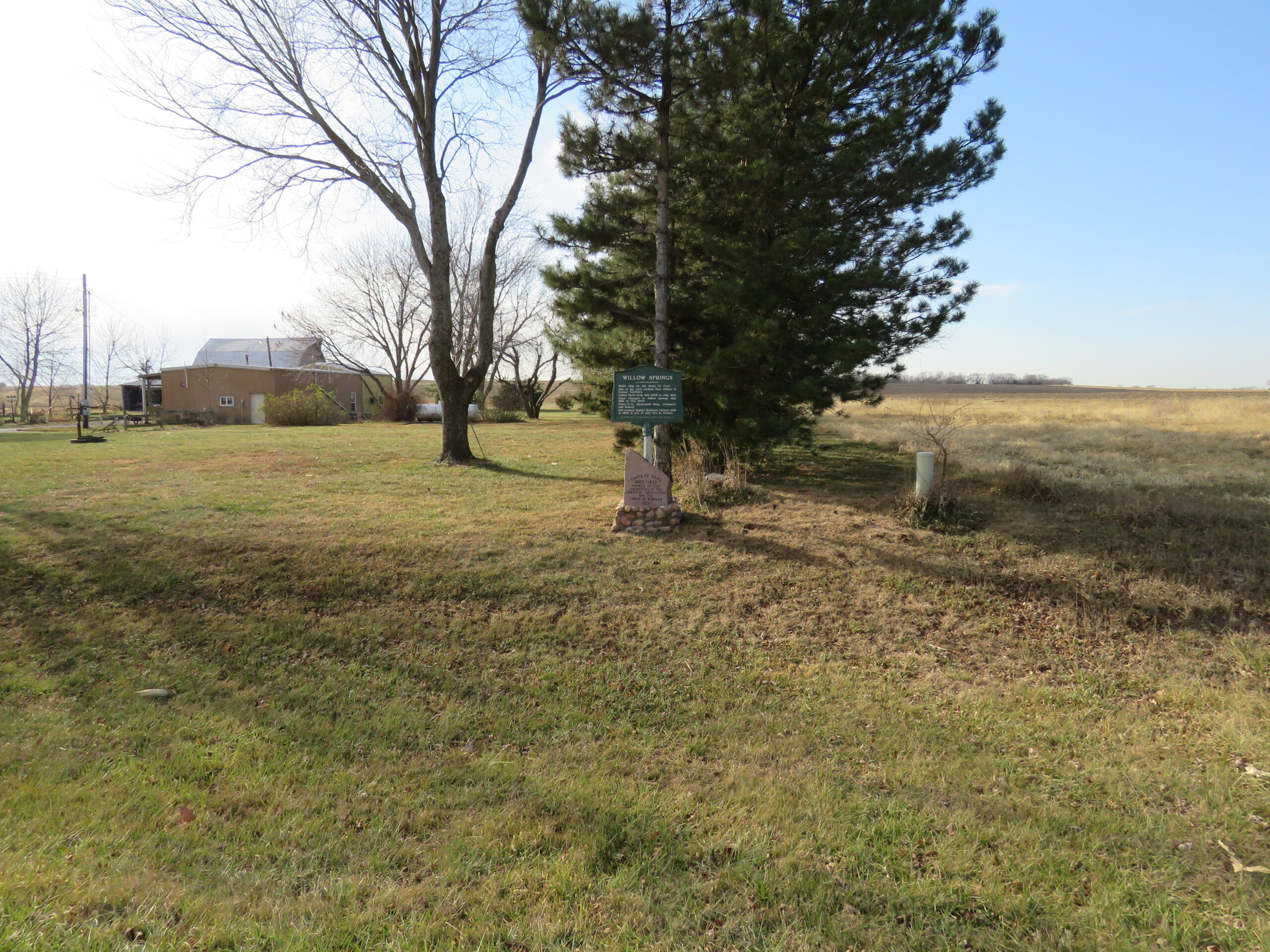
Distant view of Willow Springs DAR Marker to show general surroundings. Spring was located about ¼ mile west but is located on private property.

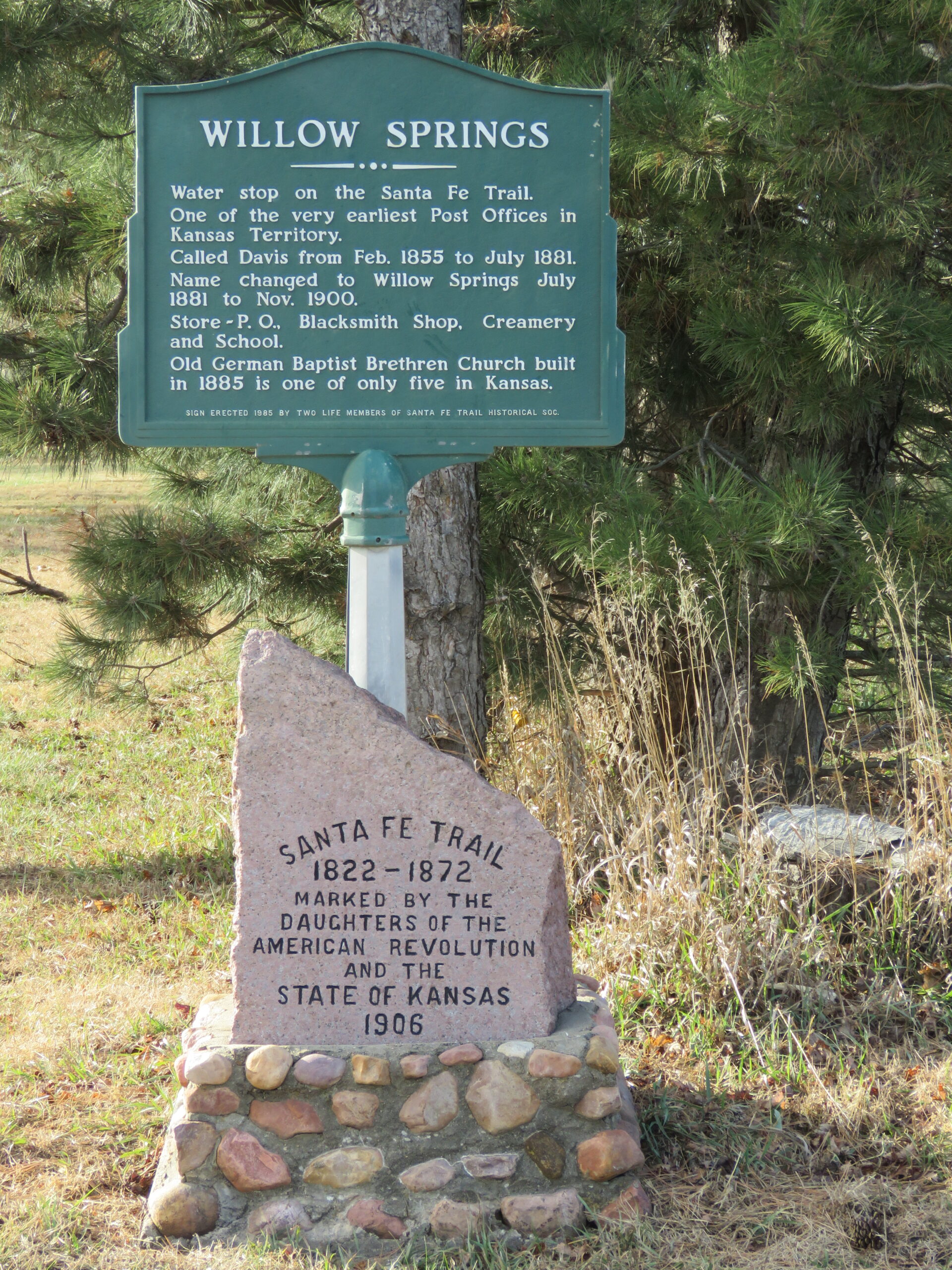
Close up view of Willow Springs DAR Marker and green metal sign placed in 1985 by Katharine Kelley and Amelia Betts. The spring was located about ¼ mile west but is located on private property.

View of faint ruts 1 mile east of marker, about 400 yards north of North 550 Rd. on East 1200 Rd. Looking west. This is about where the military trail from Leavenworth joined the Santa Fe Trail.
Previous slide
Next slide
Stop 10
Globe DAR
553 N 400 Rd. Overbrook, KS
DIRECTIONS
This marker is located at the southwest corner of the intersection of East 550 Rd. and North 400 Rd. This is along the ridge known as The Narrows which travels past Simmons Point to the west for 1.5 miles. It is located one mile north of the current Globe store.
However, when the trail was functional the only town site nearby was Marion, which was another mile further south.
The area was referred to as Globe beginning in 1881, hence the name of the marker location.

Typical granite DAR marker with green metal marker added in 1985 by Katharine Kelley and Amelia Betts.

Close up of text on green metal sign.
Previous slide
Next slide
Stop 11
Simmon’s Point Stage Coach Stop
N 300 Rd. btw. E 300 Rd. & E 400 Rd. Marion, KS
DIRECTIONS
The building was constructed in the 1880s as a way station for travelers on the Santa Fe Trail, and it was run by Phillip and Elmira Dodder Simmons.
The Santa Fe Trail passed on the north side of the hill and some tracks can still be seen on Google Earth.

It is listed on the historical register but past owners have not had an interest in protecting the structure, and it has nearly completely collapsed. This is private property and access is completely off limits.

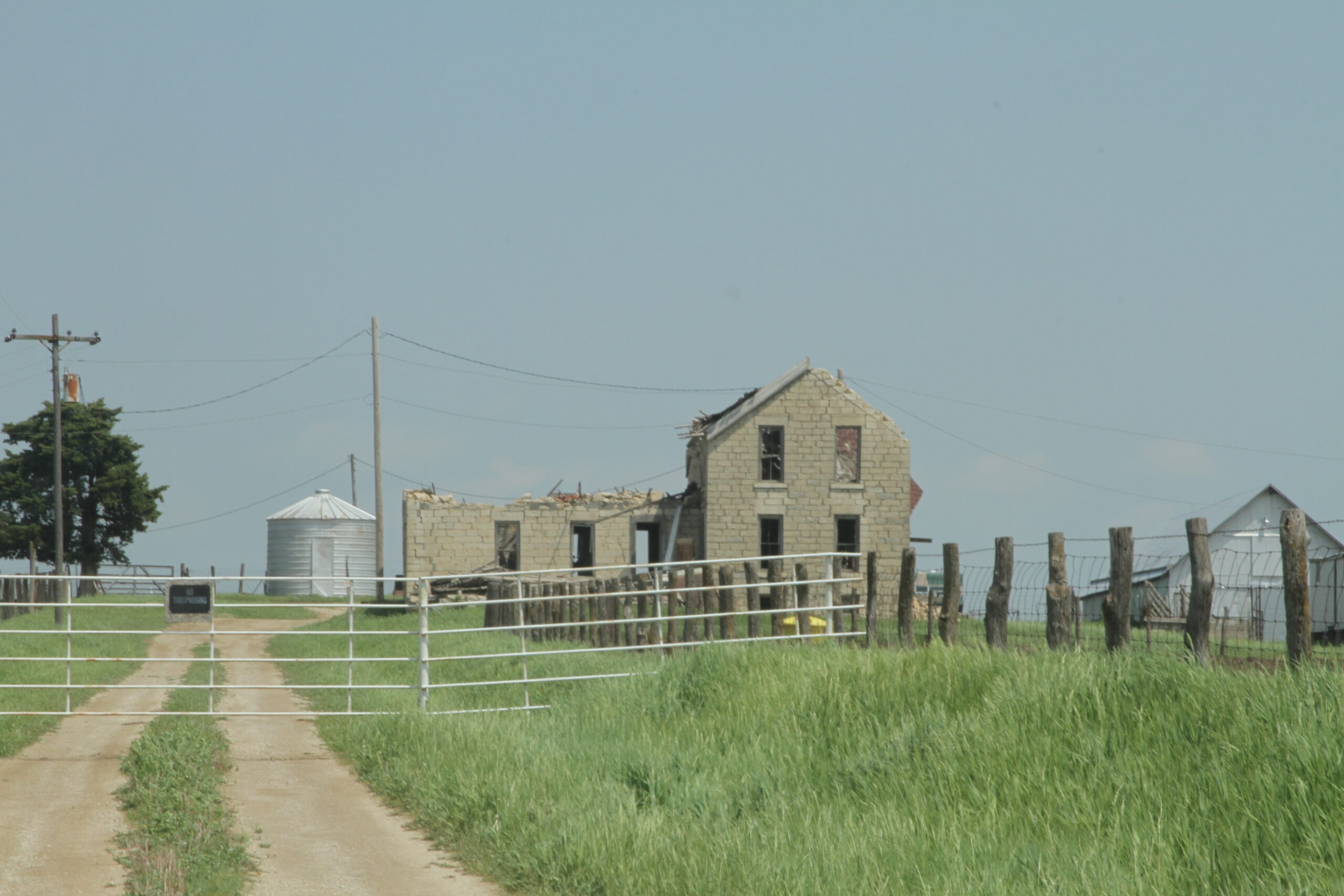
Photo of the structure as it stood in 2013.

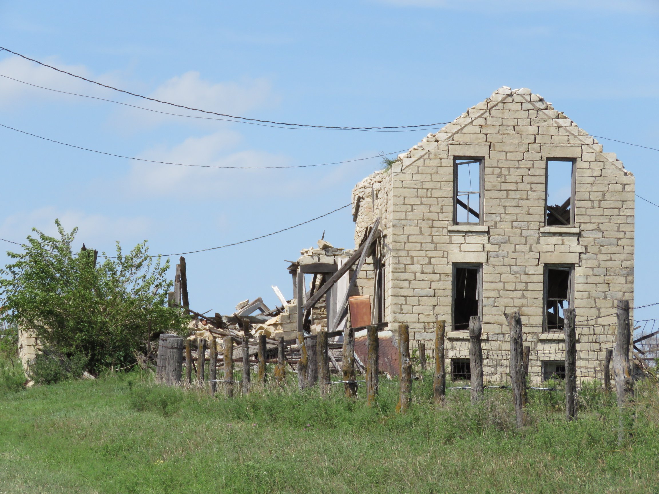
Photo of the structure as it stood in 2017.

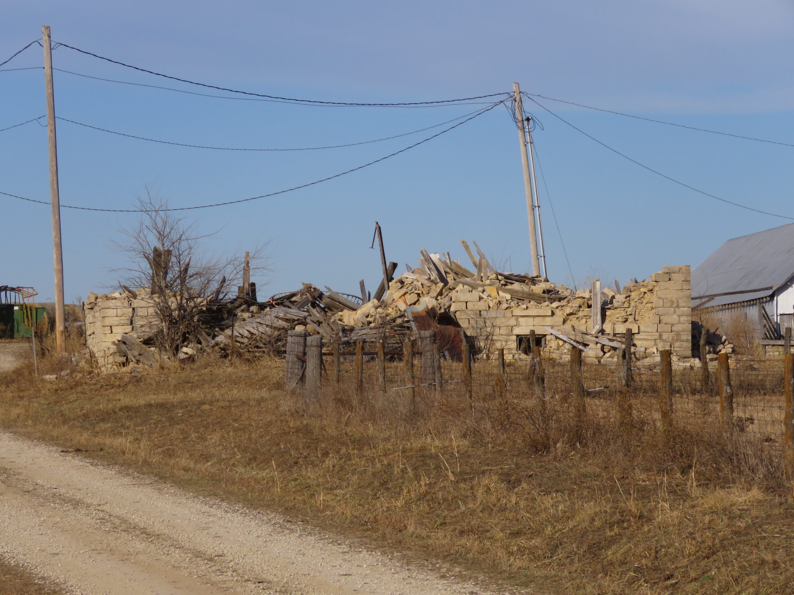
Photo of the structure in 2020 showing that it is nearly completely collapsed.
Previous slide
Next slide
Stop 12
Ruts west of Simmon’s Point
N 300 Rd & E 150 Rd. Overbrook, KS
DIRECTIONS
These ruts are west of East 150 Rd. in a native prairie pasture. It is burned infrequently so the ruts are difficult to see.
This is not part of the traditional Santa Fe Trail route, which is south of the US 56 highway. These ruts have only been acknowledged in the past few years, partly because they are not very deep and also because the pasture is rarely burned, so they were hard to see.
Trail Crossing signs on E. 150 Rd. indicate where to look for them to the west.

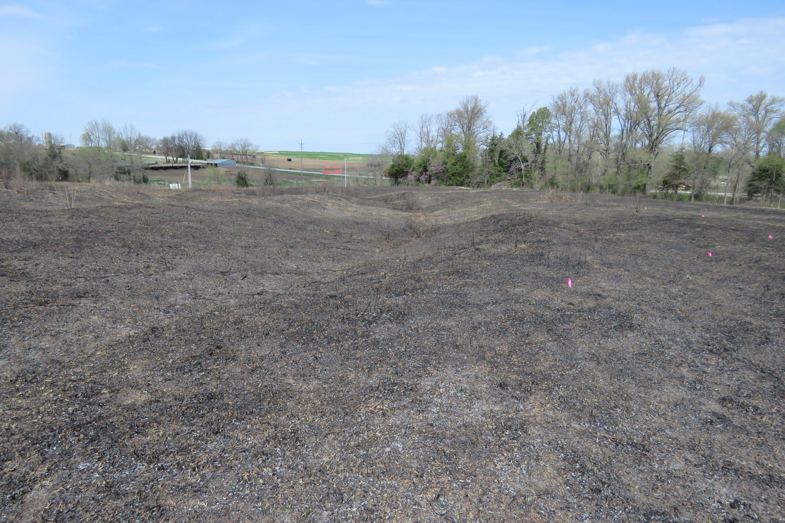
Photo showing faint depression in foreground that curves southwesterly then back northwesterly before crossing the shallow creek.

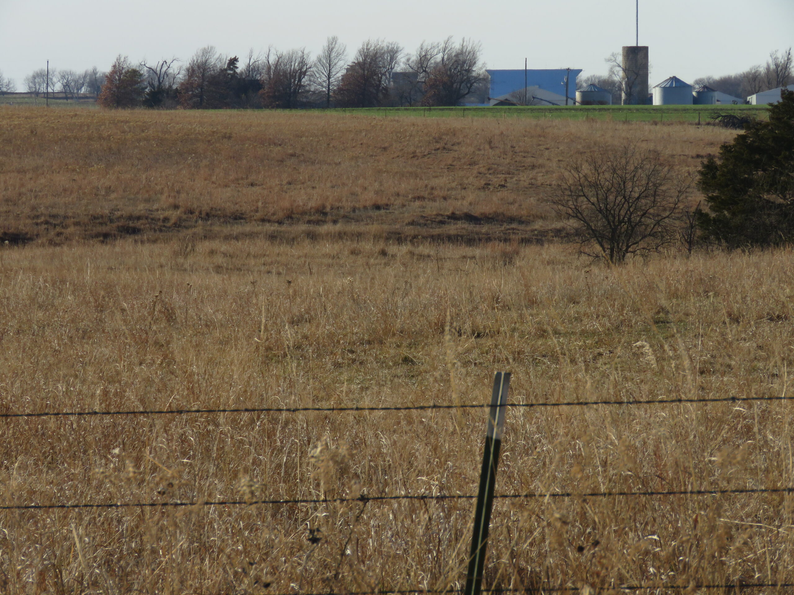
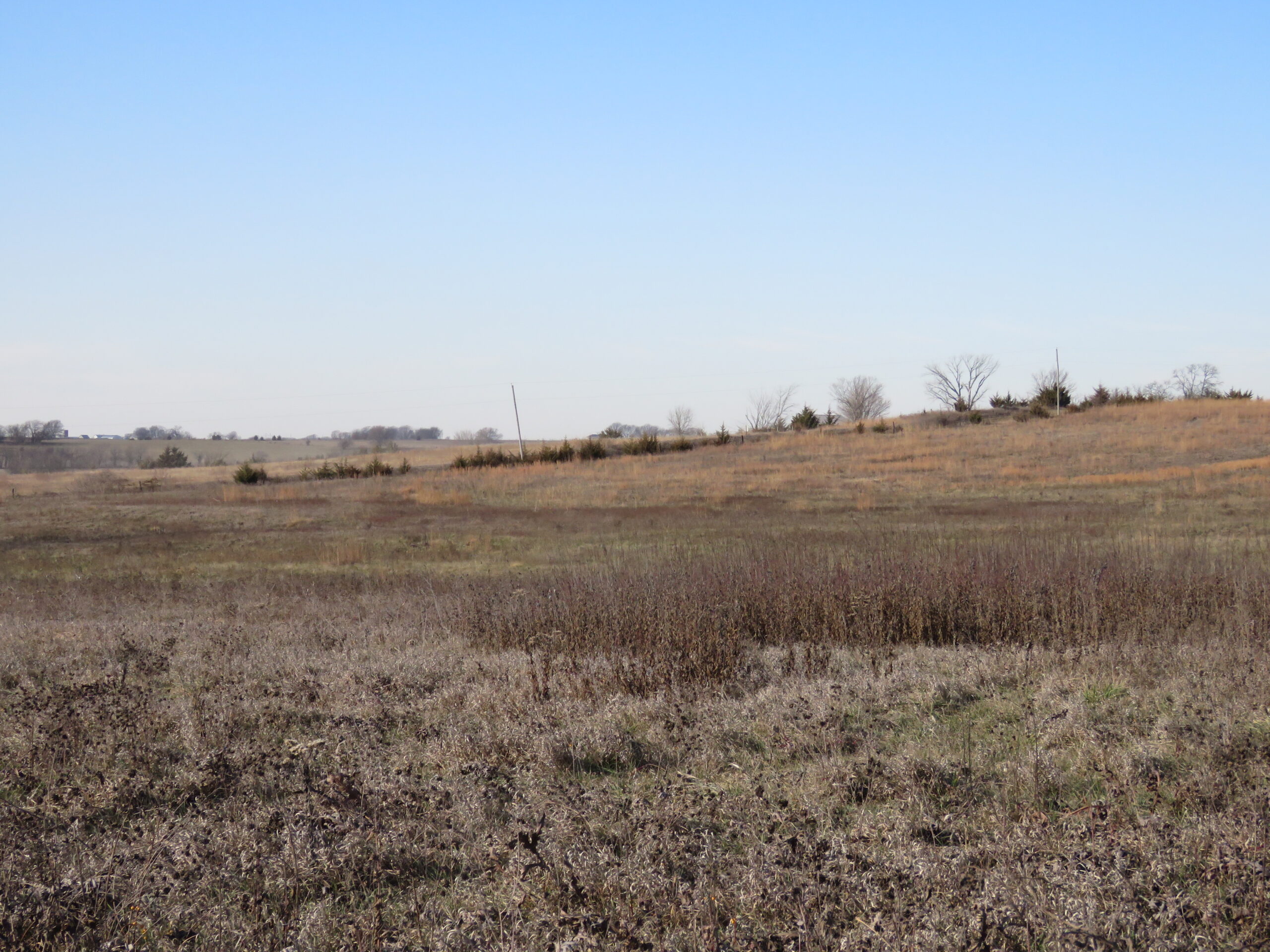
Photo showing several faint depressions on the distant hill as they traverse the hill towards the south west. They are headed directly towards the Baden DAR Marker ½ mile to the west.

Spring photo showing one or two ruts traversing the hill to the south west as they come up out of the shallow creek. Again, this is heading towards the Baden DAR marker ½ mile to the west.

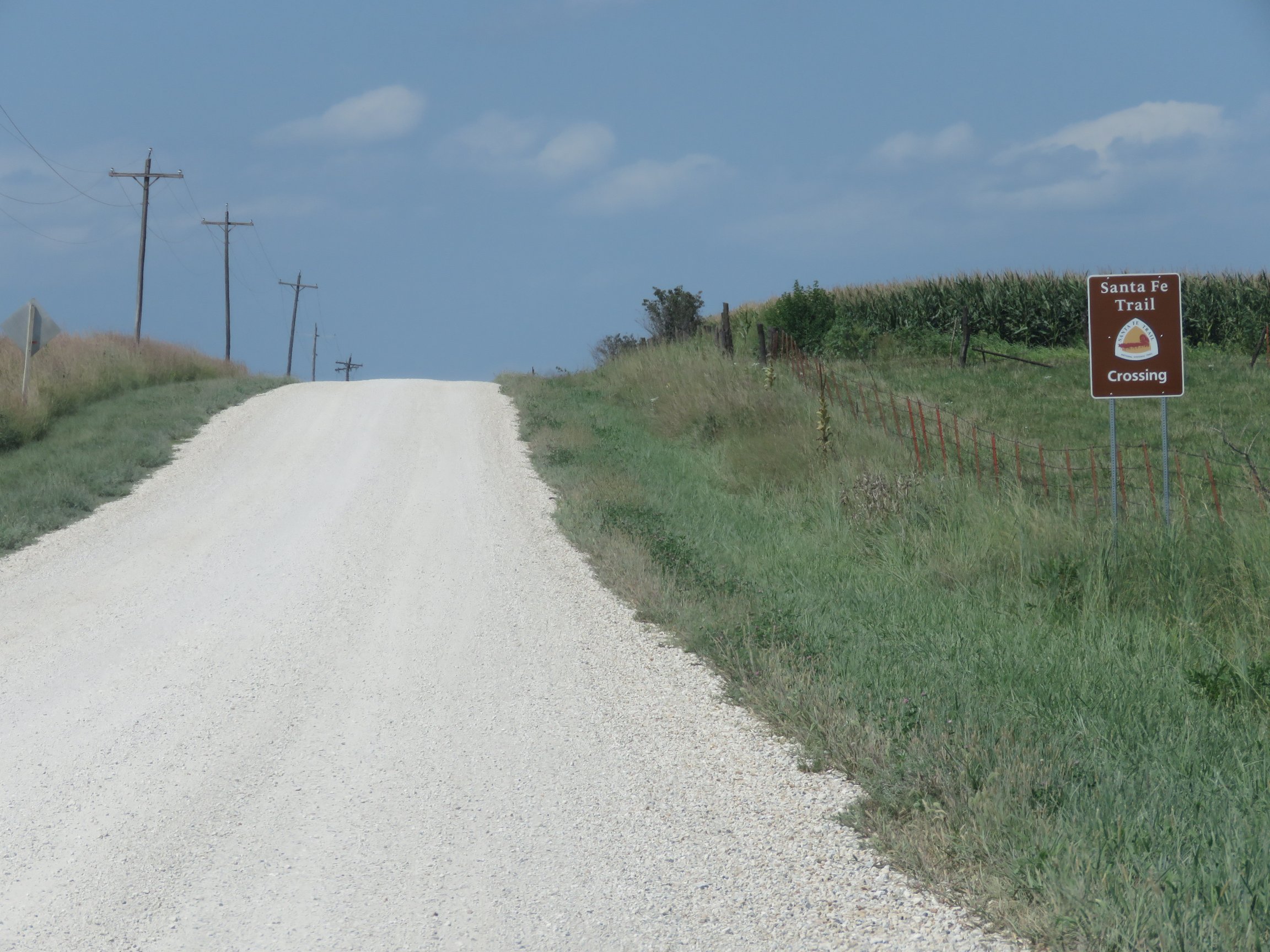
Photo showing trail crossing sign from the south, looking north.

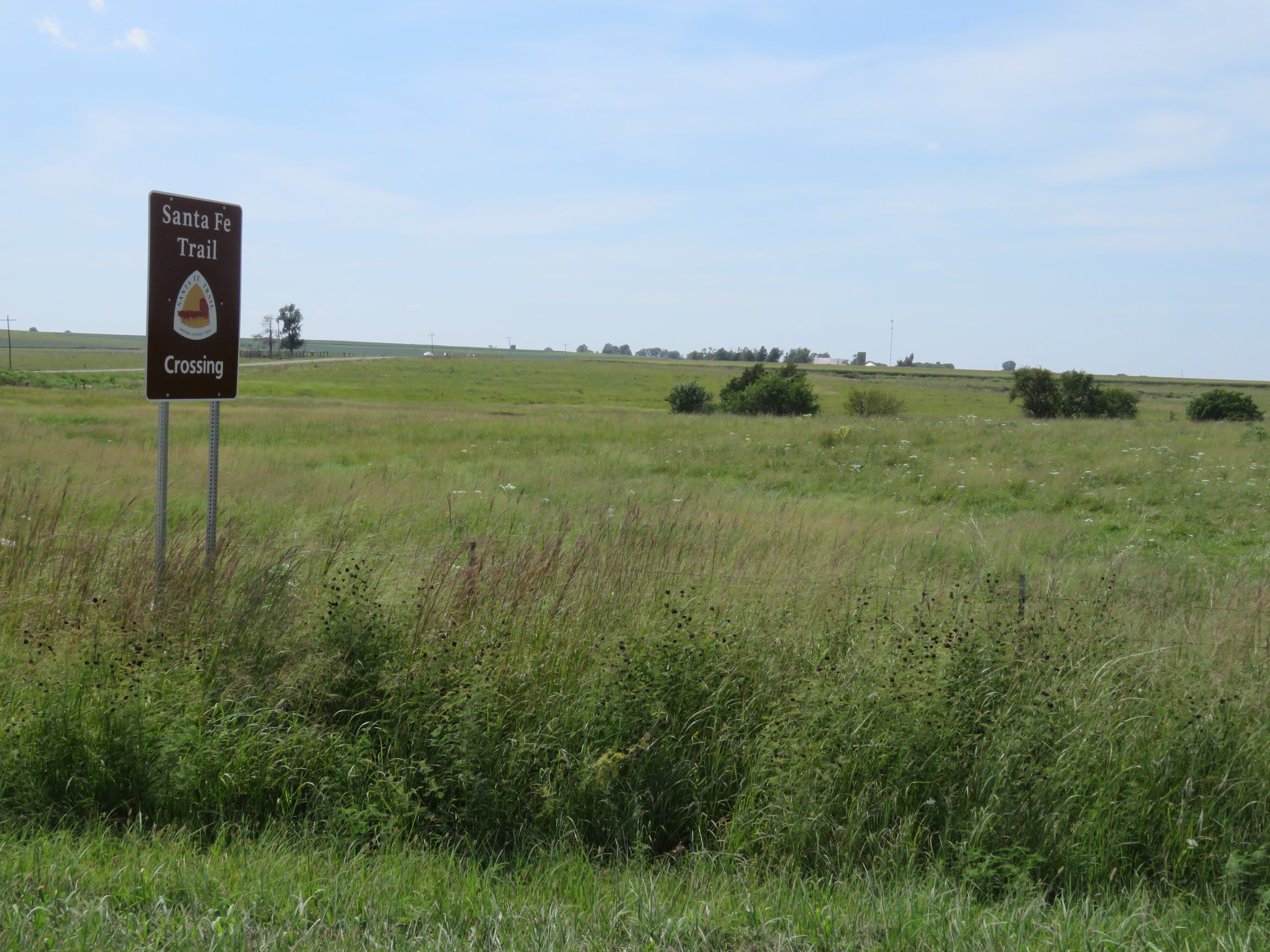
Photo showing trail crossing sign from the north, looking south west.
Previous slide
Next slide
Stop 13
Baden DAR
N 300 Rd. Overbrook, KS
DIRECTIONS
This DAR Marker is referred to as the Baden marker as it is close to where the Baden Post Office was. The trail crossed where US 56 is currently and then angled southwesterly, eventually ending up in Overbrook.
The Baden post office was functional from November 1883 to November 1886 and again for four months in 1891. It is not known if it was located in a home or business.
The marker is located on the south side of US 56, across from county road East 100, which only heads to the north.

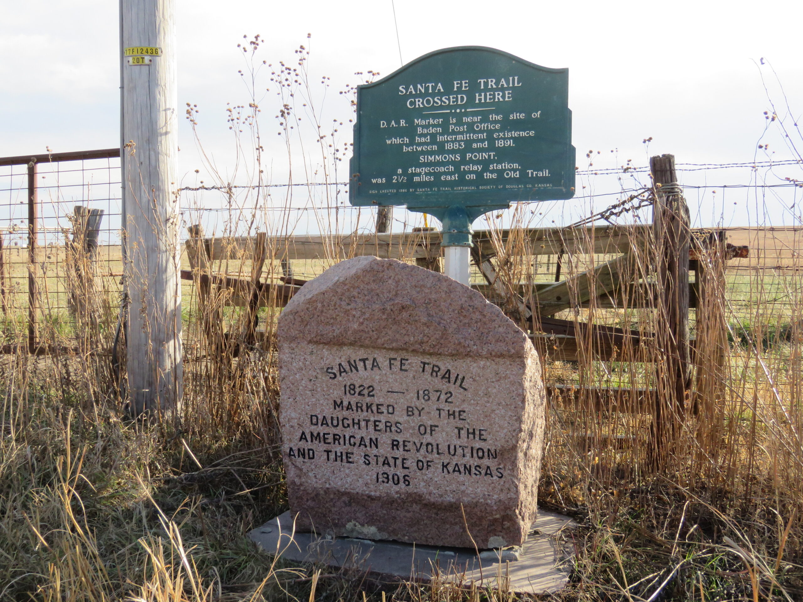
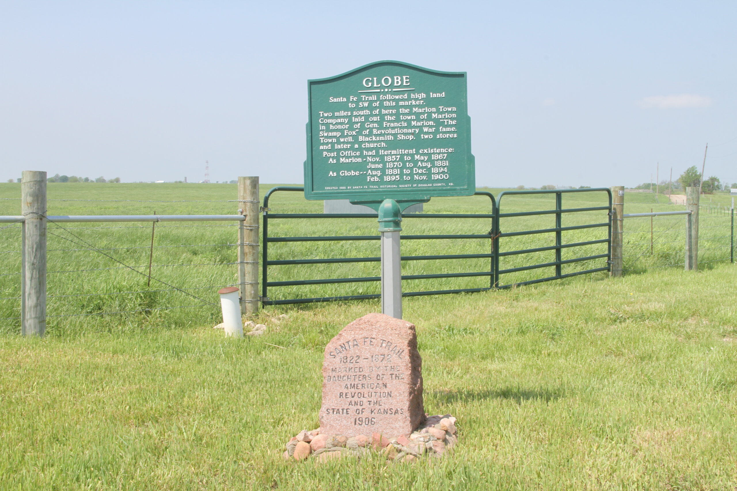
Baden DAR granite marker, and green metal marker. The metal sign was placed here in 1986 by historians Katharine Kelley and Amelia Betts.
Previous slide
Next slide